Exploring and exposing
THE HIDDEN JAPAN
FOLLOW CLAUDIO SUENAGA'S MEGALITHIC STONEWORK RESEARCH TO DECIPHER THE UNKNOWN STONE-NUB LANGUAGE AND REDISCOVER JAPAN'S SECRETS THAT HAVE BEEN KEPT OCCULT IN PLAIN SIGHT
Giant polygonal stone monuments from centuries and even thousands of years ago still survive scattered throughout the Japanese archipelago, ancient ruins so incredibly unique, bizarre and futuristic that they don't fit in with the conventional and that archaeologists and historians can't explain. Very little is known about its real builders and its strange megalithic masterpieces. Its construction technique resembles that of the Incas and pre-Incas of Peru, as well as that of the ancient Egyptians: huge stones cut at interwoven angles and embedded without mortar. As in Peru, the stones have withstood centuries of abandonment and extraction by later cultures. Unfortunately, most scholars are still unaware of the existence of these ruins, while the rest of the world is oblivious to their existence, viewing Japan as the stereotyped land of Shinto and Buddhism. Were these monuments bequeathed by a highly advanced and technological civilization that disappeared without a trace?
If on the one hand modern and technological Japan is well known to the West, ancient Japan remains an almost total mystery. Most are still unaware that Japan's past encompasses much more than the often noted Shinto and Buddhist, Shogun and Samurai temples, and typical art seen in museums.
Japan has numerous megalithic monuments, colossal and cyclopean architectures, pyramids, prehistoric stone circles, dolmens, menhirs, rock and kofun alignments (tombs) with murals with stars, constellations and star maps, a sophisticated celestial cosmology-cosmogony and advanced. This legacy is part of not only the vast pan-Eurasian megalithic complex found in Russia, the Altai-Caucasus-Mongolian steppes, Manchuria, Vietnam, China, Korea and the islands of Southeast Asia, as well as the “global megalithic order”, so to speak, intimately connected not only to Mesopotamia, one of the four cradles of civilization, megalithic culture and ancient astronomy, but also to Egypt, India and even South America.
And, of course, Gobekli Tepe, which predates Stonehenge by 6,000 years. At 11,000 years old, Gobekli Tepe, Turkey, reverses the conventional view of the rise of civilization. The discovery of 20 T-shaped stone towers, carved with drawings of snakes, scorpions, lions, wild boar, foxes and other animals that date back to 9,500 BC, that is, 5,500 years before the first cities of Mesopotamia and 6,000-7,000 years ago before the Stonehenge circle, he made Gobekli Tepe the birthplace of agriculture, organized religion, megalithic monuments and civilization itself.
The global megalithic culture expanded during the Neolithic and Bronze Age around the world during the 2nd and 1st millennium BC. Between 3,000 and 2,000 BC, funerary monuments and rituals built with large stones (the “megalithic culture”) emerged and have become milestones on a global scale. The Mesopotamian region was believed to be the birthplace of astronomy, but recent discoveries have confirmed that images of constellations found in dolmens in Korea precede the Babylonian charts by about 1,800 years. In other words, the ancient Koreans were pioneers in cultural development along with the four cradles of civilization. And like the Sumerians, the Chinese created a system of the Zodiac, and both the Chinese and the Babylonians used the 19-year Sun-Moon cycle in their calculations around the 6th century BC.
The ancients paid much attention to the celestial phenomena, because they believed that the events in the sky were a mirror and a guide for the terrestrial subjects, that is, the heavens were like a mirror that reflected the human world and reveals good and evil for through events and transformations in the celestial world.
DNA research indicates the strong probability of common ancestral lineages of the Paleolithic-Jomon with indigenous Amerindian and South American populations, including that of Peru. It has long been speculated that there is a relationship between the megalithic structures and pyramids of Japan and those of Peru.
Claudio Suenaga exploring and exposing THE HIDDEN JAPAN
Kofun (Mausoleum) of Emperor Nintoku
The main reason why I chose to come to Osaka, where I live and work since March 2016, was because that here is the largest kofun in Japan, because I always wanted to know and research such monuments up close. For those who have never heard of it, the kofun are megalithic tombs for members of the high nobility, built in the second half of the third century until the first half of the seventh century during the so-called Kofun period, belonging to the Yamato period.
Location: 1079-1 Daisencho, Sakai Ward, Sakai, Osaka 590-0035
The kofun took different forms. Originally circular, it was
followed by the rectangular, square, until it reached the most typical
one, with the shape of a vase or a lock eye.
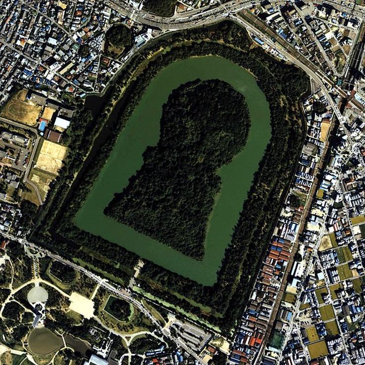
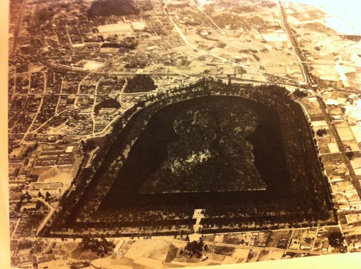
In the company of my colleague, the explorer Alexandre Akio Watanabe, I visited the Daisenryō-Kofun twice, in Sakai city, Mozu railway station, in Osaka. Built in the 5th century in the shape of a lock in honor of Nintoku, the 16th Emperor of Japan (enthroned in 313, aged 24, and who reigned for 86 years until his death in 399, aged 110), measures an astonishing 480 meters long, 300 m wide and 35 m high. Its base is so extensive that it holds the Great Pyramid of Giza (Egypt) and that of the Pyramid of the Sun (Teotihuacan) together!
We walked all around the area so that we could get a sense of its grandeur. Unfortunately, however, the monument is completely covered with vegetation and large trees that prevent an overview of its structure. The buried body of the Emperor is in the circular part of the mountain. The rectangular portion was used in mortuary rites. Since the 1970s, the Japanese government has banned archaeological research in the area. Three moats surround the tomb and public access is quite restricted.
St. Peter's Square, in the Vatican, has the same shape as Japan's kofuns, that is, with a lock eye. It was what talked about the correspondence of forms between all the sacred monuments of the world, as if they were interconnected.
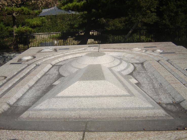
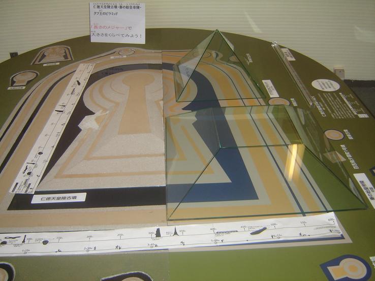
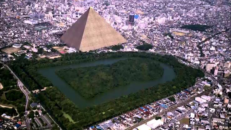
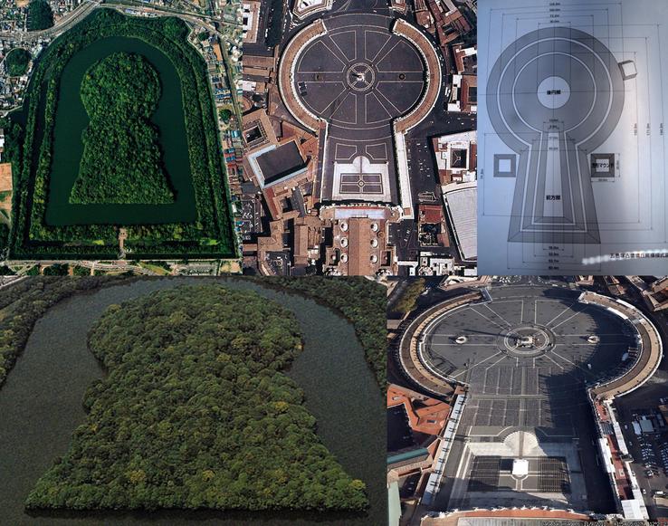
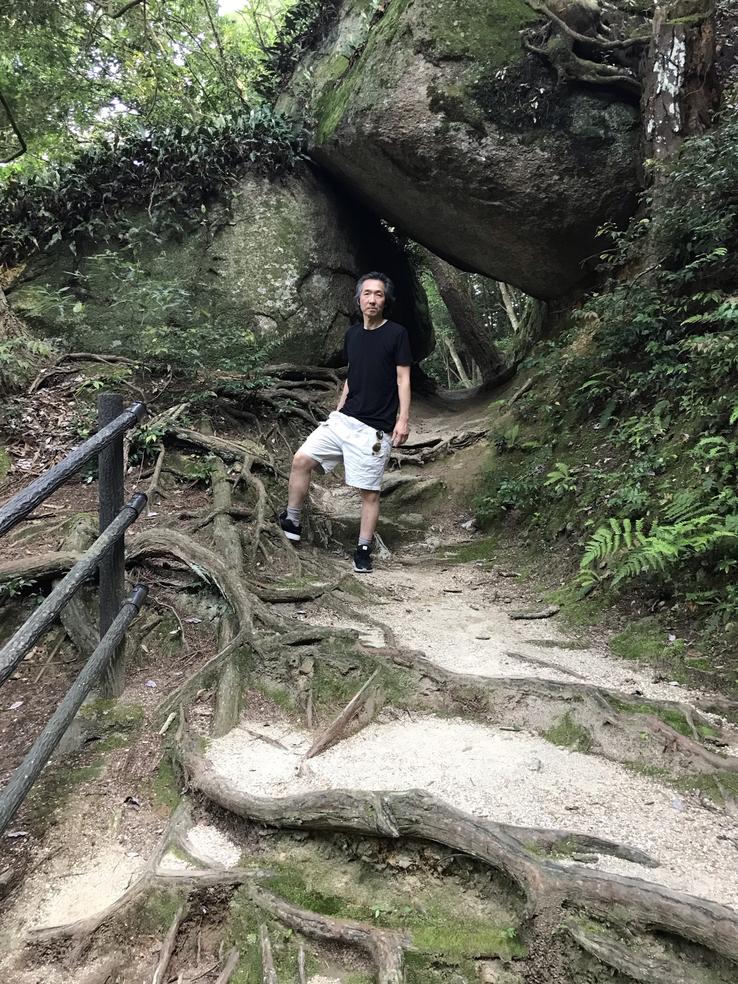
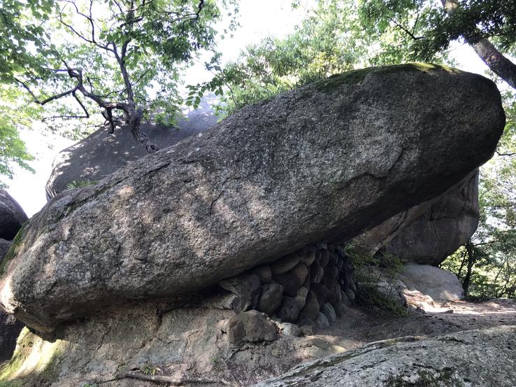
Several menhirs (cromlech) arranged in a circle can be seen in Daisen Park. This association between menhirs and kofuns is, to say the least, curious. Were they aligned in some way, maybe even astronomically?
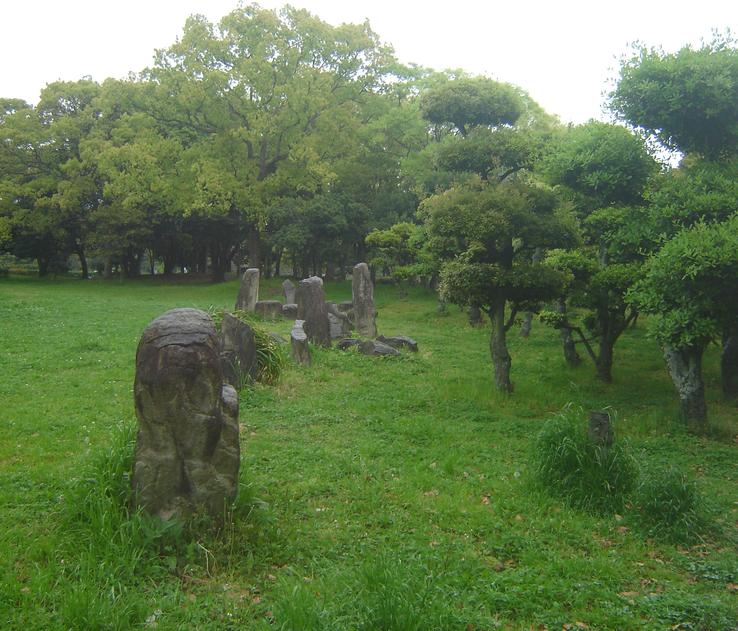
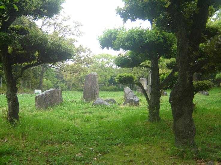
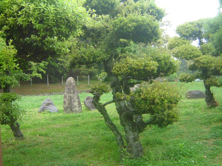
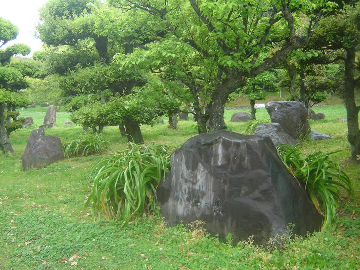
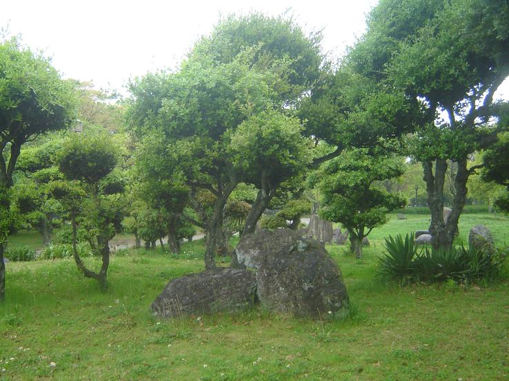
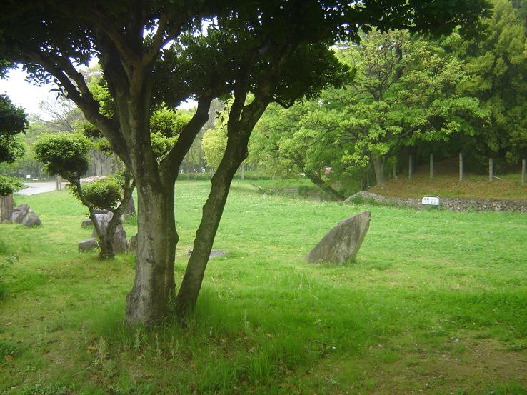
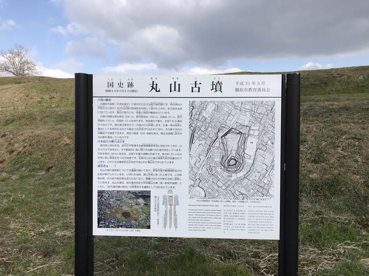
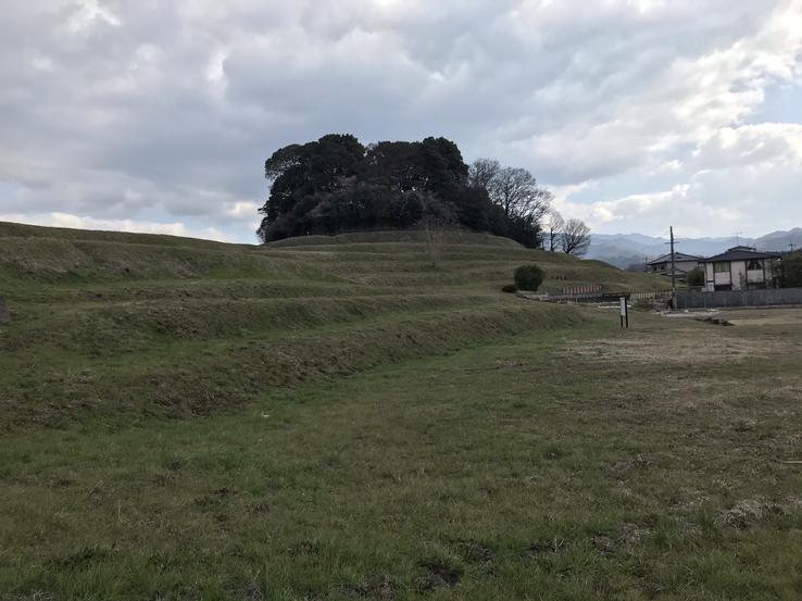
Maruyama (Round Mountain) in Asuka City, south of Nara Prefecture, is the largest kofun in Nara and the sixth largest kofun, or ancient tomb, in all of Japan. Maruyama Kofun is classified as a zenpokoenfun, meaninga giant keyhole-shaped tomb, which was the predominant style of monumental tomb in Japan for approximately three centuries, circa 300 to 600 AD.
Address: Gojonocho, Kashihara, Nara 634-0043
In the old days this tomb was called the Gojyono Maruyama Kofun. Since the Meiji Period (1868-1912) it has been called by its current name, but locally it is still called Maruyama Kofun because its round back is in the Gojyono district and a large part of its front in Ogaru.
Maruyama Kofun measures 318 meters in length. The front is 15 meters long and 10 meters wide. The circular back part measures 115 meters in diameter and 21 meters in height, and the front part, 210 meters in width.
Its stone-lined crypt inside the corridor-style mound measures 28.4 meters in length, making it the longest of its kind ever discovered (most of the largest kofun have never been excavated) in the country. The dome of its roof is covered by six pieces of natural stone 4.8 meters long, 1 meter wide and 1.5 meters high. The burial chamber is 8.3 meters long and 4.1 meters wide, in which two hollow stone coffins were placed in an L-shape.
In the chamber about 1 meter high, earth and sand are piled up and, although the details of the coffins are unknown, the bottom coffin has a lid 2.42 meters long, 1.44 meters wide and 0.4 feet tall. The front coffin has a lid that is 2.75 meters long, 1.41 meters wide and 0.63 meters high. They are made of rhyolithic weld tuff (light colored volcanic igneous rock, extrusive counterpart of granite) called Tasuyama-ishi, taken from the vicinity of the Kakogawa River.
The survey of the interior of the stone chamber was carried out several times during the Edo Period (1603-1868): in 1790 by Kitaura Sadamasa, in 1796 by Tsutumi Korenori, and in 1855 by Wakisaka Awaji. With the beginning of the Meiji Period and the opening of the country to the outside world, the English mining engineer William Gowland (1842-1922), later called the "Father of Japanese Archeology", visited Japan and researched the kofun in Nara, among them theof Maruyama.
When a child from Kashihara was playing in the Maruyama Kofun with her friends in 1991, she found an entrance to the corridor-style stone chamber outside the hedge. The child's father heard the story and decided to enter the chamber with his son in the early morning of May 30th, before going to work, and took pictures of his interior.
Osaka Asahi Broadcasting Corporation, together with the Tokai University Information Center and Konica, analyzed the photographs and concluded that the front coffin was hollow and had been made in the third quarter of the 6th century, and the posterior coffin in the first quarter of the 7th century. They further determined that the granite megalith that forms the front of the stone chamber must weigh more than 100 tons, ie, larger than the 75-ton stone at Ishibutai Kofun. From its masonry pattern, they estimated that the stone chamber had been built between the end of the 6th century and the beginning of the 7th century.
Later, Mori Koichi, a professor at the time at Doshisha University, took up this story in his talk in Osaka on December 10, and TV Asahi aired thirty photos in one issue of News Station. Kofun experts endorsed the importance of these photographs. Later, from August 10th to September 15th, 1992, Kunaicho Shoryoubu (the Kunaicho Library) performed opening closing work along with an additional single measurement investigation and, after the research, published the written report.
At one time it was believed, based on local tradition, that the stone coffins were those of Temmu (631-686), the 40th Emperor of Japan (from 672), and of Jito (645-703), the 41stEmpress of Japan (from 686), the third woman to ascend the Chrysanthemum Throne, who reigned at the end of the 7th century, but this was refuted when the tomb was definitively dated to the 6th century, a century ahead of schedule.
At present, the identities of the tomb's occupants remain unknown. The most accepted theory today is that this is one of the resting places of Emperor Kinmei (509-571), the 29th Emperor of Japan (from 539), and his consort Soga no Kitashihime, parents of Empress Suiko (554-628), the 33rd Emperor of Japan (from 592). The remains of Kinmei and Kitashihime if not in Maruyama would be in Kinmei Tenno-ryo in Asuka. The Nihon Shoki (Chronicles of Japan), an ancient book of Japanese history, states that when Empress Suiko reburied her mother, she said a prayer on the road in Karu (now Ogaru, Kashihara). But the book does not give the location of the mausoleum. So what is your final resting place? The truth is buried deep in the two mausoleums.
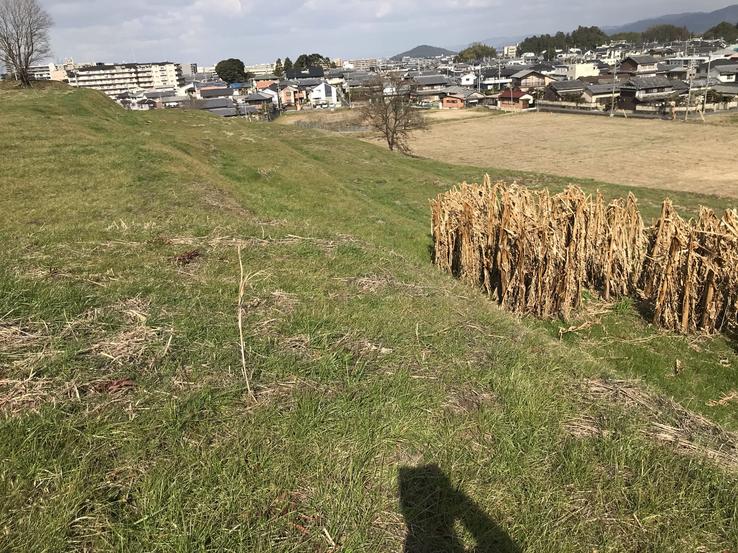
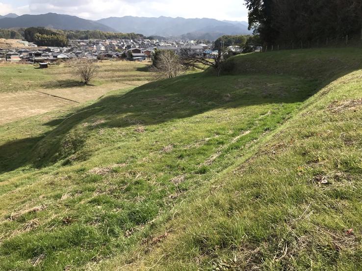
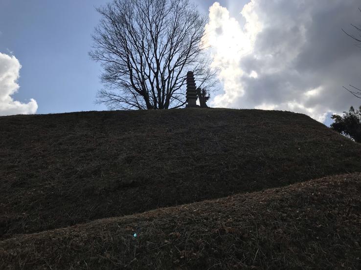
Maruyama is not attractive at all, as seen from the ground, it appears to be no more than a huge wooded hill, even though it was entirely man-made. This is precisely because it is covered with vegetation, which prevents its true forms from being discerned, so much so that those who pass along the busy avenue in front of it do not notice anything special. Only from the top can you get a sense of its scale and keyhole-style shape. From certain angles, however, like the one in the photo I took, you can see some of its outlines.
Being one of the few kofun who is allowed to walk on him, I took the opportunity to commit this sacrilege, and while I was doing it, a middle-aged man appeared in the distance. Thinking that maybe he could provide me with additional information about kofun, I approached him and what was my surprise when he took the initiative to address me. But not to clarify, but to ask what he was doing there and what was there! I then told him that it was a kofun, and he was astonished, as he was completely unaware of it despite the fact that there was a sign indicating it. That is, if not even a Japanese citizen has the notion that the hill is artificial, it shows how much this kofun is still ignored.
And as it has never been dug deeper, I wonder what treasures, perhaps even technological, there would not be there. The only object unearthed there – in the circular back part – that has been released is a Chinese-style mirror that is in the possession of Kyoto University's Department of Literature.

Claudio Suenaga exploring and exposing THE HIDDEN JAPAN
The Megaliths of Hebizuka Kofun in Uzumasa, Kyoto
Built in the 6th century, the Hebizuka Kofun, in the city of Kyoto (founded in the 1st century and which was the capital of Imperial Japan until 1868, when it was replaced by Tokyo), is a kofun (tomb) located near the Uzumasa train station (Uzumasa-eki) on the Sagano Line in Ukyo-ku.
The kofun's name, Hebizuka (Hebi = Snake + Zuka or Tsuka = Mountain), means "place where snakes hide". Snakes are commonly hated as threatening and tenacious, but in Japanese culture, markedly reptilian, they are considered “messengers of the gods” and “guardian deities of the house”.
The largest kofun in the Kyoto area, also with the typical keyhole shape (which can only be seen from above), is hidden in the middle of a residential neighborhood and is surrounded by an iron fence all around.
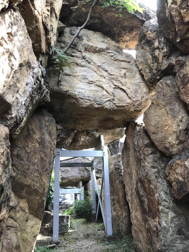
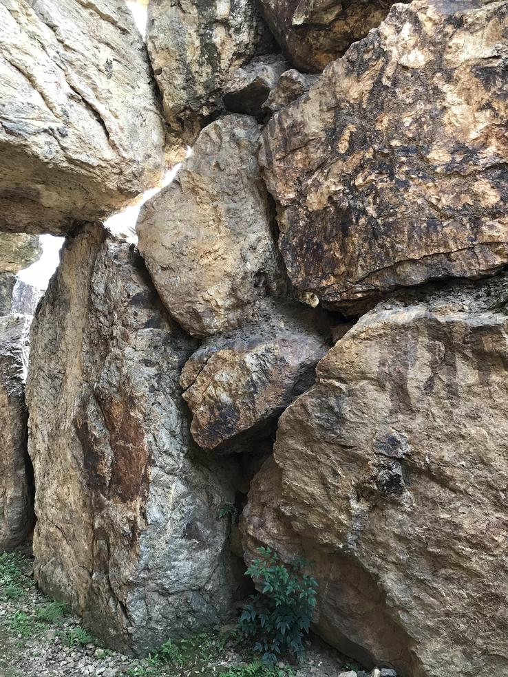
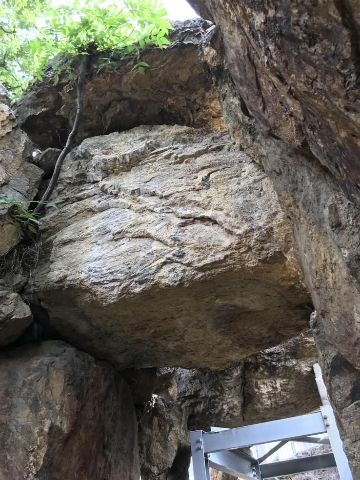
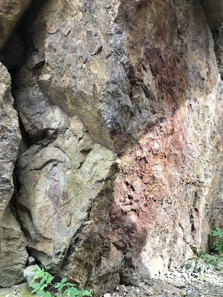
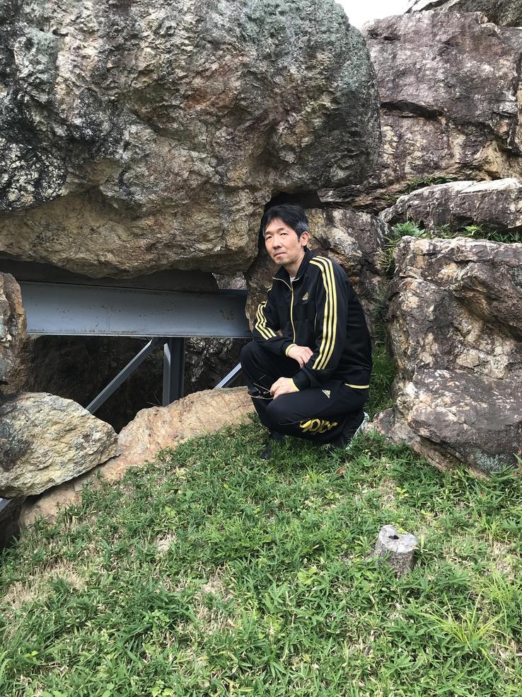
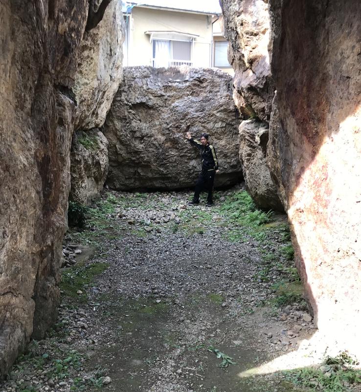
Unfortunately, most of its original shape has been lost and all you can see now are the remains of its large stone chamber, which measures 17 to 18 meters. The megaliths that make up the structure, supported by steel beams, are crudely cut but carefully adjusted rocks. The longest section of the set reaches 75 meters. The floor area of the entrance room (the room where the bodies are placed) measures 25.6 m².
The rocks that make up the structure are of the sedimentary type, formed in the ocean bed of the northern part of Kyoto between the Permian and Jurassic Period (1.45 billion-2.9 billion years ago). Because they are typical of the ancient province of Tanba, currently equivalent to the central part of Kyoto and the central-east of Hyogo, they are called Tanba, but it is a mystery how these giant rocks were transported to that place in that ancient period.
Hebizuka Kofun is supposed to have been erected by the immigrant Hata clan, active in Japan since the Kofun Period, according to the historic epic Nihon Shoki. Hata is the Japanese reading of the Chinese name 秦 given to the Qin Dynasty (the real name was Ying). According to Nihon Shoki (translated as Chronicles of Japan, the second oldest book on the history of Japan), the first Hata leader to arrive in Japan, this in the 2nd century, was Uzumasa-no-Kimi-Sukune, hencethe name of the neighborhood and the train station. He and his followers were very well received during the reign of Emperor Chūai, and Uzumasa received a great position in the government.
Claudio Suenaga exploring and exposing THE HIDDEN JAPAN
The tombs excavated in the rock of the mountain Takaida Yokoana
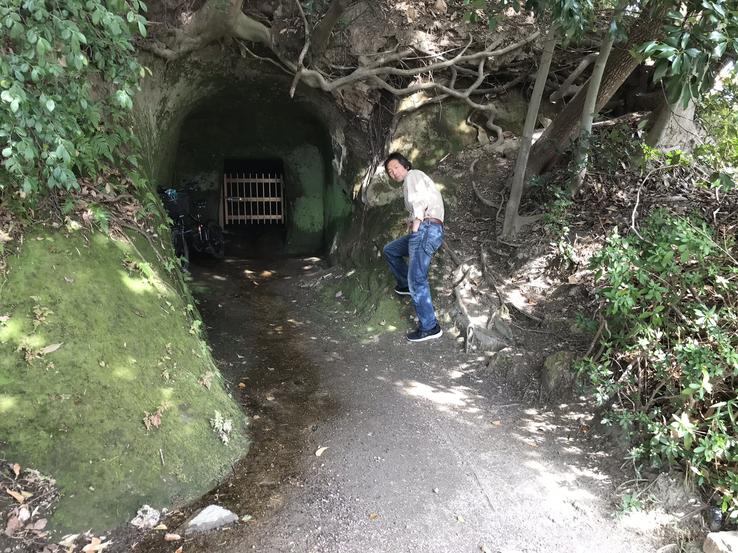
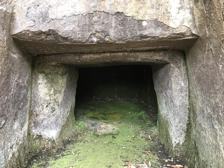
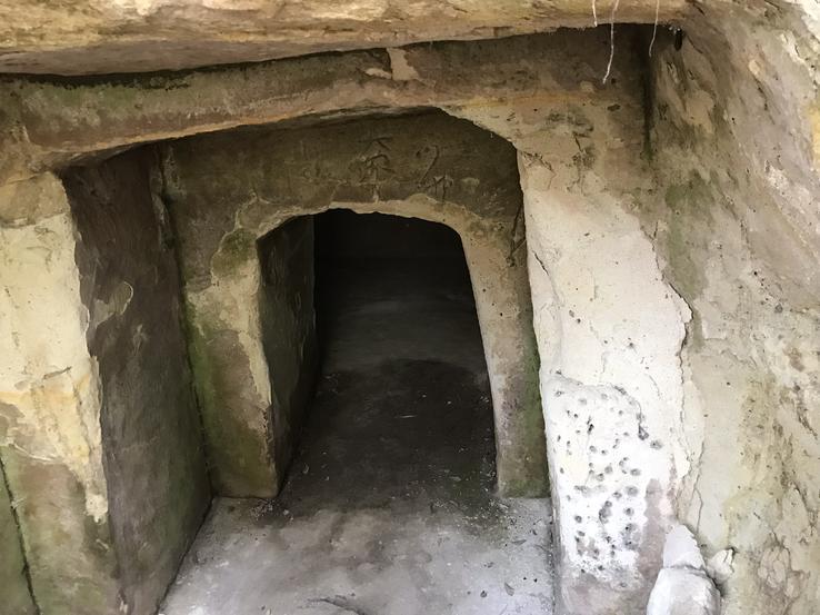
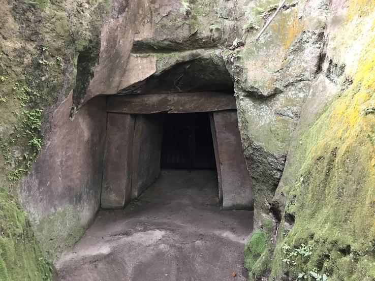
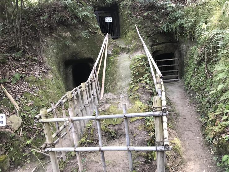
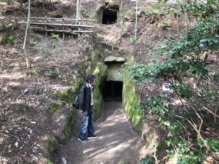
A heavy climate and an unusual air flow from a 580-meter-high mountain cliff within the Takaida Yokoana Park in Kashiwara (a city on the Yamato River, east of Osaka Prefecture and along the border of Nara Prefecture),add to the Japanese's already down, sad and manic depressive penchant.The negative vibration comes from the surrounding 160 confirmed ancient kofuns or tombs (it is estimated that there are more than 200) excavated directly in the tuff (a soft stone formed of compressed ash deposited as a result of the eruption of the neighboring Nijōsan volcano, about 10 years ago)million years) according to the natural topography of the hill.
Takaida, a very common locality name in Japan, means “high rice well”, and Yokoana, “side hole”, cave or tunnel. There are solitary tombs and in subgroups made up of two to four groups. It is speculated that this is due to the form of the composition of the clans in the 7th century, that is, for members of the noble families that constituted the group. About three bodies were stored in the deep chambers.
The tombs of Takaida, with characteristics similar to those found in other archaeological sites in the world and in Japan, were built over a period of 30 or 40 years sometime between the middle of the 6th century and the beginning of the 7th, that is, within the Asuka Period (538 to 710 AD or 596 to 645 AD), with its beginning coinciding with the end of the previous period, the Kofun (250 to 538), both smaller subdivisions of the Yamato Period (between the second half of the 3rd century AD andthe year 710, the beginning of the Nara Era).
The Asuka period (name derived from the Asuka region, in which the Japanese court settled, about 25 kilometers south of the current city of Nara), was marked by its significant social and political transformations and the arrival of Buddhism from China through the Korean Peninsula, in addition to changing the name of the country from Wa (Yamato) to Nihon (Japan). Throughout the Yamato Period, there was a great deal of interaction between Japan and the Korean Peninsula, and at the time the tombs were built, this area was inhabited by many newcomers from Korea. It is not possible to say, however, that the builders of the Takaida tombs were newcomers from Korea, not least because they are much more similar in style to the kofuns of the previous period.
CLAUDIO SUENAGA EXPLORING AND EXPOSING THE HIDDEN JAPAN
Ishi-no-Hoden Kofun on Neyagawa: The mystery of the finely cut and polished tomb
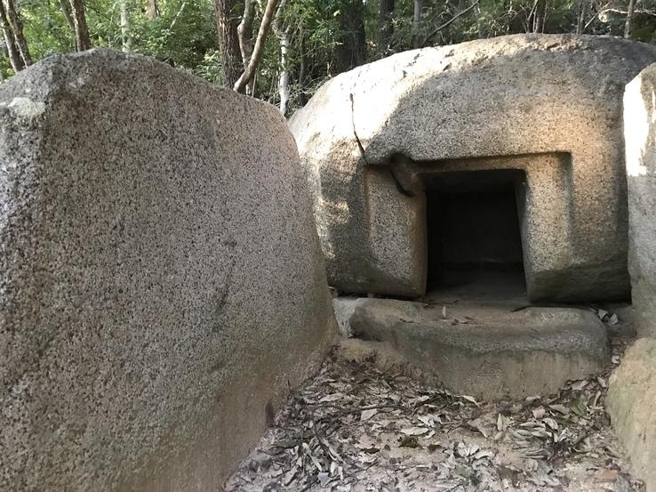
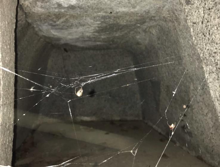
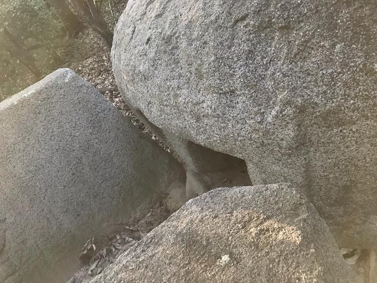
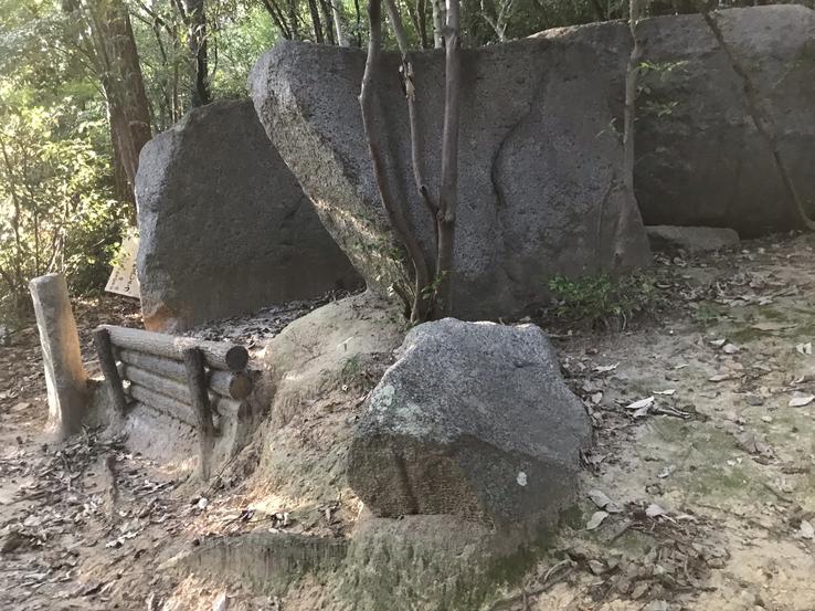
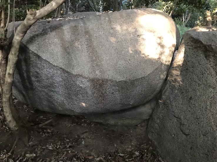
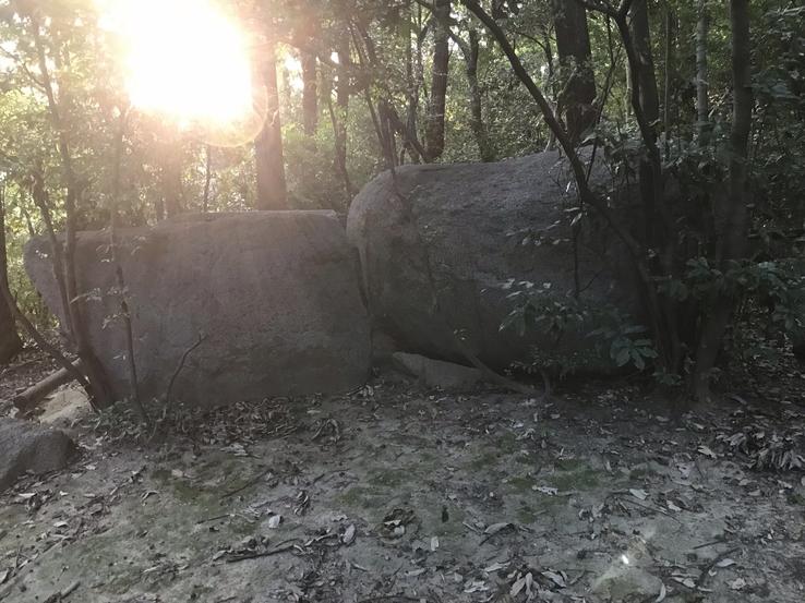
A total mystery hangs over this one of the rare tombs dug directly out of granite rock, and finely cut and polished to boot. He knows practically nothing about it, neither by whom it was built nor for whom.
It is estimated, however, that Ishi-no-Hoden (literally "Stone Treasure Hall", name identical to the megalith almost 6 meters high and 500 tons in the city of Takasago, Hyogo province, where I have also been and already discussed in previous articles), on the northern slope of the Ikomasanchi mountainous area, behind the Uchiage Shrine, in Neyagawa city, Osaka province, Kansai region, Honshu island, would date from the end of the Kofun Period (250 to 538 AD), since there were found Sueki (or Sue) pottery pieces, which appeared in the mid-5th century.





Claudio Suenaga exploring and exposing THE HIDDEN JAPAN
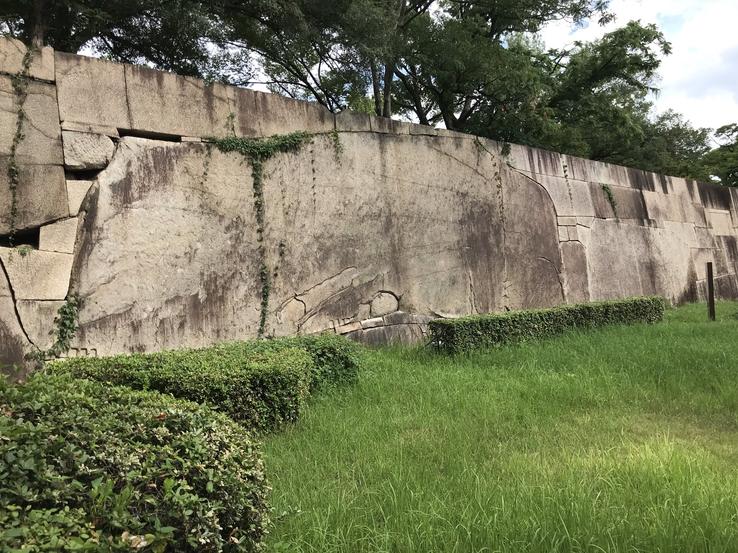
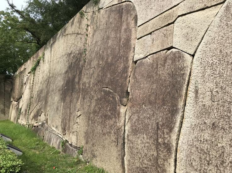
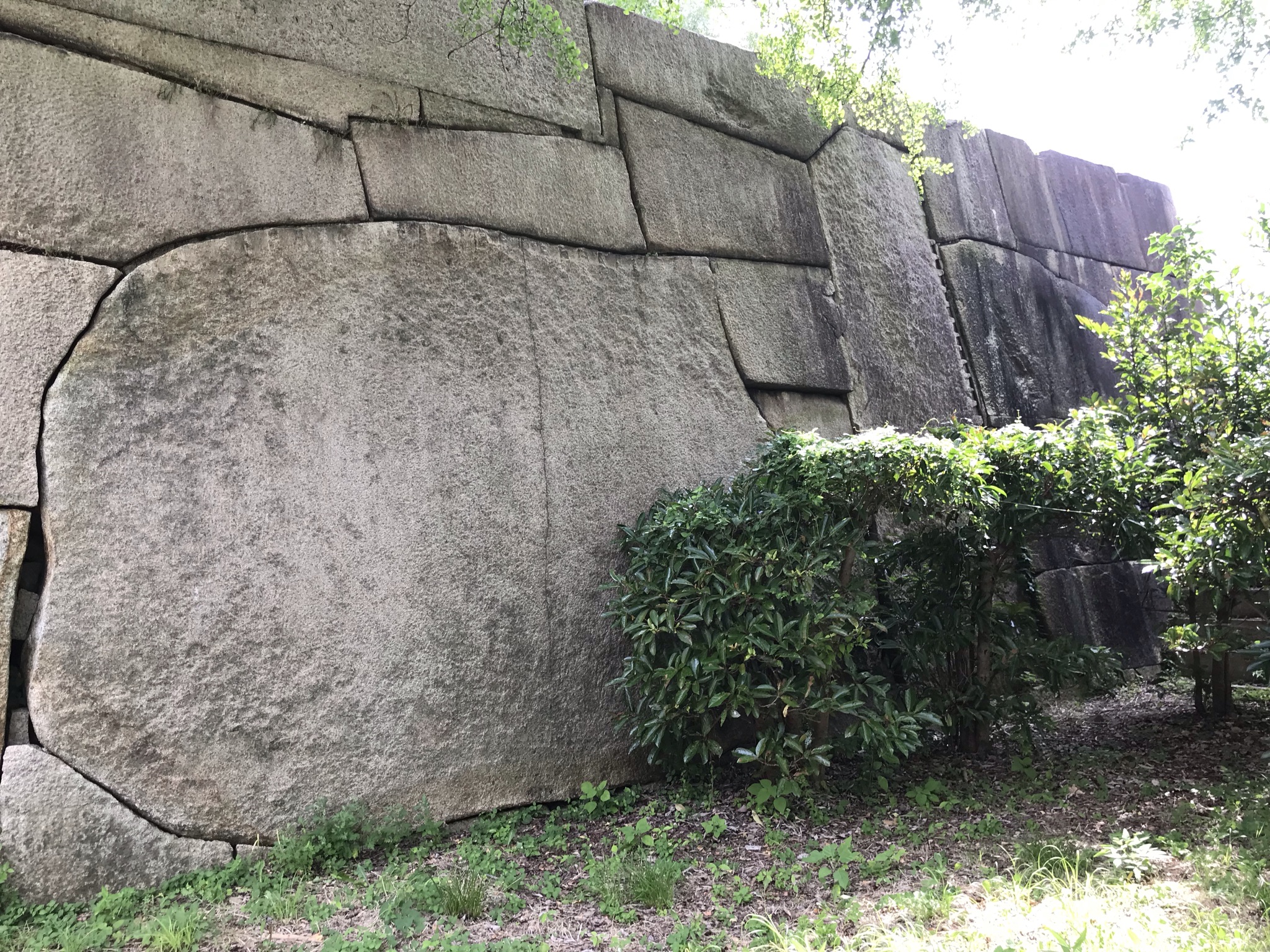
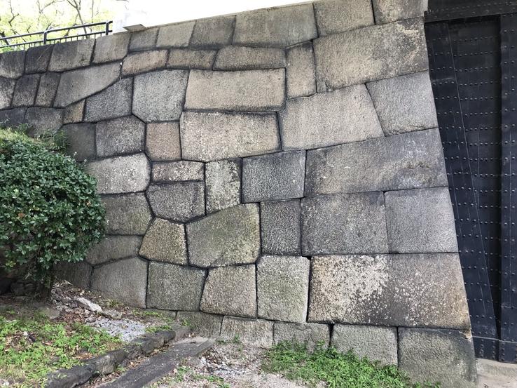
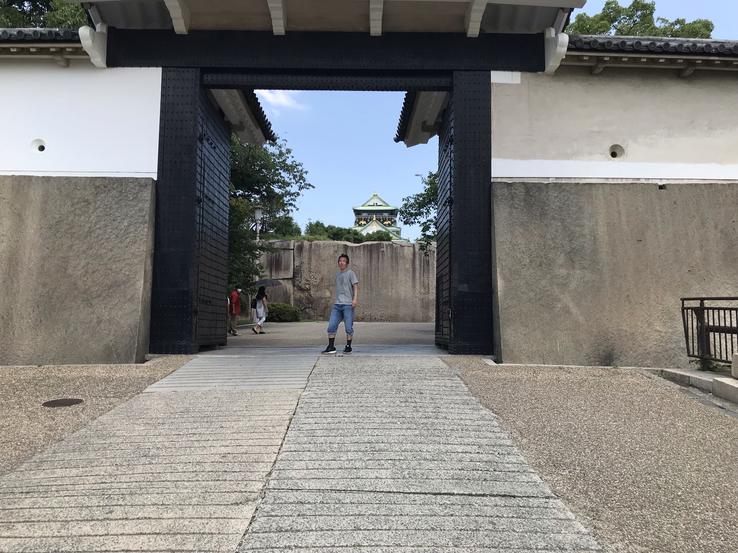
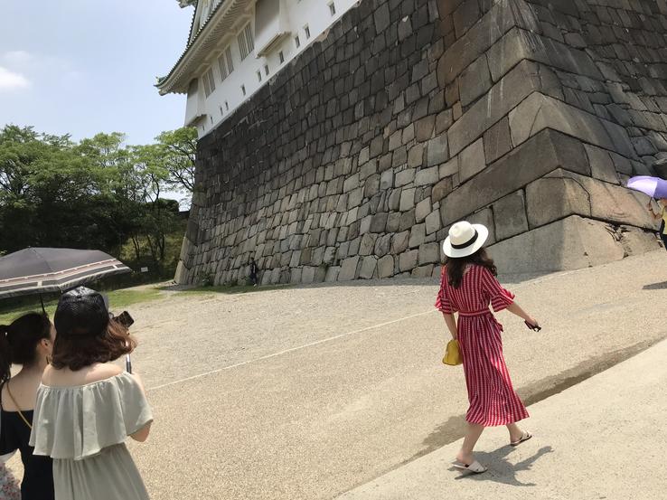
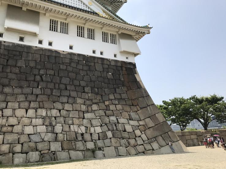
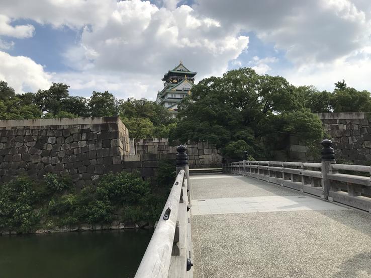
The cyclopean walls of Osaka Castle
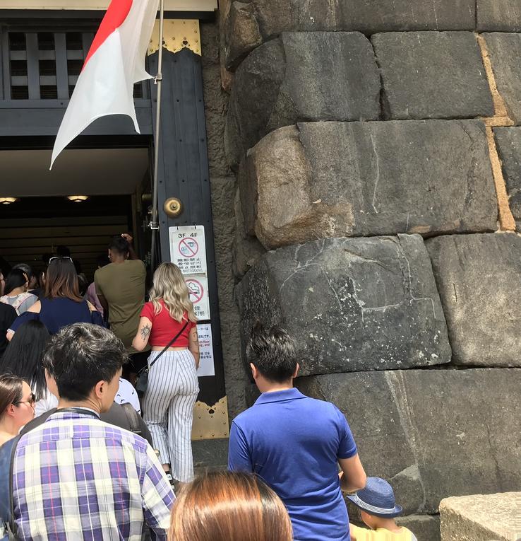
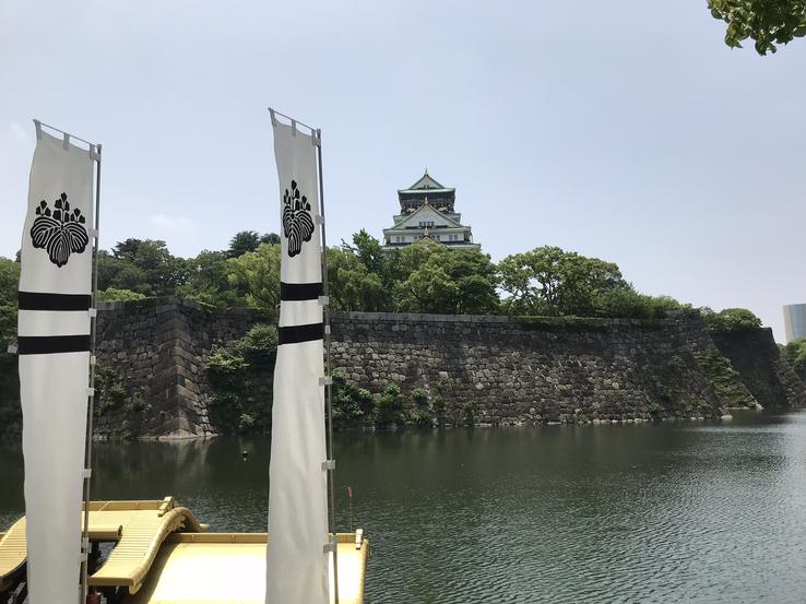
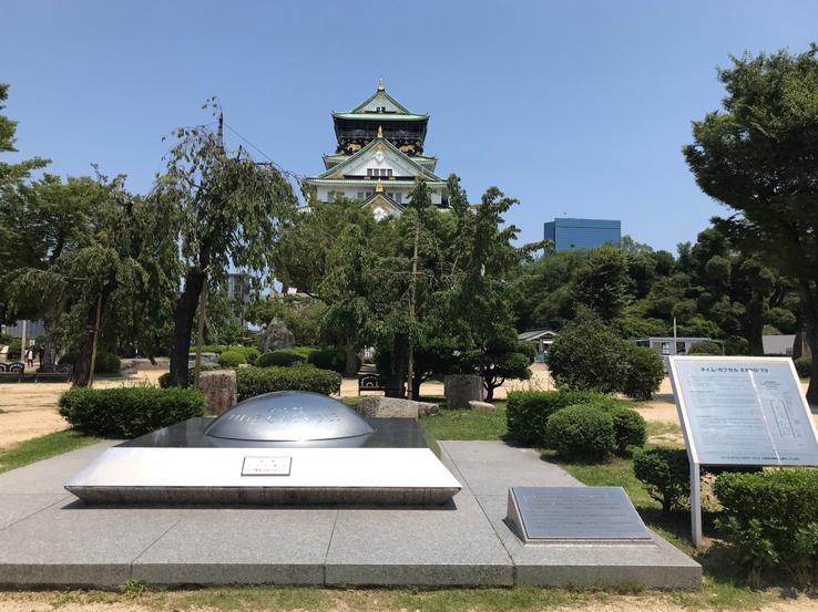
When visiting one of Japan's most famous castles, Ōsaka-jō or Osaka Castle, in the Chūō-ku district, the most central here in Osaka, in the south of the island of Honshu (capital of the Empire in the 5th century and today the thirdlargest Japanese city after Tokyo and Yokohama), I came across something unusual, not only because I was at the opposite end of the world but also because I expected to find only historical relics typical of the end of the Azuchi-Momoyama Period (1573-1603) and the beginning of theEdo (1603-1868), the Japanese Feudal Era.
Location: 1-1 Osakajo, Chuo Ward, Osaka, 540-0002
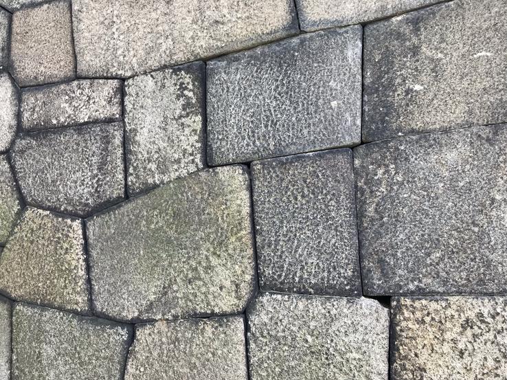
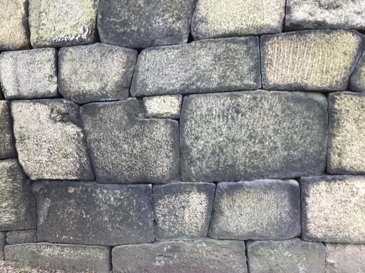
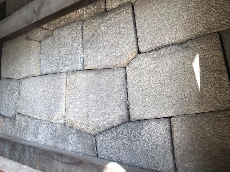
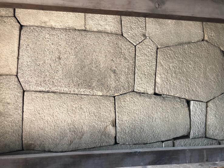
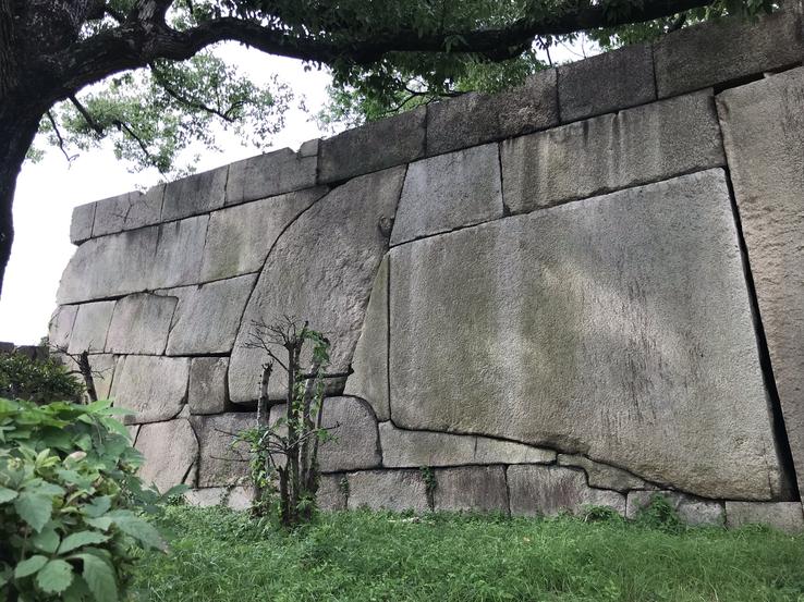
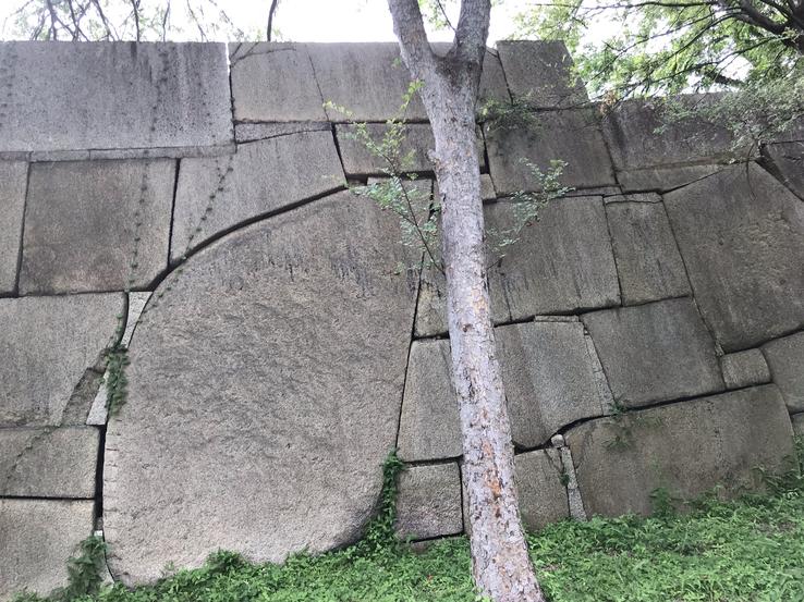
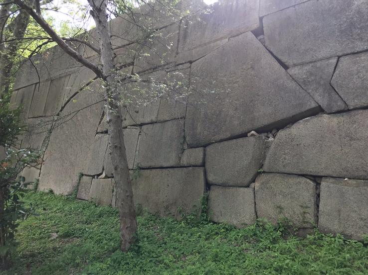
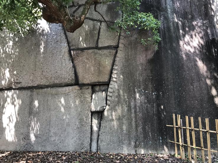
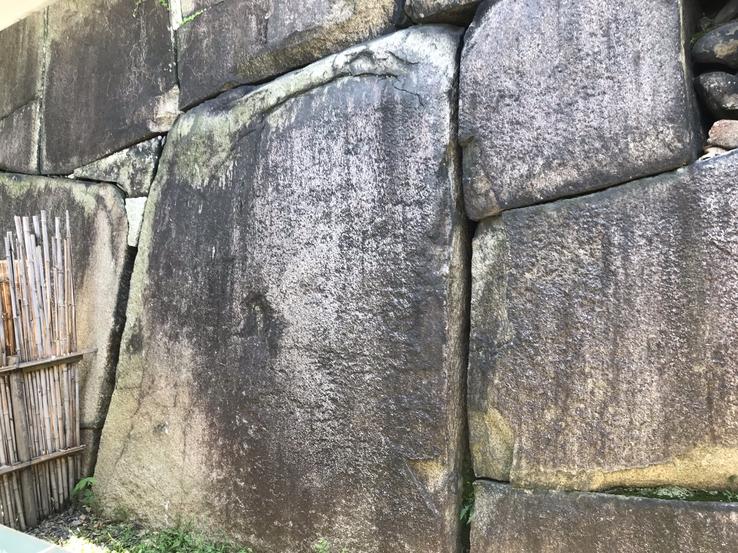
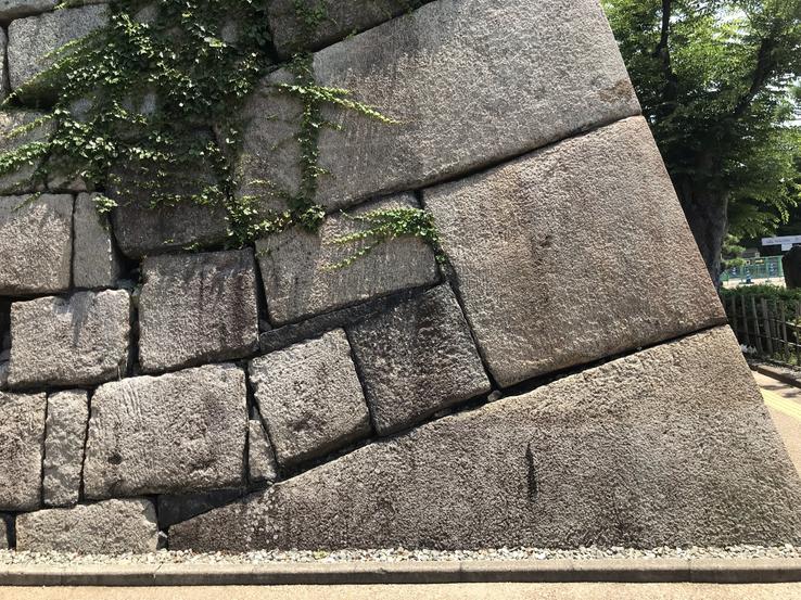
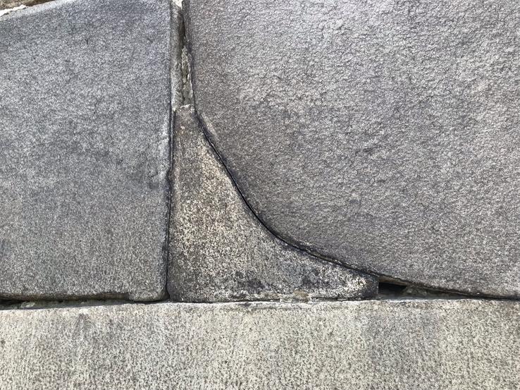
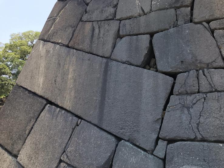
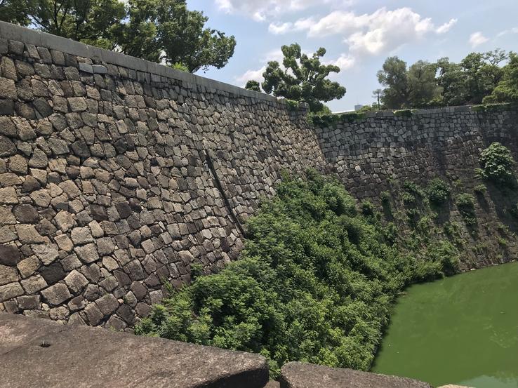
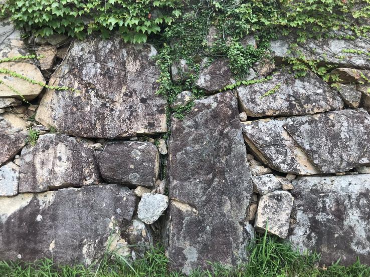
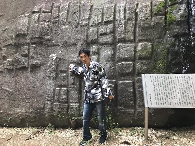
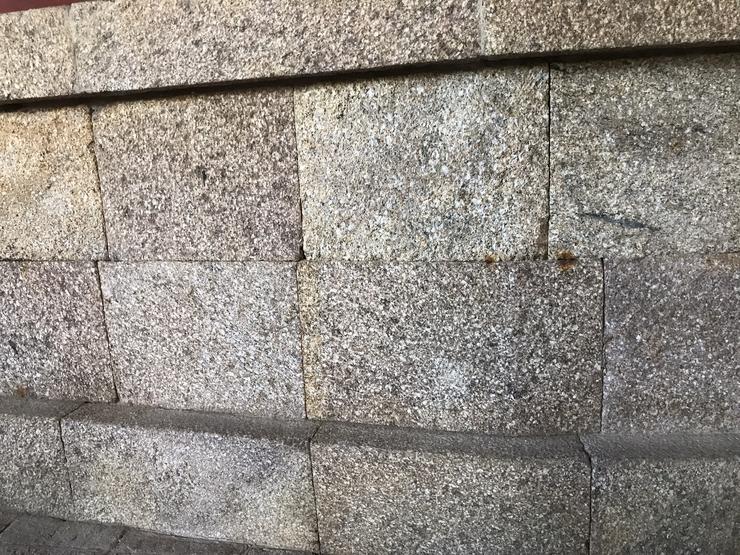
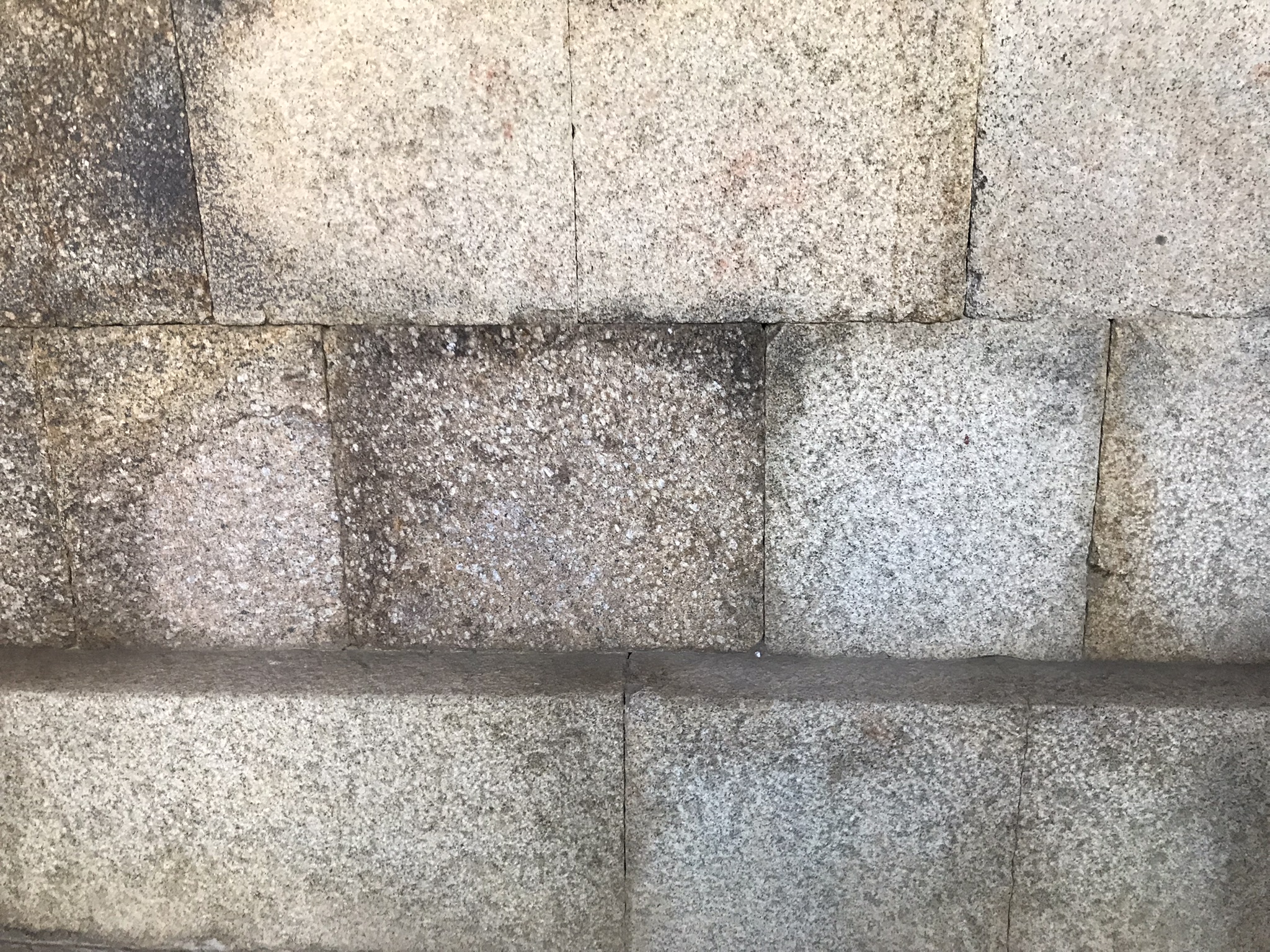
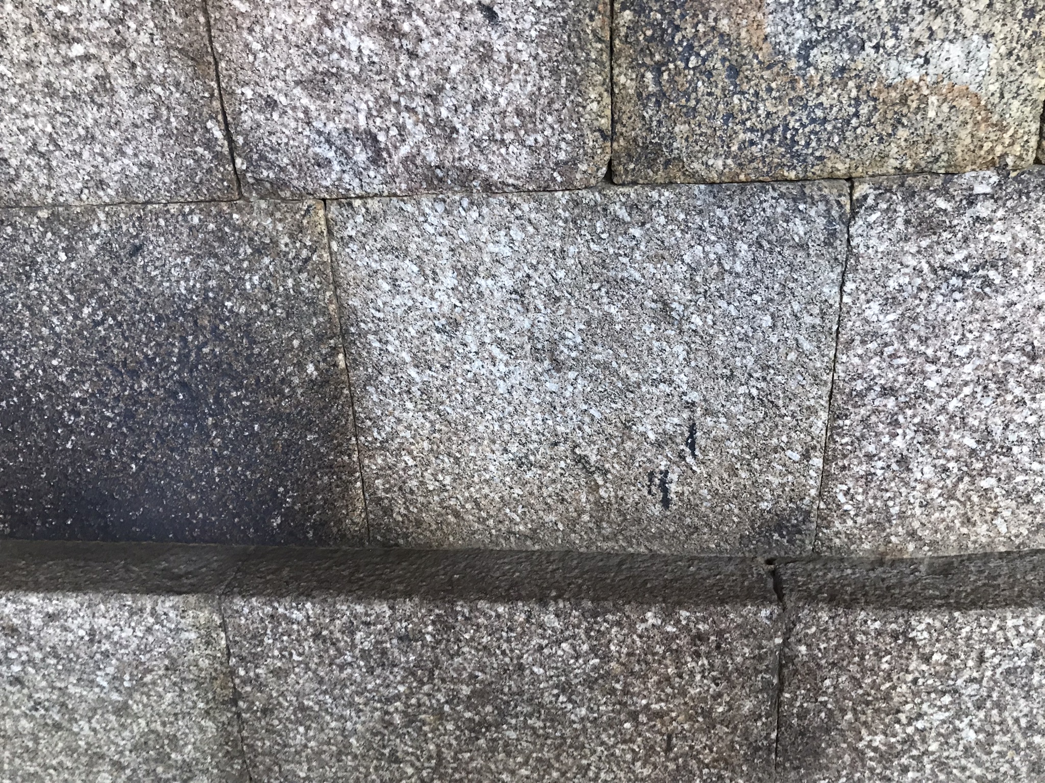
Amazed, I saw that I was facing the same perfect masonry work present in the Inca forts of Sacsayhuaman, Ollantaytambo and Machu Picchu, in Peru; in Tiahuanaco, near the southeastern shore of Lake Titicaca, in Bolivia; in the pyramids and tombs of Ancient Egypt; on the walls just above the line of statues prior to the Ahu Period (1200-1680) in Anakena and at the other end of Easter Island, in Vinapu; on the Baalbek terrace, north of Damascus, Lebanon; in the temples of Milandu, an island in the Maldives archipelago, in the Indian Ocean, southwest of Sri Lanka and India; and in so many other places, attesting to the existence in the remote past of an advanced civilization capable of handling, transporting, cutting and polishing large stones and uniting them without mortar, a culture of Sun worshipers - among the Incas, according to several chroniclers, Manco Capac, the founder of the Inca Empire and first governor Cusco (1200-1230) was the one who instituted it in the 13th century - which spread throughout the world and was present even in Japan (the land of the rising sun!), Taking with it an old and improved technology that has been lost. Cultural links extend everywhere.
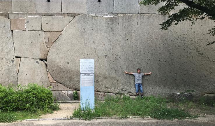
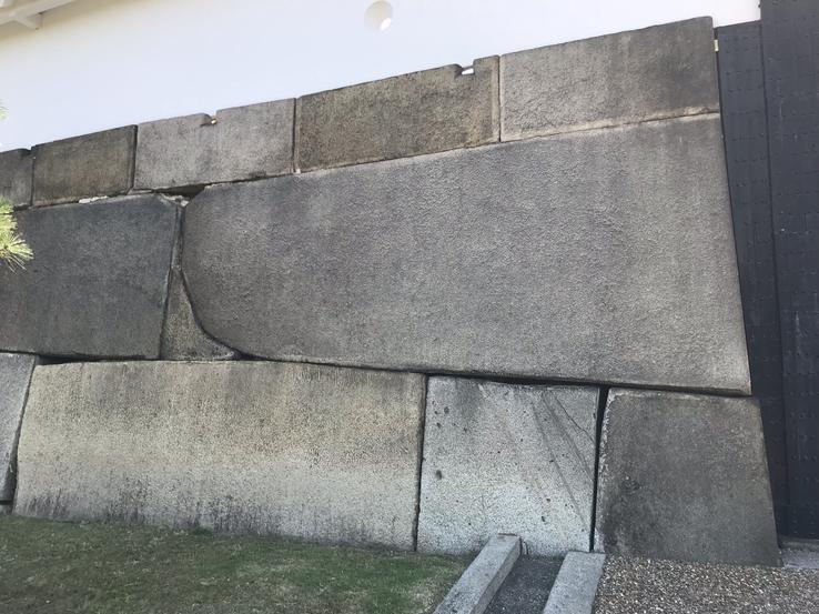
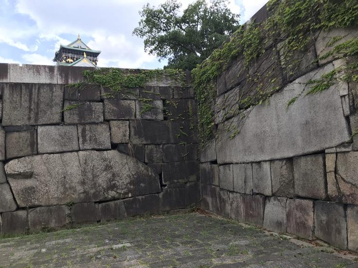
The Higoishi Stone can be found at the Kyobashi-guchi entrance to Osaka Castle. It has a surface area of over 54 square meters and its weight is 120 tons. It was placed here by Ikeda Tadao (an Okayama feudal lord ordered to take control of this region by the Tokugawa shogunate) during reconstruction efforts on the castle between 1620 and 1629, early Edo Period (1603-1868). The stone came from the island of Shōdoshima, located in the Inland Sea of Seto, part of present-day Kagawa Prefecture, formerly Sanuki Prefecture, at a distance of 176 km, that's right.
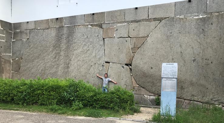
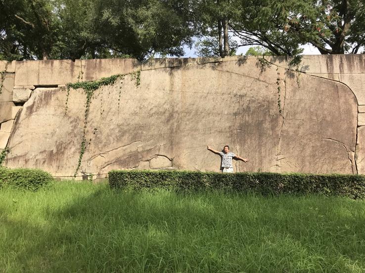
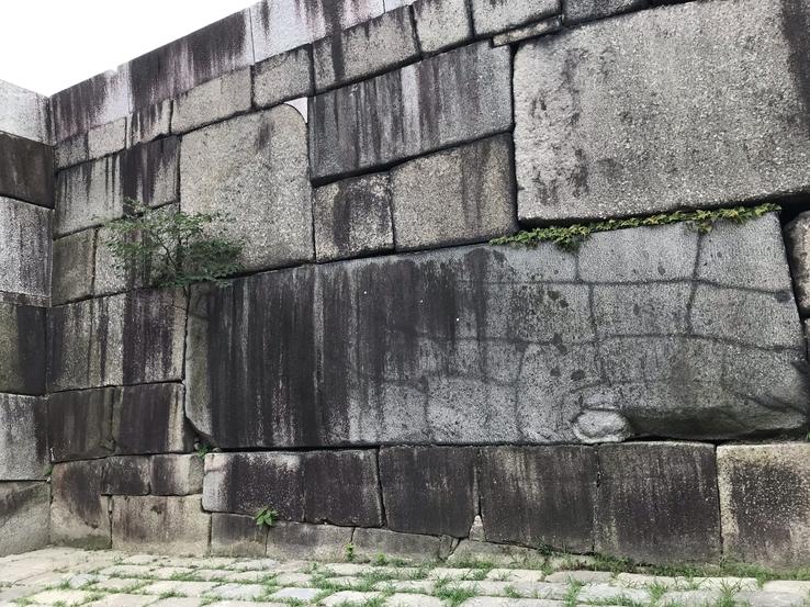
Huge stones at Sakuramon-masugata Square. To protect the front entrance to the Hommaru (Inner Bailey), a Masugata Square surrounded by a stone wall was created inside the Sakuramon Gate. This stone wall was built during the early Edo period in 1624, by Tadao Ikeda, a feudal lord of Okayama, who was ordered to take charge of this part of the premises by the Tokugawa shogunate. The stones were brought from the island of Inujima, in the inland sea of Seto, located near the coast of Okayama province, at a distance of 130 km, that's right. The stone in the front is known as Takoishi, literally, an Octopus Stone, and is the largest stone in the Osaka Castle, measuring 59.43 m2 in surface area and 108 t in estimated weight. The huge stone on the observers' left side of Takoishi is the third largest in the Osaka Castle, known as Furisodeishi meaning long-sleeved kimono stone, with a surface area of 54 square meters and weighs an estimated 120 metric tons. The black streaks are from the fires associated with the fighting at the castle in 1868.
In addition to the Octopus Stone, the wall surrounding the Castle also includes four colossal stones over 100 tons and fifteen stones over 50 tons! How were these gigantic stones cut, transported and assembled in the middle of the Japanese Feudal Era? The magnitude of the constructions - in contrast to the apparent and supposed lack of technology of the time - makes us soon come up with fantastic theories.
Claudio Suenaga exploring and exposing THE HIDDEN JAPAN
The “Inca” walls of Himeji Castle
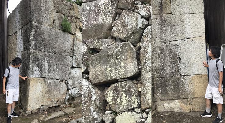
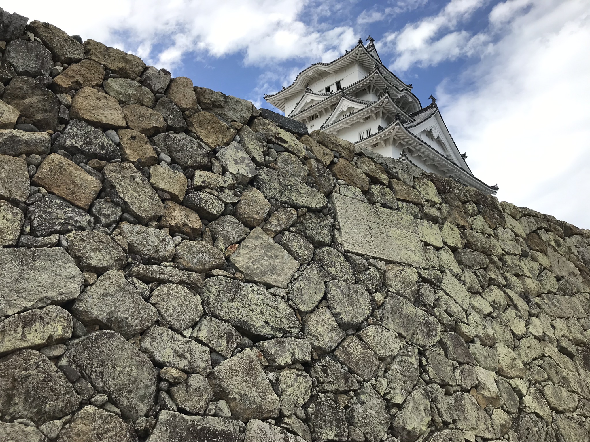
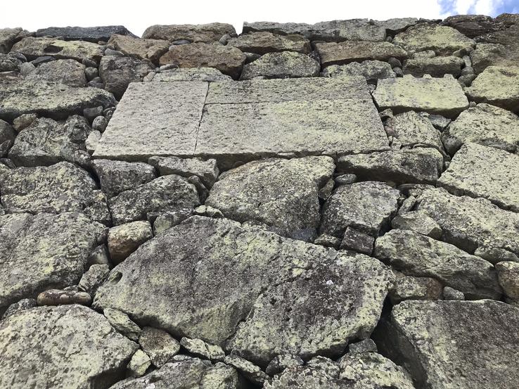
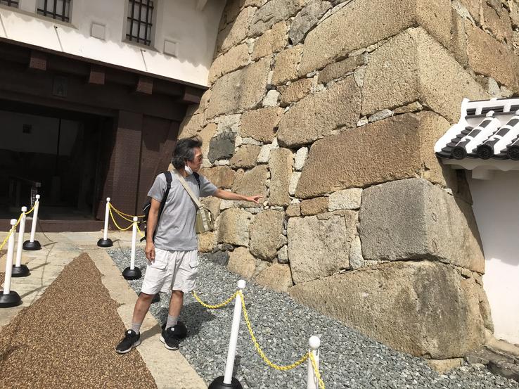
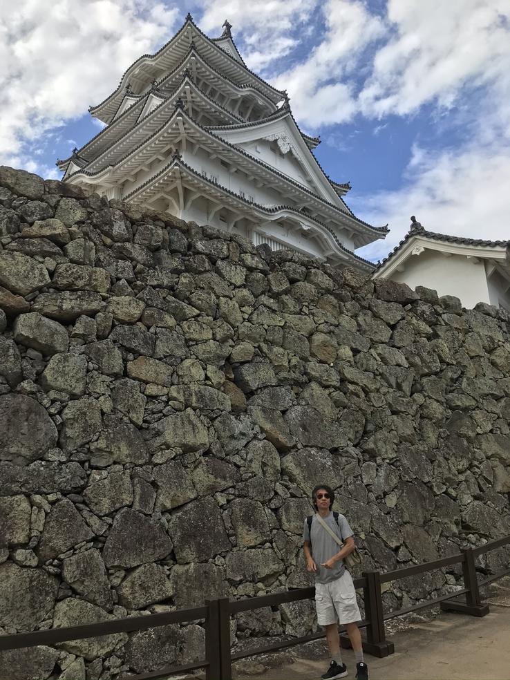
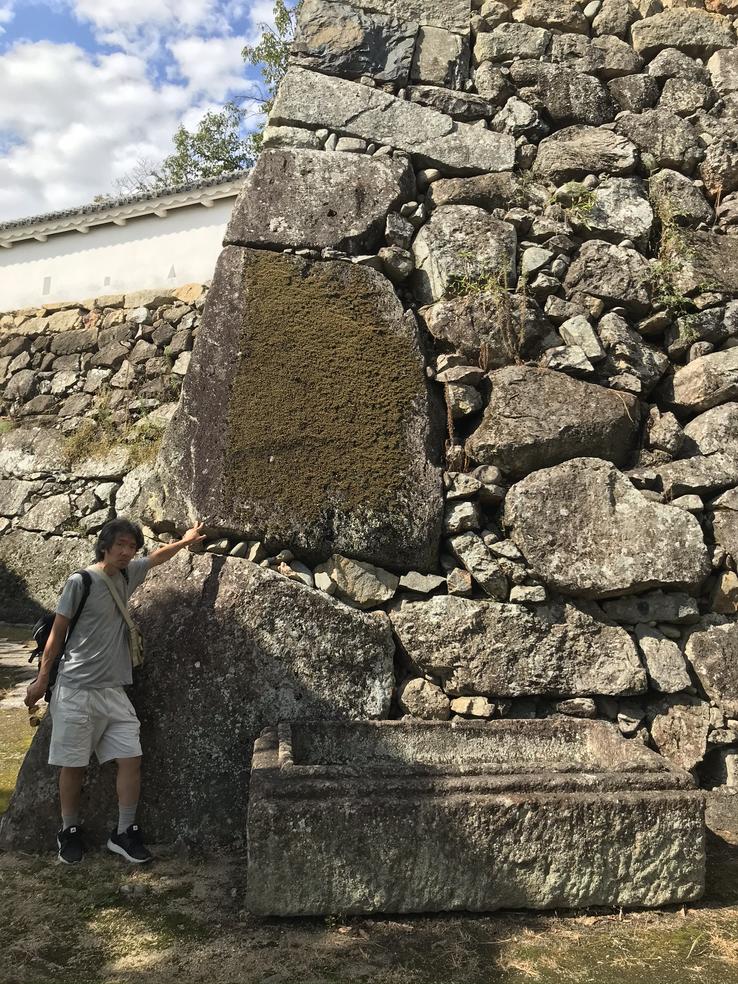
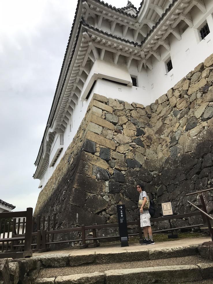
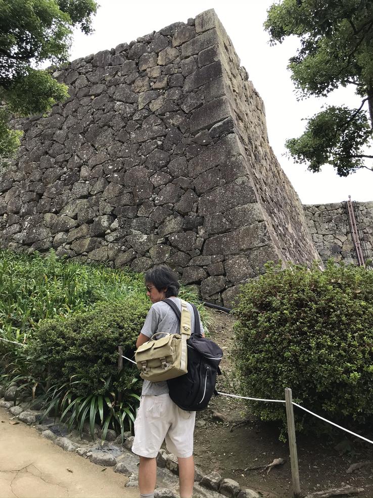
Founded by the samurai Akamatsu Norimura, who in 1333 had a fortress erected on the Himeyama hill to protect himself from the attacks of the local shoguns, in 1581 the structure began to be transformed into a castle by the daimiô Toyotomi Hideyoshi and was the home of 48 feudal lords in the centuriesfollowing.Impregnable, Himeji Castle, in the prefecture of Hyogo, Kansai region, was never surpassed in battle, survived the Second World War unscathed, and thus kept its original form intact, having been declared a National Treasure in 1931 and a UNESCO World Heritage Sitein 1993. But Himeji is much more than a castle.Its colossal stone foundations and defensive walls, cut and fitted exactly and made to last and resist earthquakes, comparable to those of the ancient Mesopotamian, Egyptian, Mayan, Aztec and mainly Inca civilizations, without any known contact.with these other peoples.
Location: 68 Honmachi, Himeji, Hyogo 670-0012
Himeji-jō is the most famous and visited castle in Japan, also known as Hakuro-jō or Shirasagi-jō (Castle of Heron or White Heron) due to its shiny white exterior, whose construction dates back to the 14th century during the Nanbokuchō Era, also known as the Era of Courts Hokuchō and Nanchō (1336-1392) of the Muromachi Period (feudal military regime established by the third Ashikaga Yoshimitsu shogun and controlled by the shoguns of the Ashikaga clan from 1336 to 1573). Located in the south of Hyogo Prefecture, about 50 kilometers west of the city of Kobe, it served as the setting for several films, including You Only Live Twice, with Sean Connery, in 1967, and The Last Samurai, with Tom Cruise, in 2003.
The labyrinthine defensive system and the multiple towers are the main highlights of the castle protected by huge stone walls and two moats (the width at its widest point is 34.5 meters with an average of 20 meters, while the depth is about 2.7 meters). The walls have a total length of 4.8 kilometers (3 miles) and some sections reach a height of 26 meters (85 feet).
With an estimated weight of 5,700 tons, the main fortress, behind three smaller fortresses, all interconnected by corridors and passages that form an internal courtyard (hommaru), is the one located in the middle and appears to have five levels, which in fact are seven,since two levels are below the five visible layers.
As good stones could not be chosen one by one in the Age of Civil Wars in 1500, stone headstones and coffins were also used in this castle. Although we do not know for sure, as there are no records, it is assumed that only the area of the wall called Uchikuruwa is about 28,000 m², the volume exceeds 38,000 m³ and the weight of 103,000 tons. If we were to transport these ship stones today, we would need 35 ships of 3,000 tonnes or 21,000 containers of 5 tonnes. Some gigantic stones that weighed hundreds of tons were used.
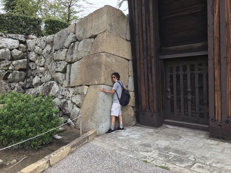
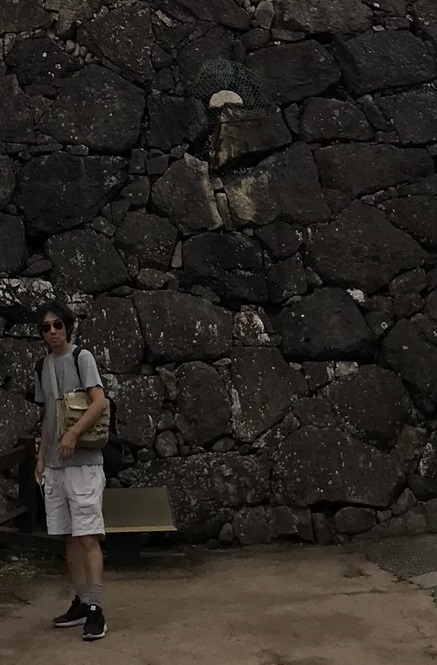
Even before entering the castle area through the Ote Gate, the main gate, whose current wooden structure was rebuilt in 1938, we already saw huge blocks of stone well worked and embedded in the Inca style to compose the outer wall and flanking the gate itself.
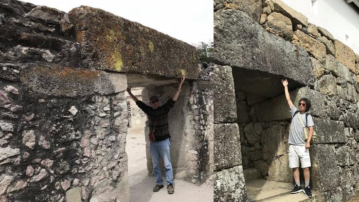
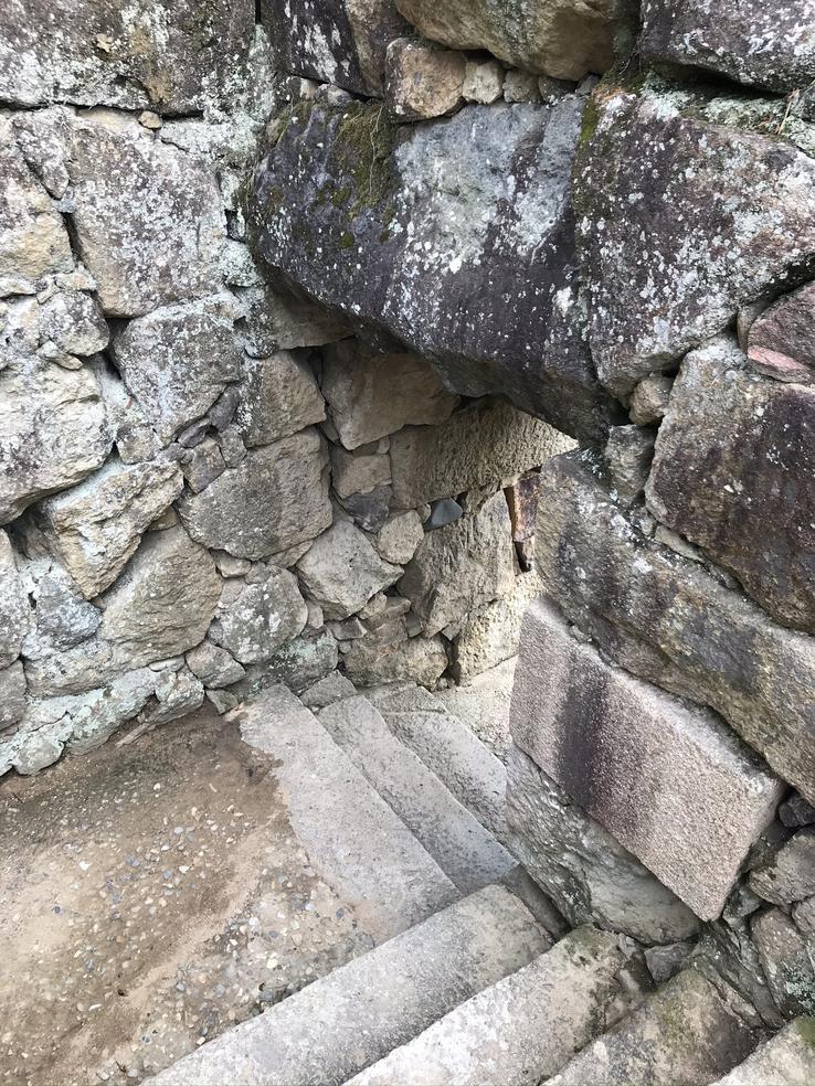
Ru Gate is also referred to as Ana Gate or Gate of the Home, and it served a tactical purpose, through which spies came and went, that is, it would be a secret exit from the castle. What stands out is the large lintel that sits on the jambs. This structure is identical to one found in Zapotec civilization in Mitla, Oaxaca, Mexico, as evidenced in this photo by explorer Brien Foerster.
Claudio Suenaga exploring and exposing THE HIDDEN JAPAN
Takeda Castle, Japan's Machu Picchu
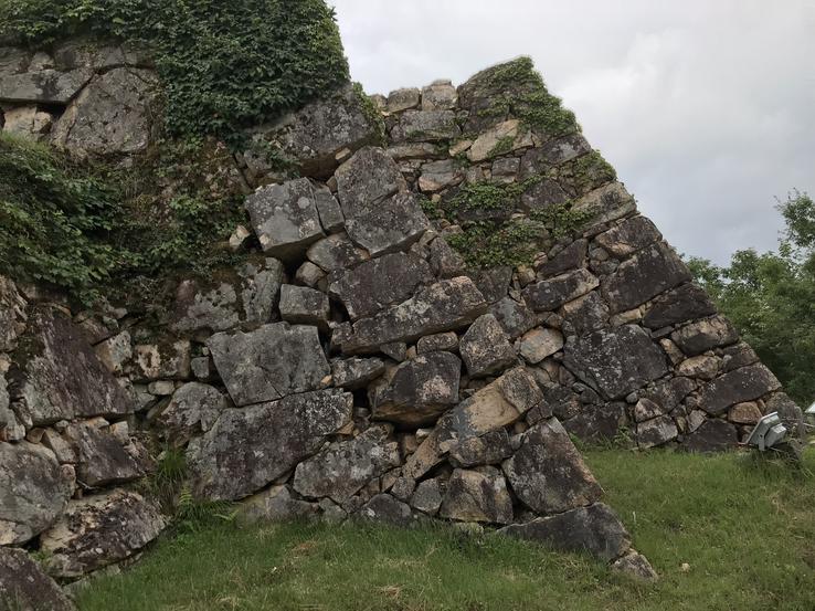
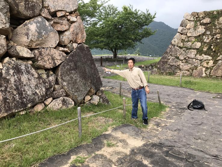
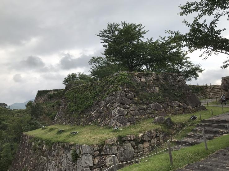
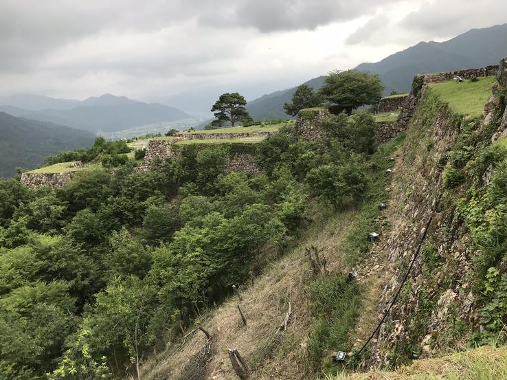
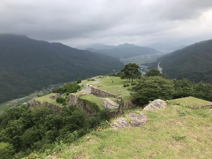
The ruins of Takeda Castle (Takeda-jō), known as the “Castle in the Clouds” or the Japanese “Machu Picchu”, are hidden in the depths of the tiny inner city of Asago, in the northern part of Hyogo province, Kansai region, on the island of Honshu, about 353 meters above sea level. Takeda, one of Japan's hundred largest castles, has only recently started to become known to the rest of the world.
Right at the entrance to the city of Asago, next to Takeda Station, we come across a menhir or cromlech, reminiscent of ancient megalithic monuments, which are present in all parts of Japan, as in the rest of the world.
Takeda Castle was built by Mitsukage Otagaki, a daimiô (powerful feudal lord) of the Yamana clan in 1441. Otagaki became lord of the castle, conquered in 1577 by Toyotomi Hideyoshi during the Tajima Province campaign to unify Japan and placed under control of his younger brother, Hidenaga, who in less than two years ended up moving to Izushi-jo. Akamatsu Hirohide, the last lord of the castle, fought alongside Tokugawa Ieyasu (1543-1616), the founder and first shogun of Japan's Tokugawa Shogunate, which lasted for more than 250 years and only came to an end with the Meiji Restoration in 1868. Although he fought bravely in the decisive battle of Sekigahara, popularly known as the “Kingdom Division”, on September 15, 1600, which paved the way for Tokugawa's rise to power in the same year, he was accused of arson and less than a year later he ended up committing seppuku. He was the last known owner of the castle and the premises were abandoned shortly after his suicide.
At the top of the ruins of Takeda Castle, we have a beautiful and wide view of the adjoining opposing mountains, the city and the valley below. At that dizzying height, we felt the danger of falling and rolling over the edge. There are no barriers or high fences that prevent you from approaching the edges.
Claudio Suenaga exploring and exposing THE HIDDEN JAPAN
Colossal floating megalith Ishi-no-Hoden
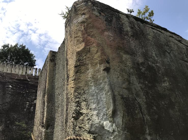
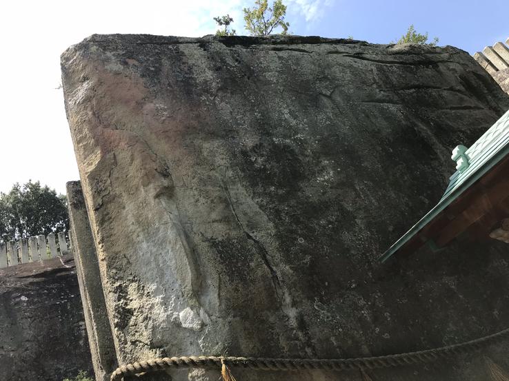
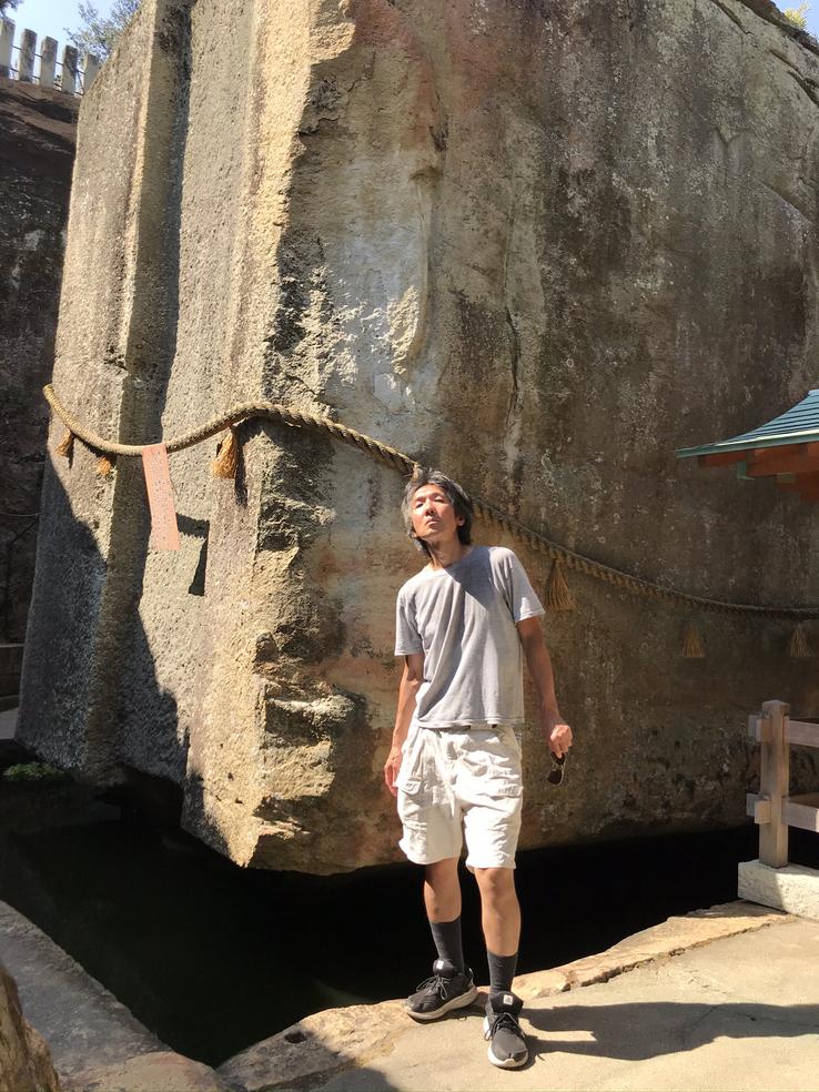
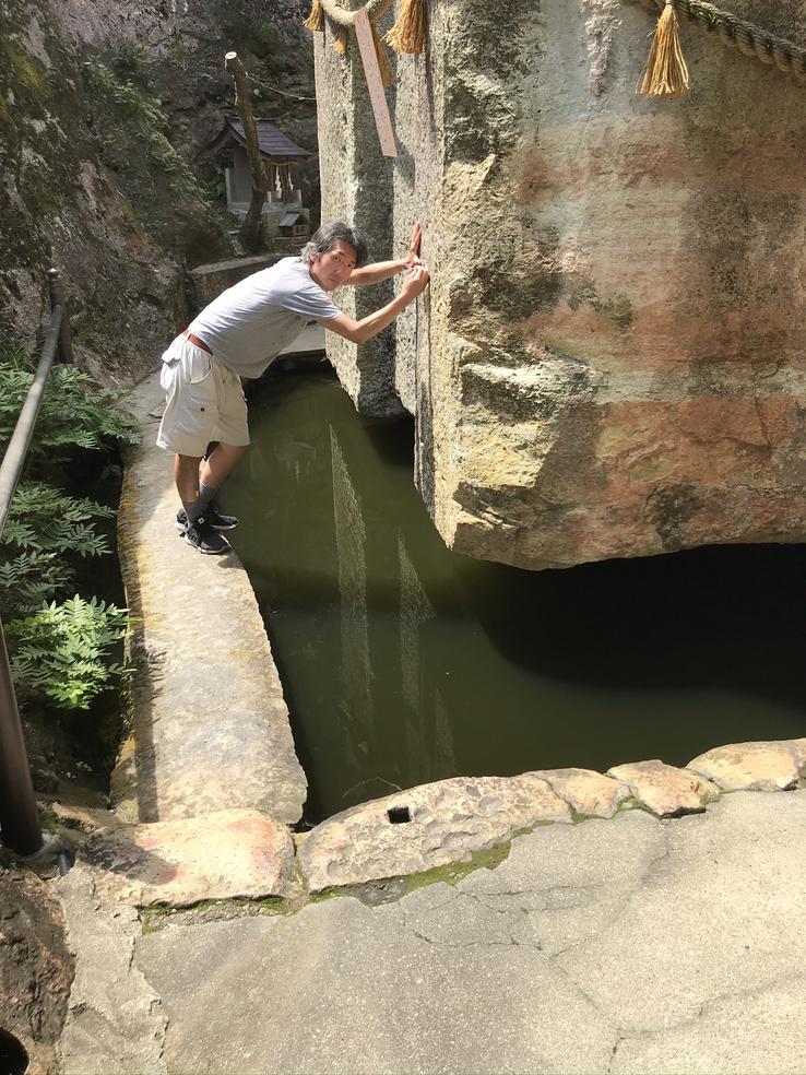
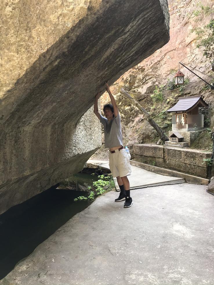
Ishi-no-Hoden (literally "Stone Treasure Hall"), one of the biggest and oldest puzzles in Japan's history and archeology, is a colossal megalith located in the Kansai region, in the Amidacho neighborhood, in Takasago city, Hyogo Prefecture, about 100 kilometers from Asuka, in the province of Nara.
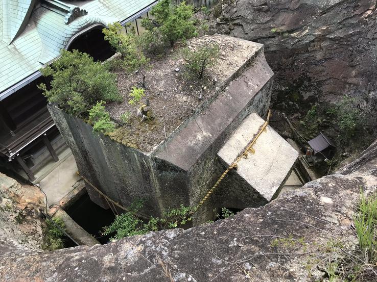
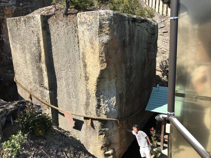
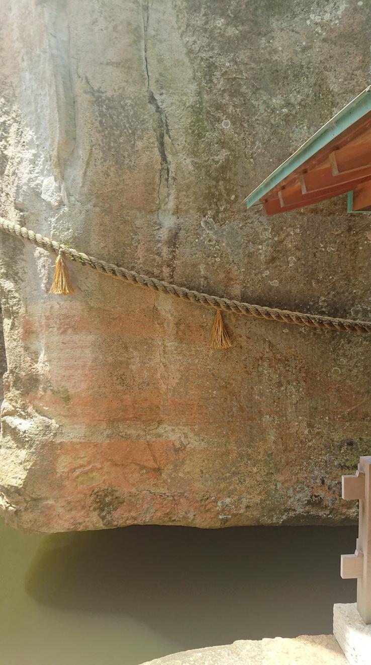
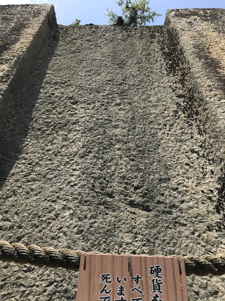
Carved out of hyaloclastite, a type of hydrated stone rich in black volcanic glass, formed during underwater or subglacial volcanic eruptions 70 million years ago, Ishi-no-Hoden is 5.6 meters high, 6.5 meters wide, 7.5 meters deep and weighs 500 tons. This makes it bigger than any of the stones used in the construction of the Great Pyramid of Giza, since the largest one weighs 80 tons, while the typical blocks of this pyramid weighed between 6 and 10 tons.
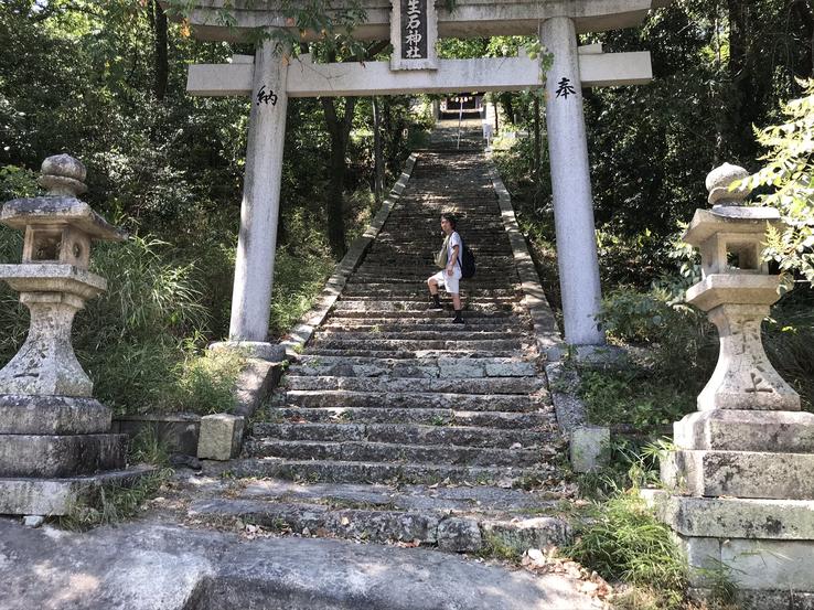
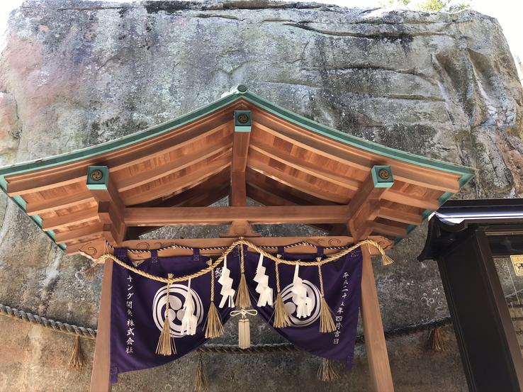
Japanese civilization developed over the centuries in the Kansai area and a Shinto shrine, the Ooshiko-jinja shrine, was built around the stone to worship and honor the god Onamuchi-no-kami (better known as "Ookuninushi", that is, "Great Master of the Earth"), ruler of the invisible world of magic that bequeathed knowledge in the fields of agriculture and medicine and that, according to Shinto mythology, assumed with Sukunahikona No Kami or Sukunabikona (who claimed to be so small that she escaped through the fingers of her mother, Kamimusuhi), goddess of healing and sake associated mainly with thermal waters, the challenge of building an entire castle on the spot in a single night. rebelled against Ookuninushi and Sukunabikona, reissuing the old Jewish myth of the fallen angels who rebelled against Yahweh, preventing them from completing the work, in which the stone palace, from which the nation would be governed, remained unfinished or semiman ufactured, with the appearance of a fallen house.
Records from the history of the city of Takasago confirm that Ishi-no-Hoden was already a well-known place during the Nara Era (710-794). Philipp Franz von Siebold (1796-1866), German physician, botanist, naturalist and explorer who entered then isolated Japan disguised as Dutch and introduced Western medicine to that country, stopped during his journey from Nagasaki to Edo (now known as Tokyo) in 1826 and made detailed sketches of it, which he published in the first volume of his book Nippon, a richly illustrated ethnographic and geographic work on Japan that he wrote during his stay in Leiden in 1832. Sibeold also wrote six additional parts, the last published posthumously in 1882. The Bibliotheca Japonica, co-written with fellow countryman Johann Joseph Hoffmann (1805-1878), a scholar of the Chinese and Japanese languages, and Kuo Cheng-Chang, a Javanese of Chinese origin, who had traveled together with Siebold from Batavia, it appeared between 1833 and 1841. This work contained a survey of Japanese literature and a Chinese, Japanese and Korean dictionary. Siebold's writings on Japanese religion and customs have remarkably shaped modern European conceptions of Buddhism and Shinto and have notably suggested that Japanese Buddhism was a form of monotheism.
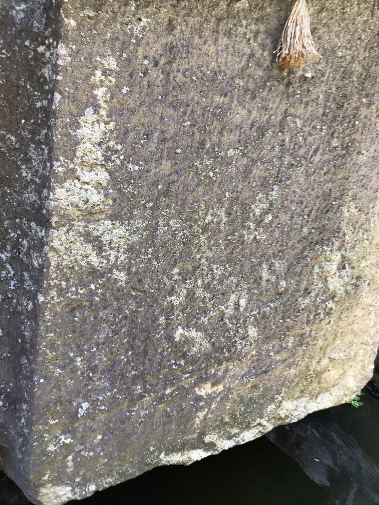
At first glance, the surface of the megalith, quite worn by time, with certain broken parts, appears to have been roughly and artistically roughed, but there are no traces of blows from stone axes, chisels or other hand tools. Would the lack of these traces in the rock indicate the use of unknown “machines” or sophisticated instruments?
And when you look at it from the side, you can't help thinking how much it looks like an old television set or computer monitor CRT (Cathode-ray tube), a type of thermionic valve containing one or more guns of electrons and a fluorescent screen used to view images invented by the German physicist Karl Ferdinand Braun (1850-1918) in 1897. Memories of the future?
Find out more by reading my article published on the website Ancient Origins.
Claudio Suenaga exploring and exposing THE HIDDEN JAPAN
Masuda-no-iwafune (Masuda Stone Ship)
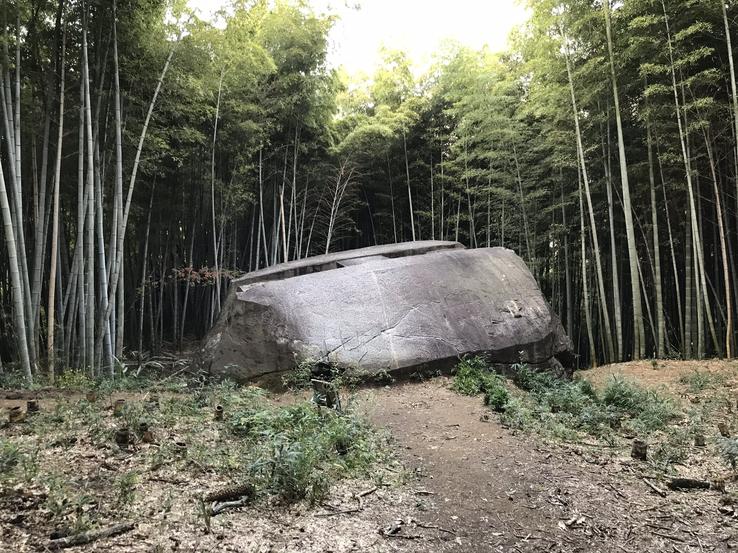
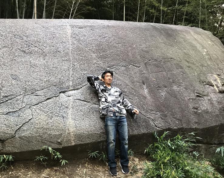
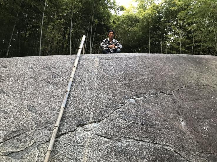
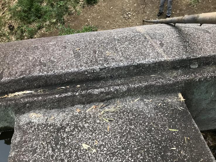
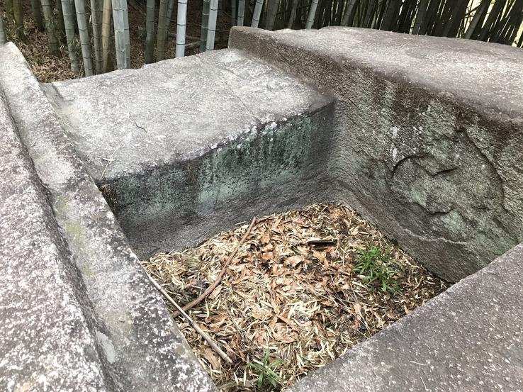
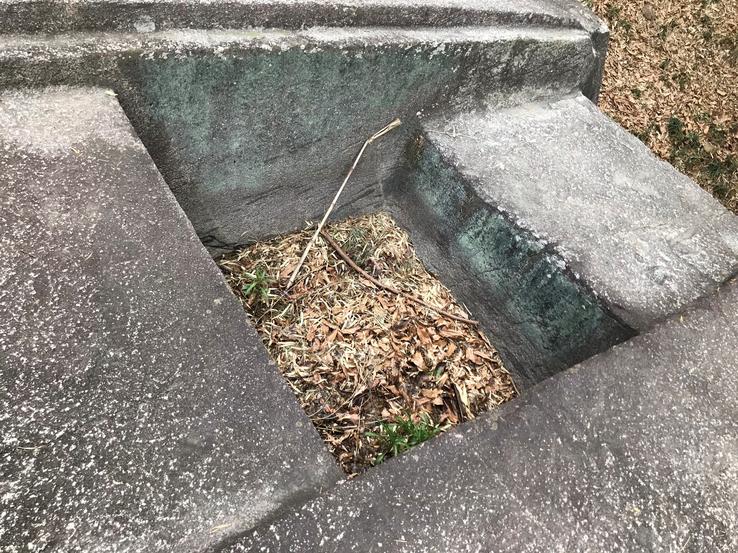
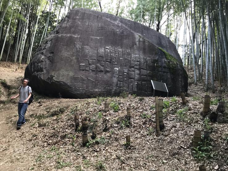
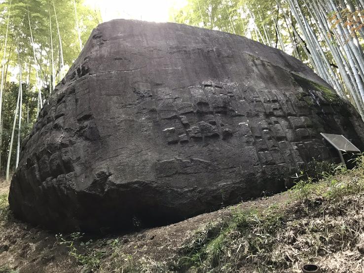
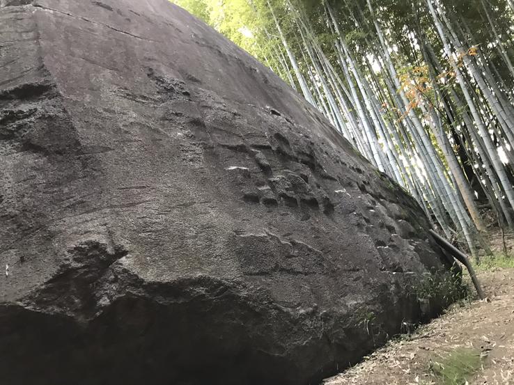
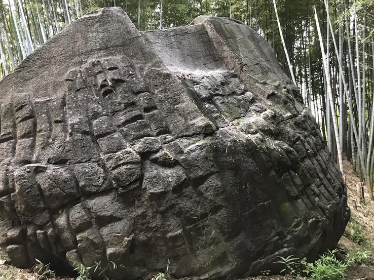
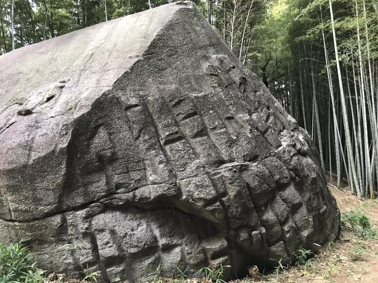
Masuda-no-iwafune (“Masuda Stone Ship”), on top of a hill in the middle of a residential neighborhood in the village of Asuka, in the Takaichi district, Nara province, is one of the strangest and most mysterious megalithic monuments in Japan. Carved out of a single 800-ton granite block measuring 11 meters long, 8 meters wide and 4.5 meters high, planed at the top, where there are two hollowed-out square cavities, and embossed lattice cutouts on the sides, evokes an unknown high civilization that disappeared without a trace.
Location: 8 Chome-20-1 Shirakashicho, Kashihara, Nara 634-0051.
One clue is that Masuda-no-iwafune has a certain similarity in its construction, not exactly in its shape, with another stone puzzle in Japan, as we just saw: Ishi-no-Hōden, in the city of Takasago (in the province of Hyogo, Kansai region), which although it is a place of worship dedicated to the Shinto god Onamuchi-no-kami (better known as "Ookuninushi", that is, "Grand Master of the Earth"), and the Ooshiko-jinja shrine templeit was built around the stone to worship it, nobody knows for sure who sculpted it, why and for what, but the fact is that, like Masuda-no-iwafune, it has similar grooves on the sides and two cavities at the top of the rock, even if they are not visible, hidden that are under trees that grew on them.
Why did they sculpt the Masuda-no-iwafune rock and for what purpose? Who, when and why? Did it have a ceremonial purpose? Could it have been used for fertility rites or animal and even human sacrifices? Were these cavities used to store and drain the blood of the immolated? Or were these "tanks" simply used to produce sake, Japan's traditional rice-based drink? Unfortunately, there are no definitive answers to these questions, but numerous suggestions have been made to explain this unique and unusual structure.
Some suggested that the site was an astronomical observation point.It is interesting to note that the central depression and the square holes in Masuda-no-iwafune are aligned and run parallel to the top of the mountain on which it rests, which would indicate that this specific stone may be related to the development of the Japanese lunar calendar.In addition, the summit of the top of the rock is aligned with the sunset on a certain day of the year called "Spring Entrance", which occurs 13 days after the spring solstice and is called "Pure Brightness". This day was important in the lunar calendar and in Japanese agriculture, as it marked the beginning of the agricultural season.
Learn more about Masuda-no-iwafune by reading my article published in the british magazine Shadows of Your Mind, edited by Dave Partridge.
Claudio Suenaga exploring and exposing THE HIDDEN JAPAN
Sakafune-ishi megalithic
monument and its connection to Masuda-no-Iwafune
The Asuka area, south of Nara, is one of the richest historically and
archeologically in Japan, full of kofuns (ancient tombs), megalithic monuments
and relics scattered over the hills and small farms, most of them shrouded in
mystery about their builders, age and original function. Some were of interest to archeoastronomers because
of their possible Solsticial alignment.
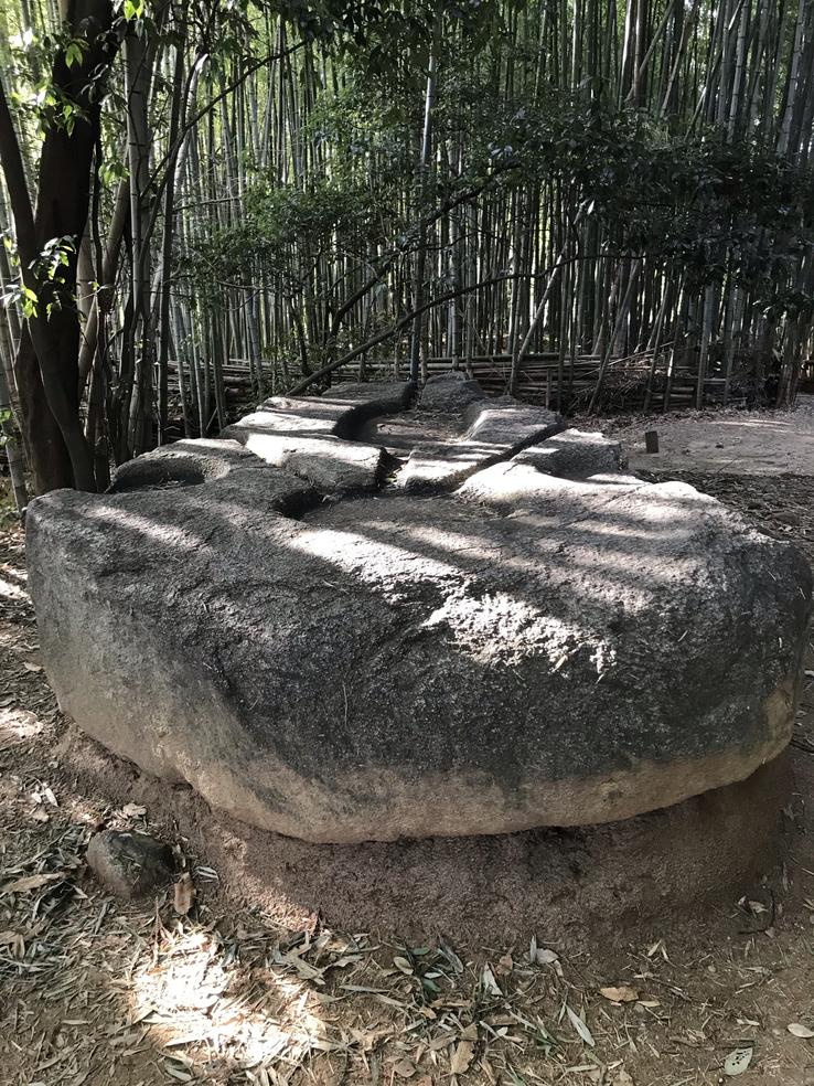
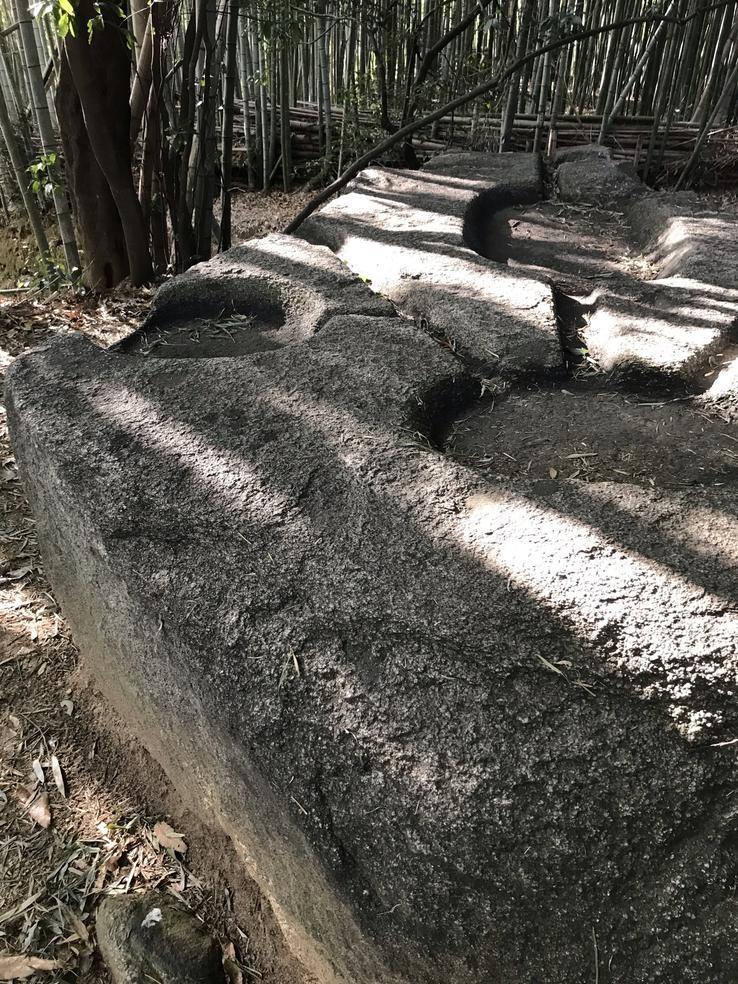
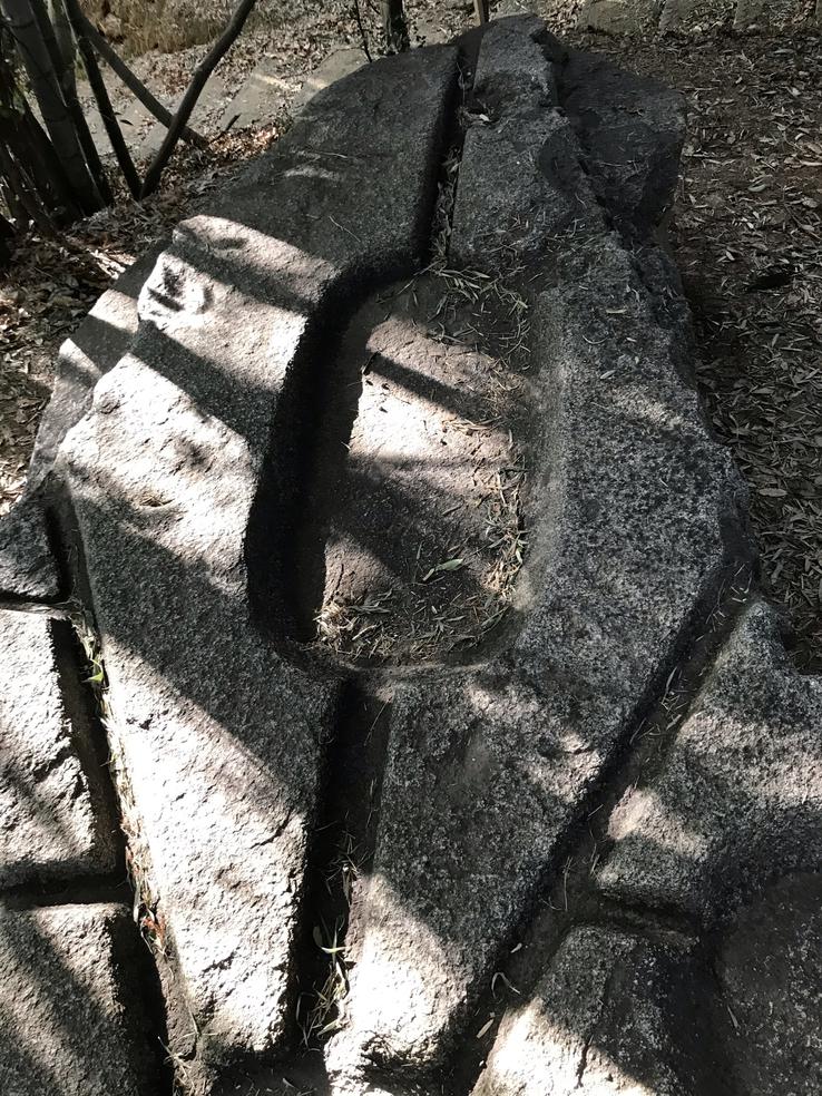
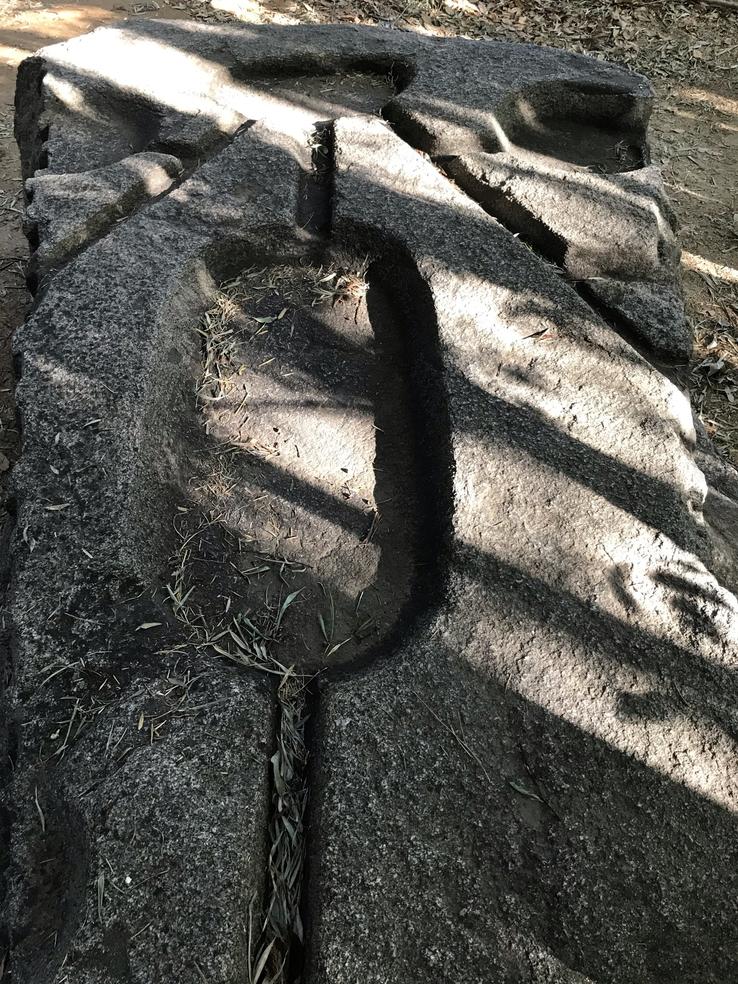
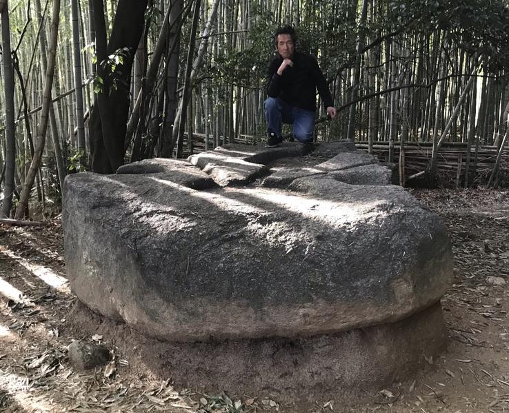
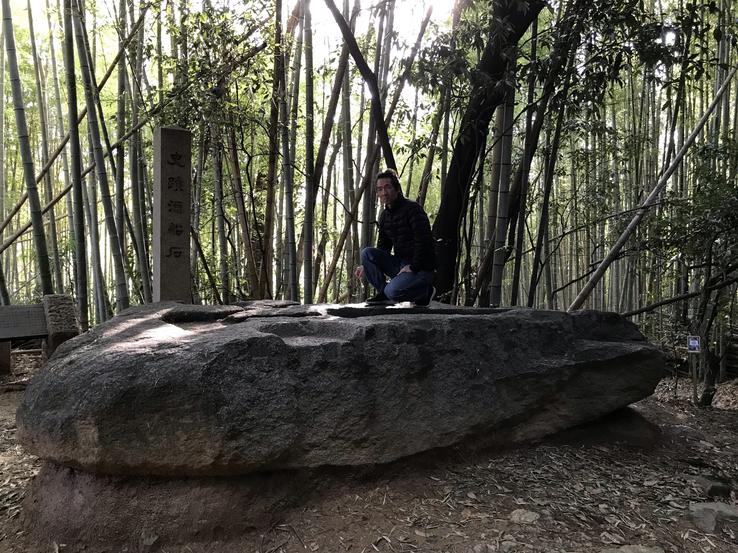
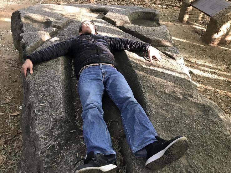
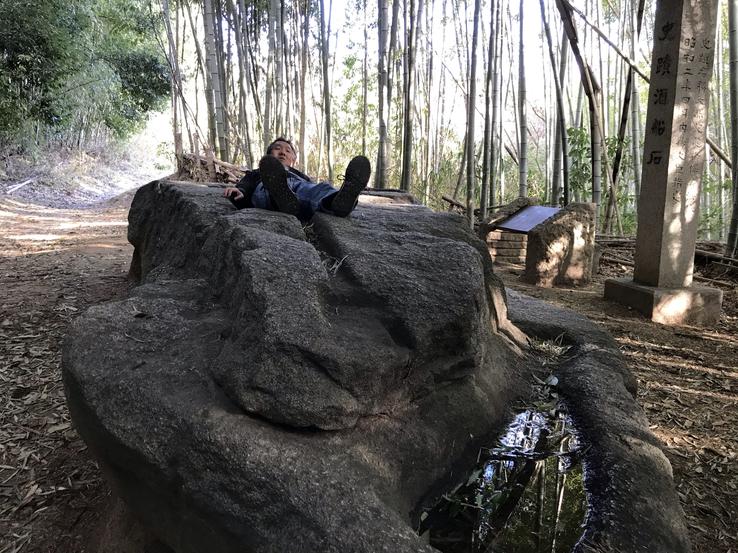
Sakafune-ishi (literally "Liquor Ship Rock" or "Drinks Stone Ship"), close to the center of Asuka village, about a 20-minute walk a top Muraoka Hill, is made of granite and measures 5.5 meters in length, 2.3 meters in width and 1.0 meters in height or thickness.
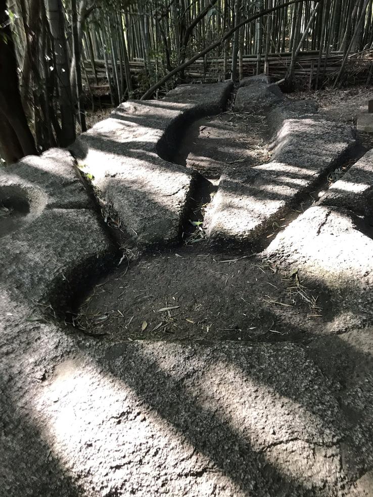
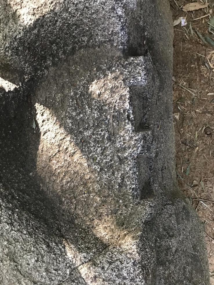
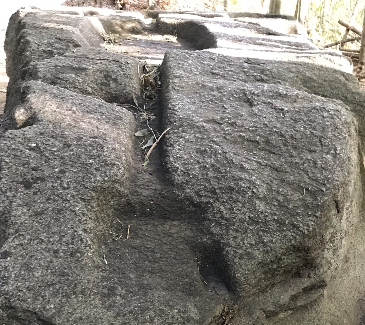
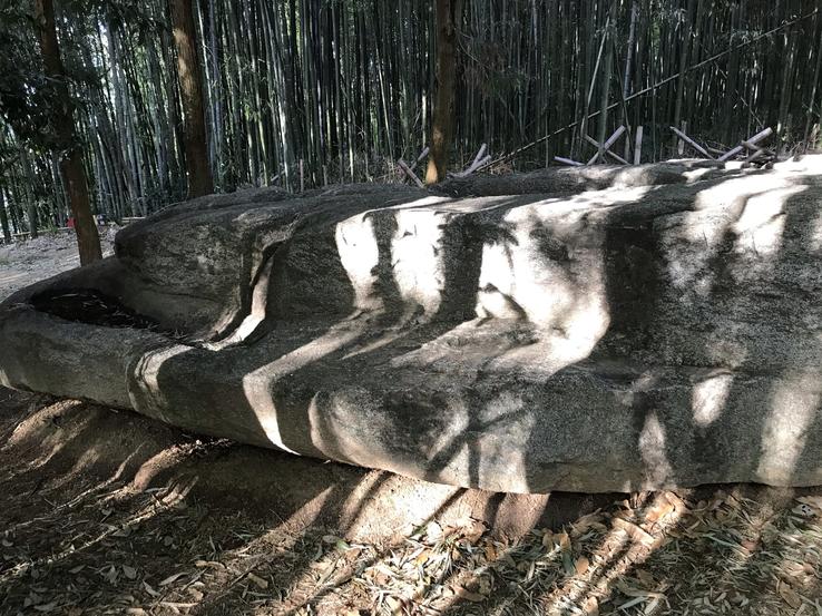
The upper surface of the slab has circular and oval cutouts connected by narrow channels. In the Edo Period (1603-1868) it was called "the sake valley of an old-time chief", hence the dominant local theory that Sakafune served as a kind of gutter to squeeze out the moisture from the sake lees, the traditional drink and popular in Japan based on rice, or even in the preparation of oils or medicinal potions. There is also a theory, reinforced by remains of pottery dug up nearby, that the stone was related to some kind of garden accessory. In any case, it appears that the water was transported to the stone by stone conduits and clay tubes, the traces of which were discovered at a slightly higher altitude, 40 meters to the east.
It would not make sense for them to do so much work, so much care and precision to produce such perfect and remarkable cuts, with straight lines that suggest the use of compasses, squares and even grinding machines, and point out the notches and circular grooves on their upper surface as sacred, esoteric, magical, ritualistic, cartographic, astronomical, astrological, cabalistic symbols or of some kind of high frequency field.
Sakafune-ishi's role as an astronomical observation post is the one that has so far had the most empirical weight due to the attempts that have been made to frame it in this sense. In the April/June 1980 issue of Archaeoastronomy, Kunitomo Sakurai reported the results of his studies related to the position of the stone. Looking to the west from the eastern edge of Sakafune, Sakurai noted that the central valley is "well aligned along the east-west direction, coinciding with the path of the sun at the equinoxes". He made this assessment in relation to the celestial north, which is about 7 degrees east of magnetic north in the Asuka area. He also measured the angles of the two outer gutters and found that both were 29 degrees from the center gutter. Through triangulation and location along the valleys towards passages in the distant mountains to the west, Sakurai concluded that Sakafune-ishi's primary function was that of a sunset observation station to determine the winter and summer solstices.
Kuniji Saitou, while agreeing with Sakurai's interpretation, in turn provides a slightly different view based on his own investigations of Sakafune-ishi, as well as Masuda-no-Iwafune located some distance to the west.He claims that the angle of Sakafune-ishi's central "depression" is actually about 13 degrees north from an east-west line and that this angle is exactly parallel to the Masuda-no-Iwafune ridge line.He believes that such parallelism is not a mere coincidence, but results from the planning of former observers to assist in the planting of Japan's most important agricultural product: rice.
Masuda-no-Iwafune is located near the top of a hill, just a few hundred meters west of Okadera Station. The ridge line (mentioned by Saitou) is parallel to the two square holes. Saitou believes that Masuda-no-Iwafune was built sometime after Sakafune-ishi. In Saitou's sense, the most important solar point for early Japanese agriculture was the "entry into spring", which occurs 13 days after the sectional solar term Pure Brightness. Posing to the west along the Masuda-no-Iwafune ridge line, it is possible to determine when the sun sets and the exact date of spring entrance. He further believes that Sakafune-ishi was subsequently repositioned with its 13-degree offset so that it is also possible to determine the sunset on this very important day. Historically, there has been some support for Saitou's speculation. Undoubtedly, almost all Japanese historians agree that it was the fertility of the Yamato plain and the ease with which "paddy" rice could be grown that formed a nucleus around which the first rulers obtained and maintained wealth and some sense of centralized power.
Aspects of sacred or esoteric symbology would have been embedded in profusion in Sakafune, which perhaps served as a giant astrological clock divided into decans or sections, just as it was done in Ancient Egypt. The angles of the branches coincide with the angles of the sunset between the equinoxes and the solstices. Certain globes appear connected by lines, the famous ley lines or lines of energy that cut our planet and which are marked by colossal stone monuments such as dolmens, cromeleques, obelisks, pyramids, cathedrals, etc. Sakafune could thus have been designed to be an immense repository of information, a database or walking stone HD (Hard Disk) made to withstand the passage of time and carry a coded message to us in the future.
Claudio Suenaga exploring and exposing THE HIDDEN JAPAN
Takamatsuzuka: the circular tomb with an astronomical map
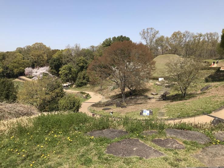
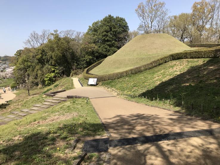
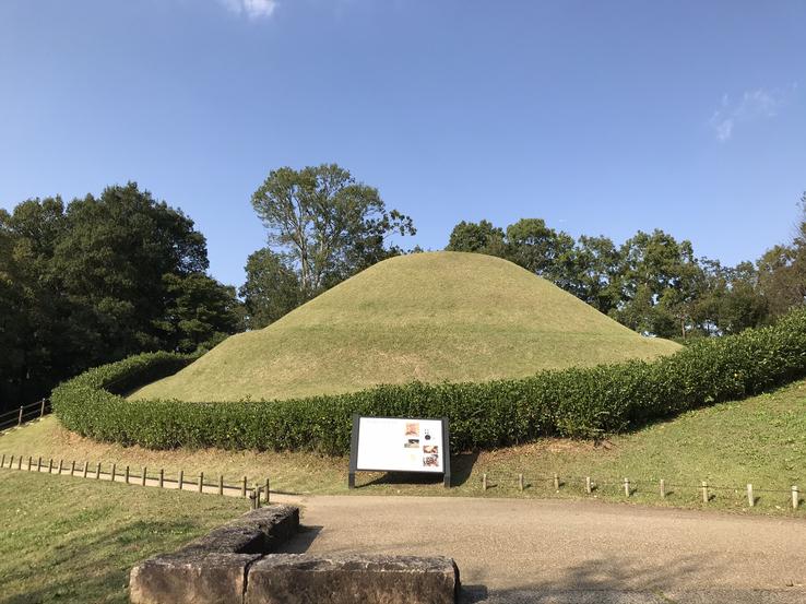
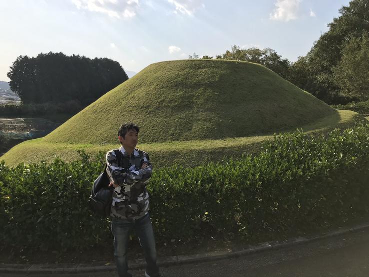
Takamatsuzuka (Japanese meaning “Ancient Burial Mound of Tall Pines”) is an ancient two-tiered circular tomb built sometime between the end of the 7th century and the beginning of the 8th century, therefore, within the so-called Asuka period (538 to 710 CE or 596 to 645 CE), which was named after the region from Asuka, about 25 kilometers south of the present-day city of Nara. The Takamatsuzuka kofun, about 5 meters high, with a lower layer 23 meters in diameter and an upper layer 18 meters in diameter, currently covered with grass, was erected with alternating layers of clay and sand.
Location: 444 Hirata, Asuka, Takaichi District, Nara 634-0144.
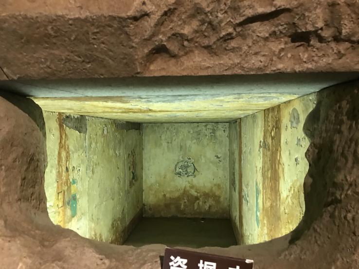
Excavated in the 1970s by a team led by Asuka natural archaeologist Aboshi Yoshinori (1927-2006), an associate professor at Kansai University and researcher at the Kashihara Archaeological Institute in Nara, richly colored fine paintings were unveiled on the plaster walls of the funeral camera in 1972 and soon became a sensation. Designated as National Treasures, in order to protect them, the tomb was sealed and replicas can only be seen in the nearby Takamatsuzuka Mural Museum, built especially to display the large-scale fresco reproductions of the crypt, along with various funerary items.
Astronomical references are clear. One sees images of the sun (on the east wall), the moon (on the west wall) and constellations (on the ceiling). The image of the sun is covered with leaves of gold and the image of the moon with leaves of silver. The astronomical map on the roof of Takamatsuzuka's stone chamber was affixed with uniform circles cut from thick gold leaf to represent the stars, connected with red lines to include constellations.
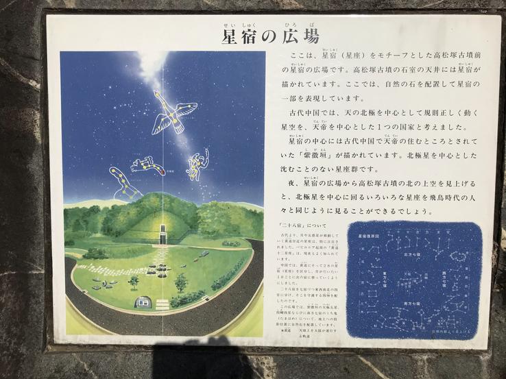
In ancient China, the starry sky, which regularly moves with the celestial pole as its centre, was considered an emperor-centered nation.In the center of the hoshijuku (constellation) is drawn the “Purple Forbidden Enclosure”, which was considered to be the place where the emperor lived in ancient China. It is a group of constellations that does not disappear, with the North Star in the middle, representing the figure of the emperor. At night, if you look at the sky north of Takamatsuzuka from Hoshijuku Square, you can see the various constellations circling the North Star, right towards the top of the kofun, just as people from the Asuka period saw it!
Claudio Suenaga exploring and exposing THE HIDDEN JAPAN
Ishi-no-Karato, the button-shaped kofun
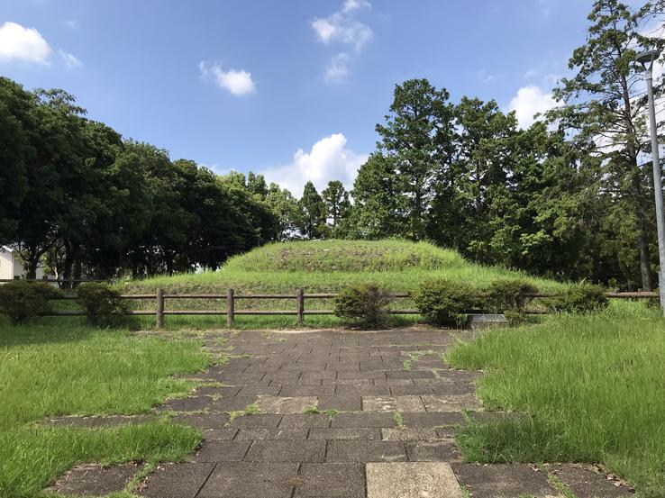
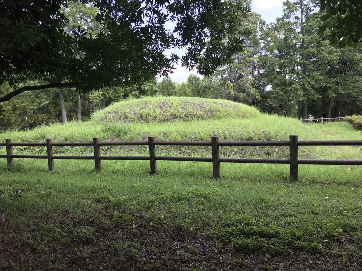
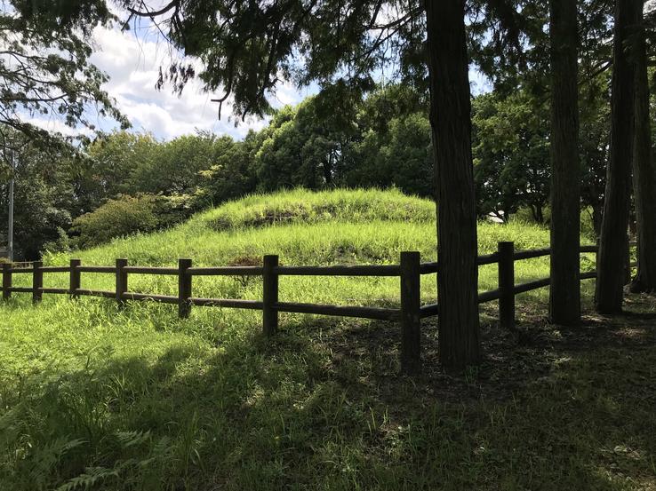
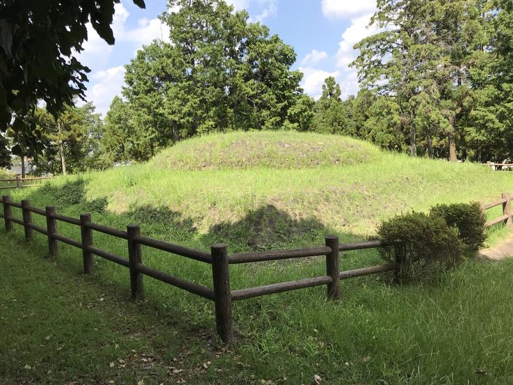
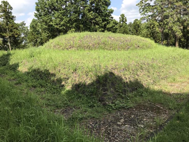
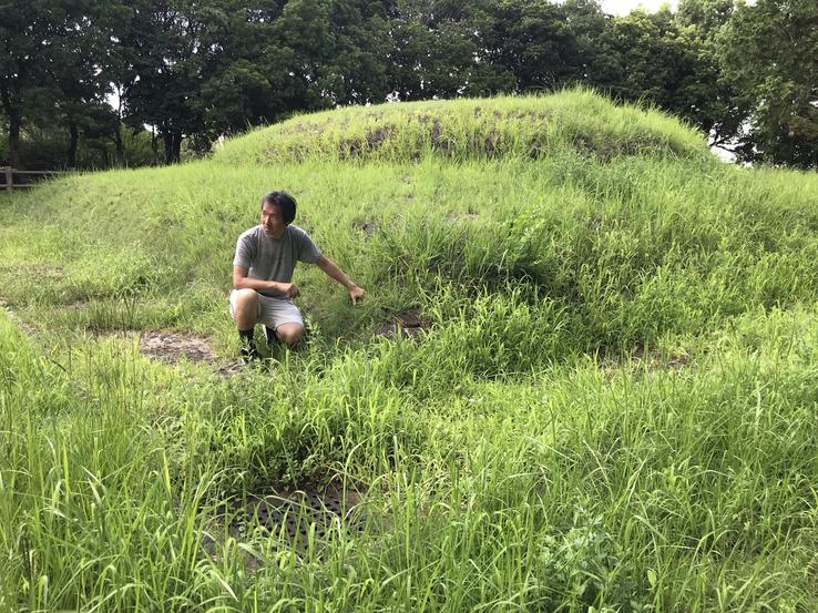
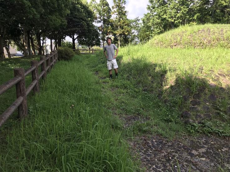
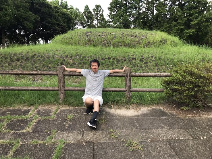
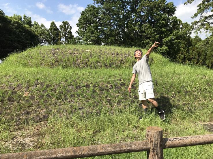
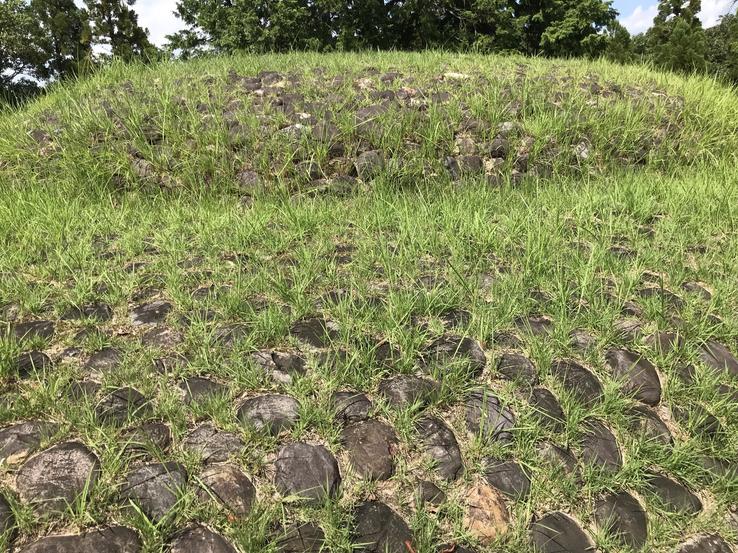
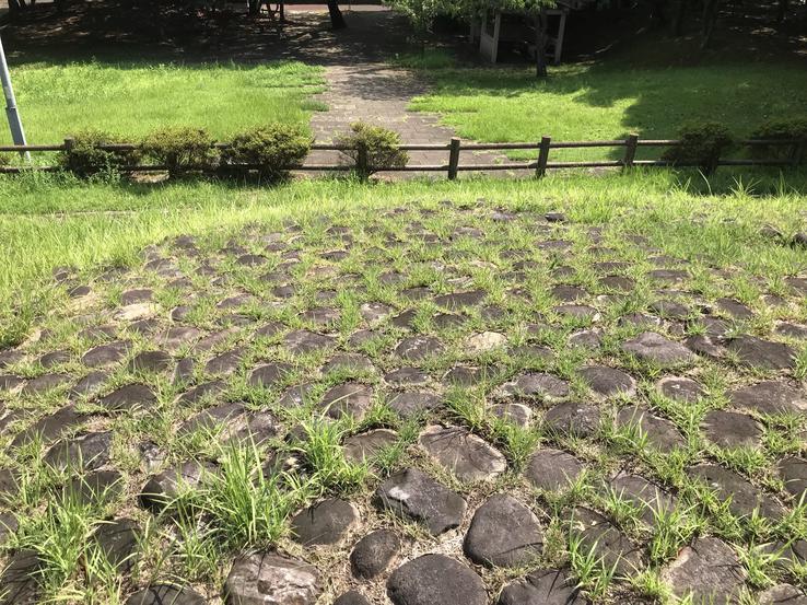
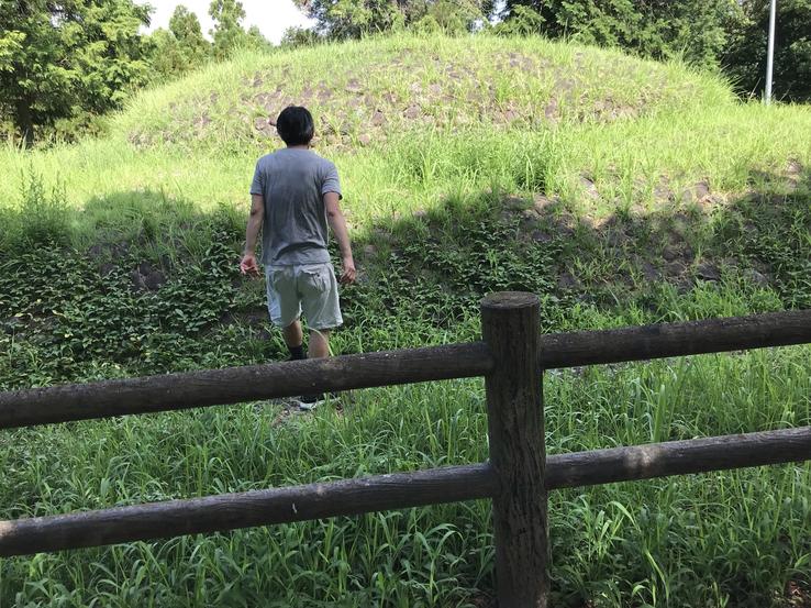
Rare button-shaped kofun, that is, a spherical mound atop a flat terrain similar to a square platform, Ishi-no-Karato, designated a National Historic Site in 1996, stands on the eastern slope of the Narayama Hills near the villagefrom Jingu, north of the city of Nara and in the extreme south of Kyoto, on the border between the two cities, in the northern suburbs of Heijokyo, in the Honshu region.
Location: 〒631-0804 Nara, Jingu, 1 Chome-5
Claudio Suenaga exploring and exposing THE HIDDEN JAPAN
Finely cut, polished and embedded giant stones from
Iwayama kofun
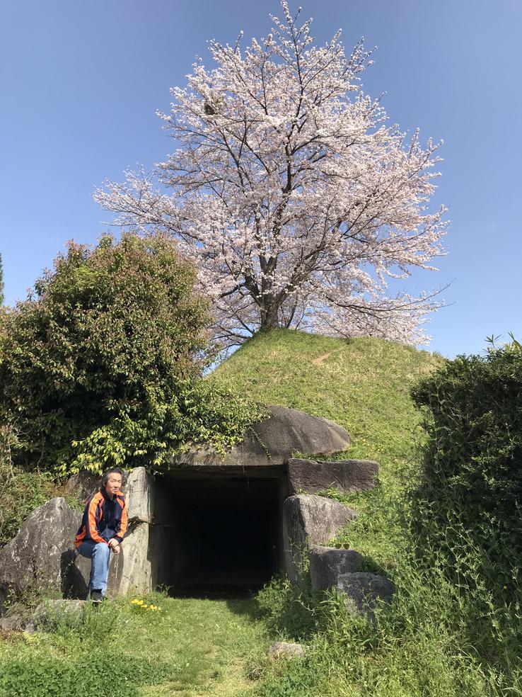
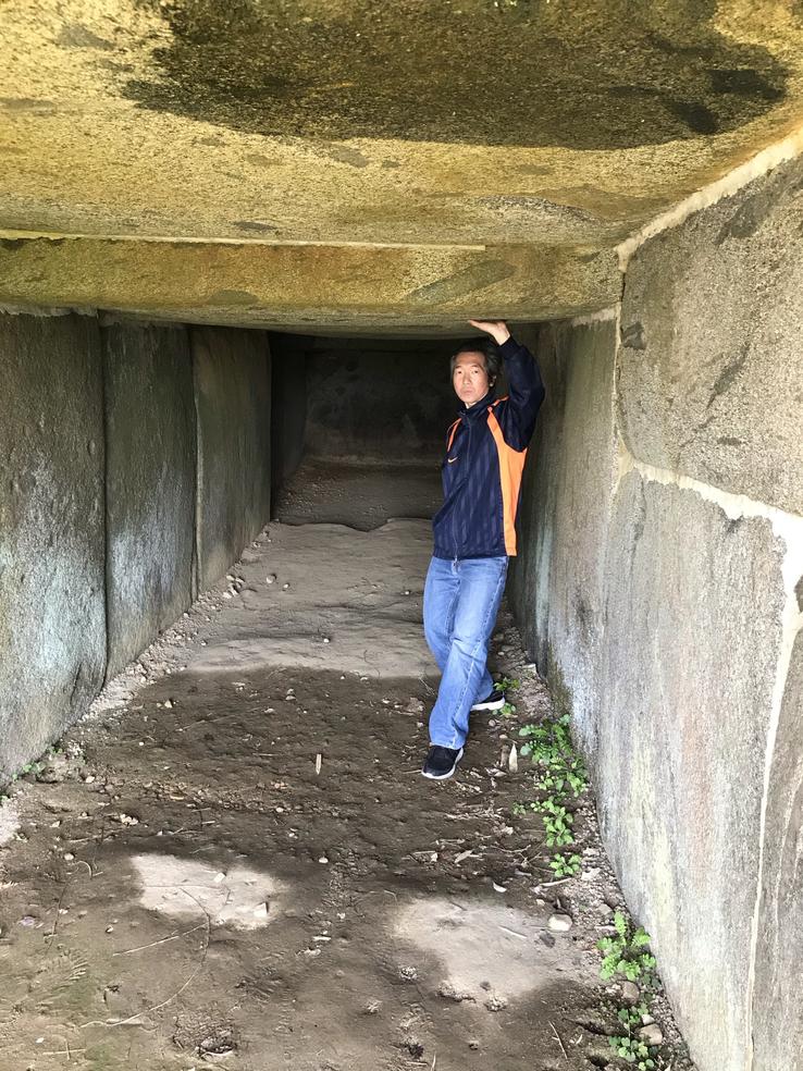
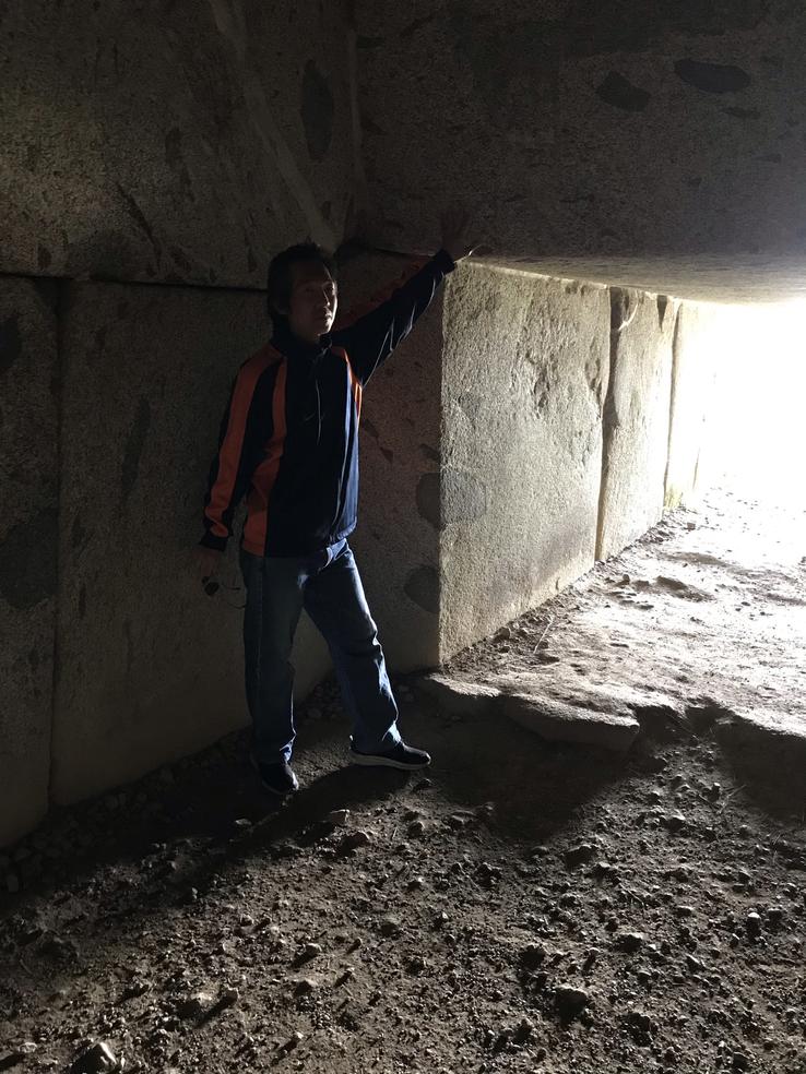
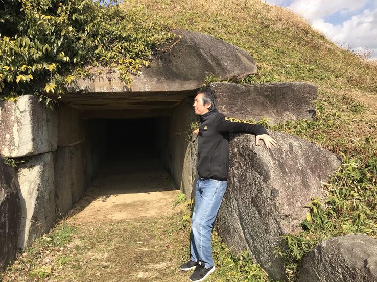
A few minutes west of Asuka train station, on the eastern side of Mayumi-no-oka hill, in the middle of a residential neighborhood, is Iwayama’s kofun, built in the early 7th century.
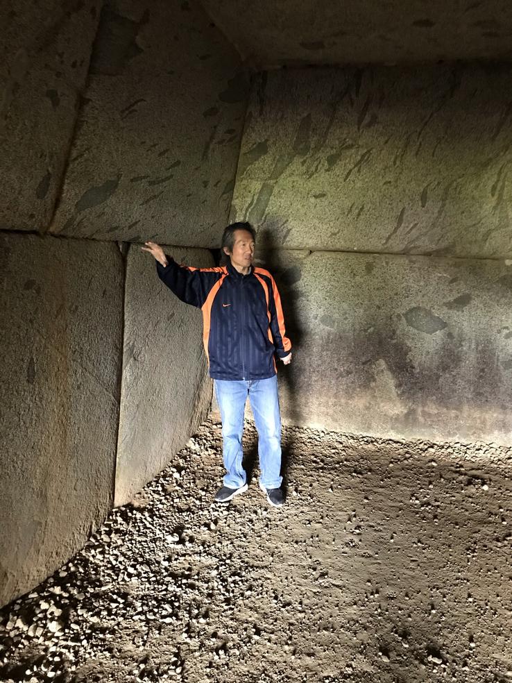
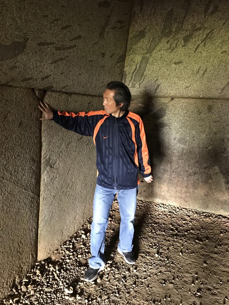
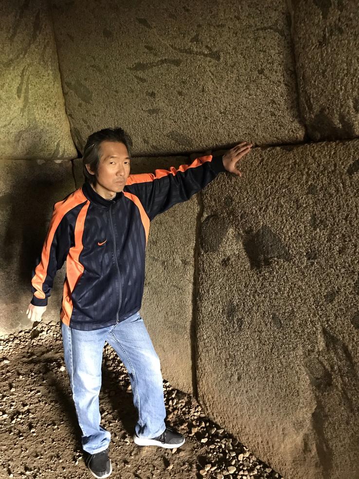
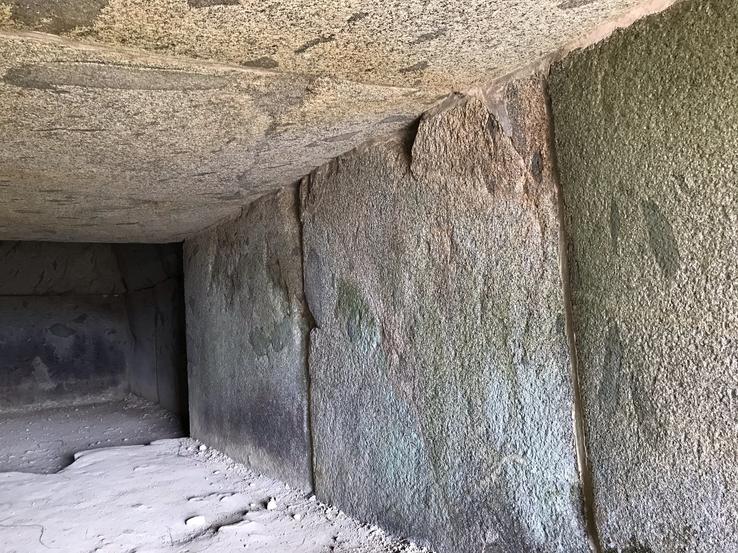
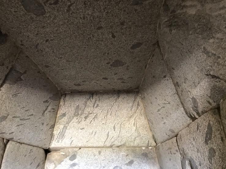
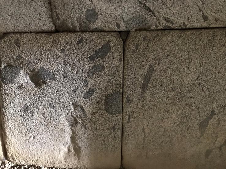
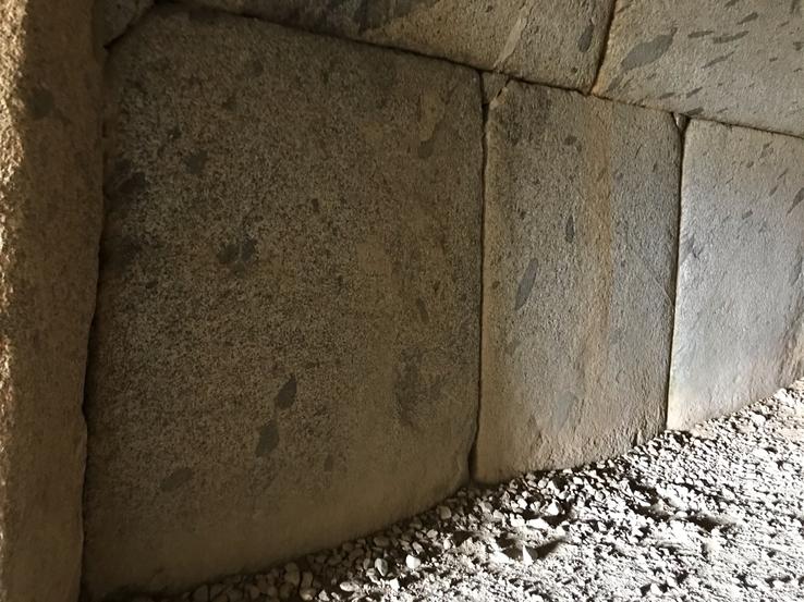
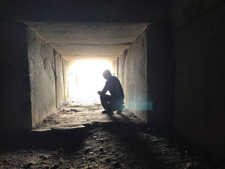
Its crypt is composed of exquisitely cut and embedded stones. The surfaces and joints have been polished with finesse and sophistication. The original plaster was of such good quality that it remains on the stone interfaces.
The upper sections of the chamber walls are angled inward, so that the ceiling is narrower than the floor. As if it were a calculated effort to make the entrance hall give an exaggerated appearance of depth, the entrance is relatively high and wide, while the passage becomes lower and narrower as you move inward.
The stone chamber, 54 meters long, is a beautiful Yokoana-shiki sekishitsu (horizontal stone chamber), open to the south in the “Iwayama style”, found mainly in the area between Asuka and Sakurai.
Although the hill was slightly destroyed, some scholars suspect that its original shape was a round or octagonal pyramid.
There is hardly any additional information about this kofun. It is not known which were the nobles buried in it and the objects found in it.
The main question is how it was built, which denotes a superior culture with techniques or even sophisticated technology for cutting, polishing, polishing and fitting stones weighing several tons neatly and precisely.
Was Iwayama’s kofun in some way connected with other megalithic monuments in the region as well as in other parts of the world, which have similar characteristics? If so, we would have to consider the existence in the past of a high civilization that, from a common center, spread knowledge that has been lost over time.
Claudio Suenaga exploring and exposing THE HIDDEN JAPAN
Ishibutai Kofun, Japan's largest megalithic structure
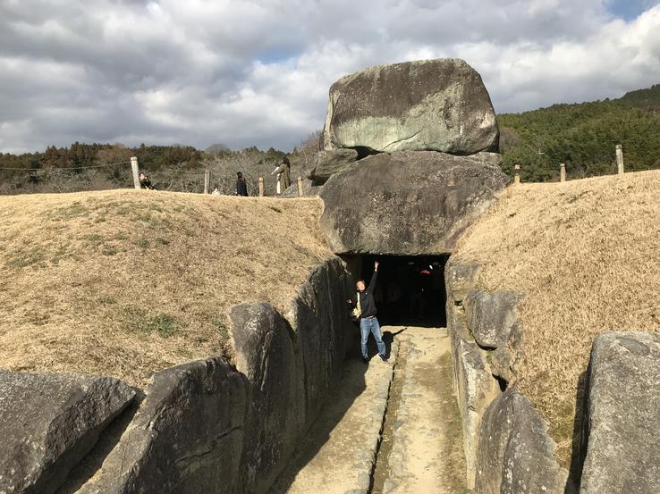
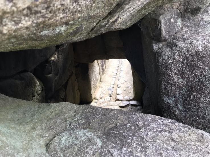
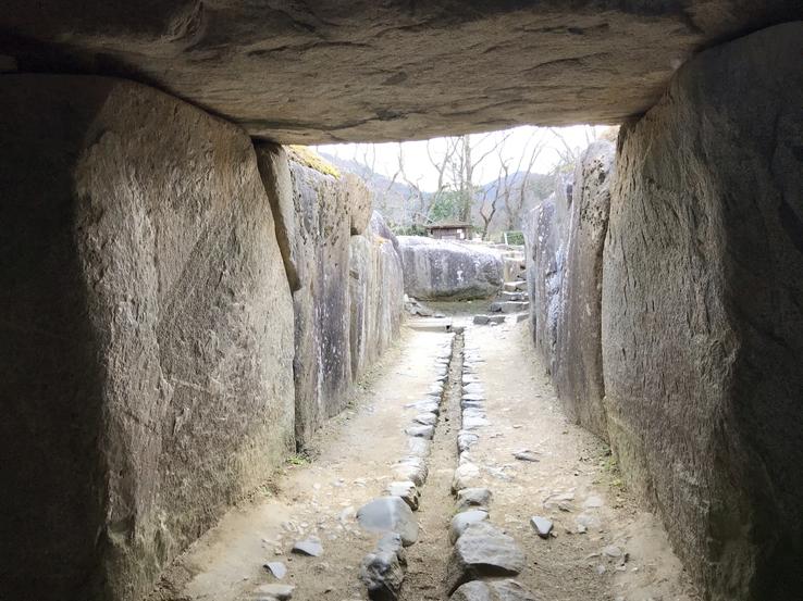
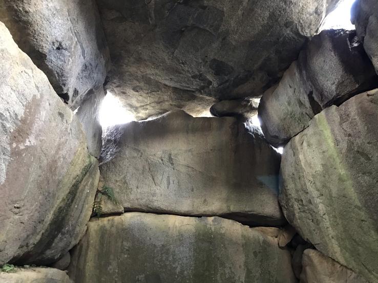
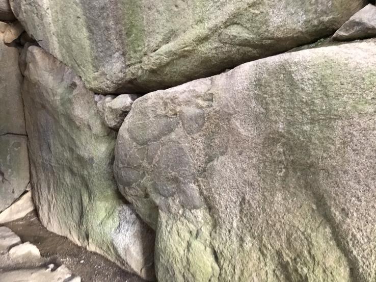
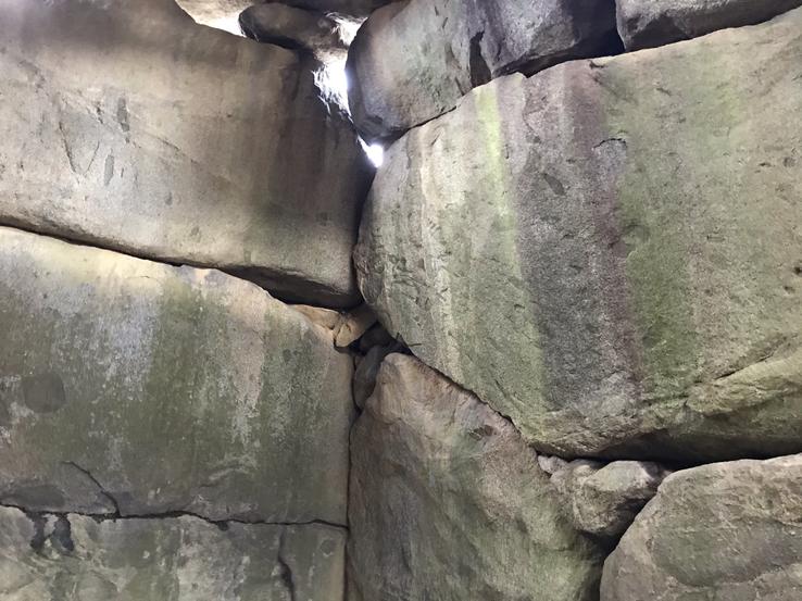
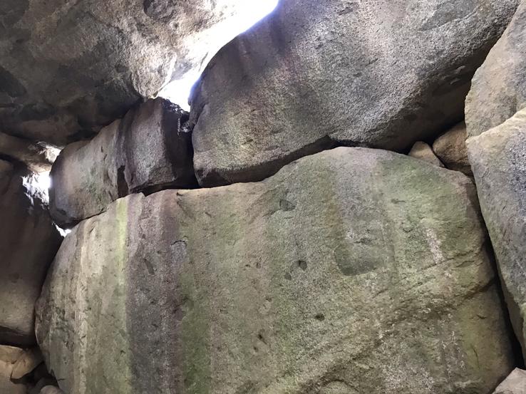
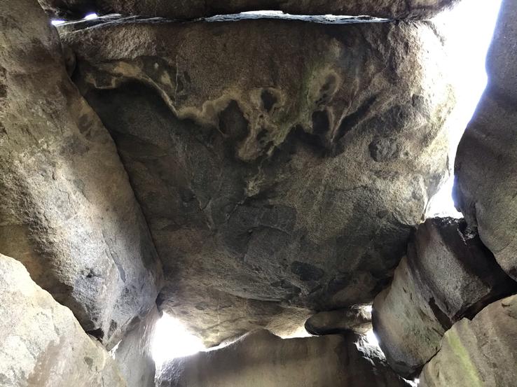
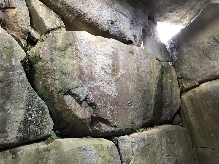
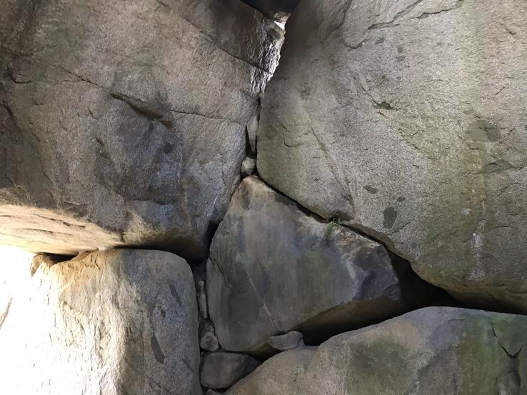
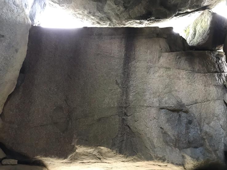
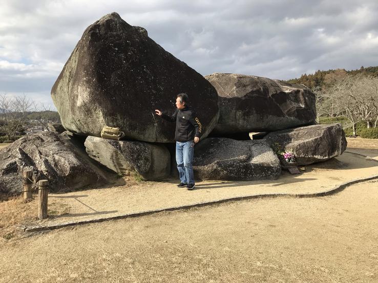
A combination of the words ishi (stone) and butai (stage), meaning literally “Stone Stage”, the Ishibutai Kofun, in the village of Asuka, in Nara, erected around the beginning of the 7th century, is formed by 30 colossal megalithsof granite that weigh in all about 2,300 tons.The two largest, making up the roof, weigh 77 and 64 tons.With what tools they were cut and how they were carried from a distance of approximately 3 kilometers, to be lifted and finally fitted without cranes, is a mystery that remains to this day, along with the identity of its builders.
Location: 254 Shimasho, Asuka, Takaichi District, Nara 634-0112
In the village of Asuka, in Nara, east of Shimanoshō, there is one of the rare kofuns open – throughout its interior – to public visitation in Japan: the Ishibutai, where Soga no Umako was allegedly buried (551-626), a powerful and influential politician of the Asuka Period (552-645). Son of Soga no Iname (506-570), a member of the Soga Clan, a dominant Japanese aristocratic family during the 7th century, Soga no Umako led political reforms alongside the legendary Prince Shotoku (574-622) during the reigns of Emperor Bidatsu ( 538-585), the 30th Emperor of Japan (from 572), and Empress Suiko (554-628), the 33rd Emperor of Japan (from 592), and established the strength of the Soga Clan in government by marrying her daughter with members of the royal family.
At the end of the sixth century, Soga no Umako greatly contributed to establishing the foundations of Buddhism in Japan by employing immigrants from China and Korea, obtaining from them, in exchange, new knowledge and technologies. Historian and archaeologist Sadakichi Kita (1871-1939) proposed that the Ishibutai Kofun is the "Momohana" tomb of Soga no Umako, as mentioned in the Nihon Shoki (Chronicles of Japan), the second oldest book on the history of Japan.
The megalith to the north of the tomb, on the left, weighs approximately 64 tons, and the largest stone to the south and on the right weighs approximately 77 tons. The name Ishibutai is a combination of the words ishi (stone) and butai (stage), meaning literally “Stone Stage”, as the stone surface of the ceiling is wide and flat, reminiscent of a theater stage. Local folk legends say that foxes were seen atop the kofun dancing on full moon nights, using the stones as a stage for their performances. The total weight of the 30 stones that make up the kofun is estimated to be no less than around 2,300 tons! The large granite megaliths came from Mount Tōnomine, which is approximately 3 kilometers away.
The Ishibutai Kofun was built around the beginning of the 7th century, when there were obviously no cranes or any other type of transport vehicle. However, official archeology explains that these huge stones were somehow carried by human force, with the resources and transportation technology available at the time. A local tour guide explained to us with the help of photos and diagrams that the stones were moved into position using simple wooden rollers, ropes and pulleys, an operation that would have required considerable time, daring, skill and labor. A deep hole was dug and there stones were placed upright. The hole was then covered with earth to the top of the vertical stones, while other large stones were moved over the earth and placed on top of the vertical stones. When everything was in place, the supporting earth was removed leaving only the stones. This ingenious construction technique would also have been used in making the colossal bronze statue of the Vairochana Buddha (Daibutsu) at the Tōdai-ji temple in Nara, where I visited a few days earlier.
The kofun was first excavated in 1933 by archaeologist and academic Kōsaku Hamada (1881-1938), president of Kyoto University. Work on the base and moat began in 1935 and excavation of the tomb continued until 1975. The Ishibutai Kofun first appeared in literature only around 1680. This means that all of its preceding history, as well as its association with Soga no Umako, is nothing but speculation. The mystery surrounding Ishibutai therefore remains. It would not be unreasonable to suppose that it was actually the work of a highly advanced civilization much older and more unknown and as such would only have been appropriated by the Soga clan, if in fact it was.
Claudio Suenaga exploring and exposing THE HIDDEN JAPAN
Oni-no-Secchin and Oni-no-Manaita: Megalithic monuments of the devil to slice and digest travelers
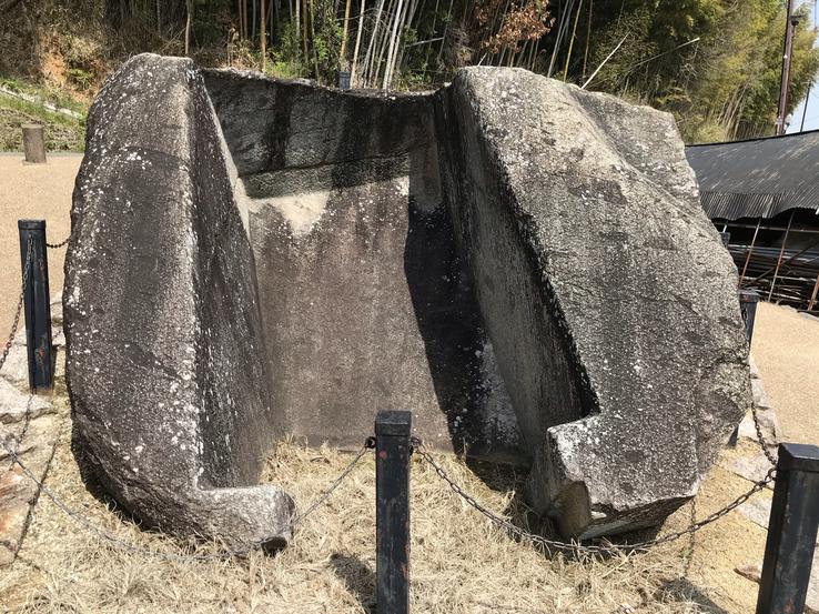
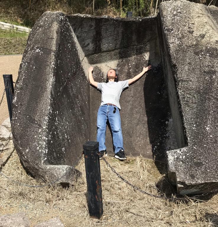
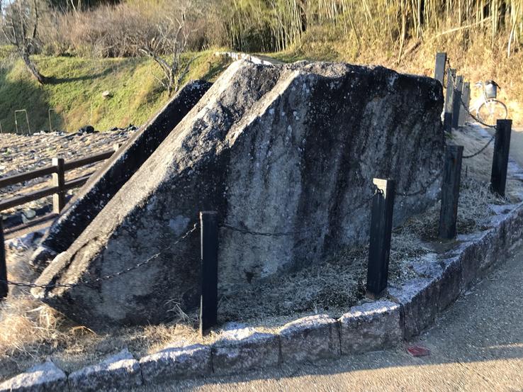
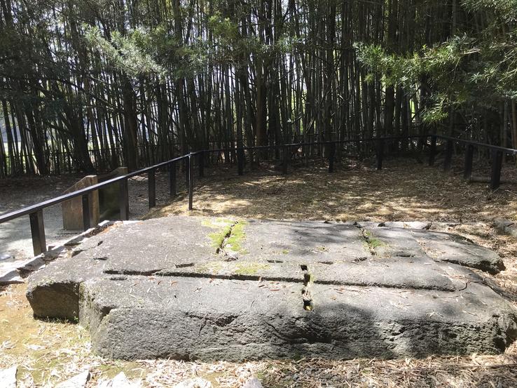
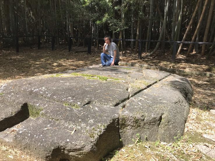
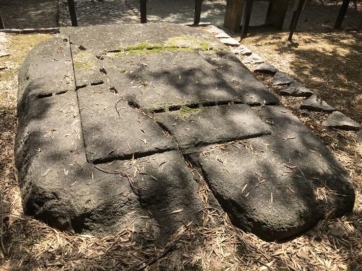
The legend says that in this rural region of Asuka, in Nara, surrounded by plantations, there lived giant demons (oni) who confused the travelers by descending on them a mist, then capturing them, slicing them up (on the Oni-no stone-Manaita, or “Devil's Cutting Board”) and devour them.Later, with a full stomach and after having done the digestion, they relieved their needs in the megalith Oni-no-Secchin, which in Japanese literally means “Devil's Bathroom”.
The legend says that in this rural region of Asuka, in Nara, surrounded by plantations, there lived giant demons (oni) who confused the travelers by descending on them a mist, then capturing them, slicing them up (on the Oni-no stone-Manaita, or “Devil's Cutting Board”) and devour them. Later, with a full stomach and after having done the digestion, they relieved their needs in the megalith Oni-no-Secchin, which in Japanese literally means “Devil's Bathroom”.
Legends aside, official archeology explains that the megalith is part of the stone chamber of a kofun (ancient tomb) from the late period (last half of the 7th century) of the Asuka period that lost its mound of earth that covered it. In its complete form, the stone chamber would have consisted of three large granite pieces (the base section, the lid and the portal) finely worked. The Oni-no-Secchin megalith would be the part of the lid that fell from the Oni-no-Manaita (the base section of the burial chamber) above it. That is, somehow he was turned upside down and was in this position contrary to what he was originally.
This is the only information available about the “Devil's Bathroom” and no one can explain how the megaliths were carved or moved.Note that the cuts are neat and precise, like those made by the Incas and the Egyptians, just to name these two great civilizations. With what tools did your craftsmen cut the granite like butter? Would there also be here the indications of the use of old technologies that were lost?
Claudio Suenaga exploring and exposing THE HIDDEN JAPAN
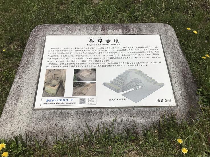
Miyakozuka kofun, a huge stepped pyramid-shaped tomb in the village of Asuka, Nara
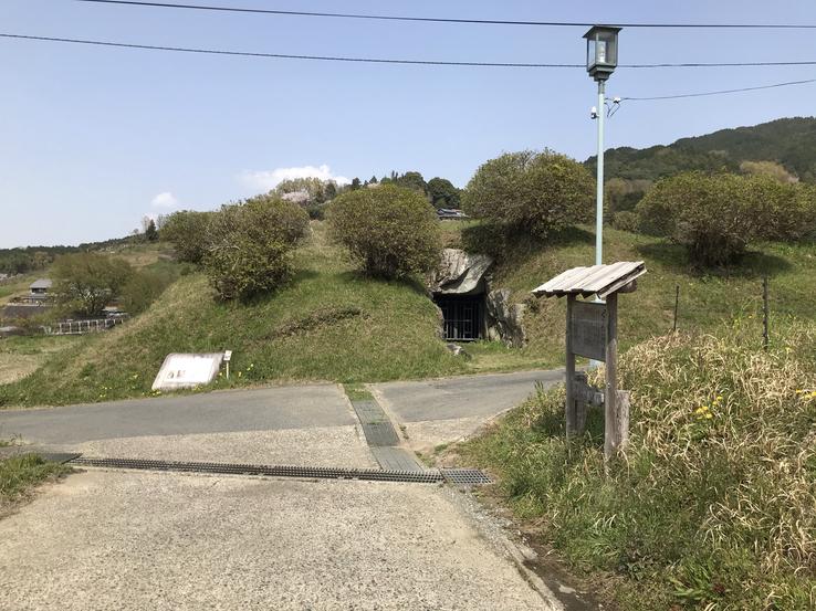
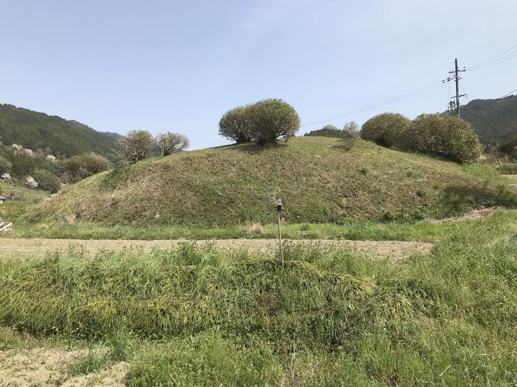
On the slope of a valley in Sakada district, Asuka village, Takaichi district, Nara Prefecture, is one of the rare kofuns built in a pyramid shape in Japan, because these ancient tombs were usually built in the circular shape of a hole of lock.
Address: 〒634-0122 Nara, Takaichi District, Asuka, Sakada, 小字ミヤコ938
The surrounding area was controlled by Clan Soga, the dominant Japanese aristocratic family during the 6th and 7th centuries. Based on this assertion, some experts believe that the pyramid of Miyakozuka was built in the late 6th century to be the tomb of Soga no Iname (506-570), father of Soga no Umako (551-626), whose attributed kofun Ishibutai, not far from there, a few kilometers to the south, formed by 30 colossal megaliths of granite weighing a total of about 2,300 tons, is the largest megalithic structure in Japan. Miyakozuka is located upstream (near the source of the river)from Ishibutai, at the key point of the confluence of the Hosokawa and Asuka rivers.
The tomb's unique construction method and unprecedented scale further reinforced the assumption that it was likely built for a member of the powerful Soga Clan.
The pyramid of Miyakozuka is formed by a square base of 41 meters from east to west and 42 meters from north to south.It has more than six steps lined with river pebbles in terraces (a more or less flat portion of land on a slope, supported by a wall) 1 meter wide - more than the five previously thought - which are filled with a large number of stonesto reinforce the structure. As it is weathered and covered in earth and vegetation, the pyramid appears to be just a regular hill or circular mound 4.7 meters high.
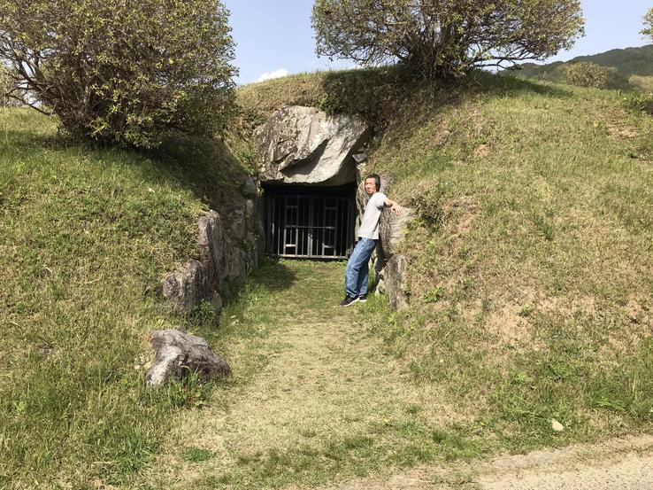
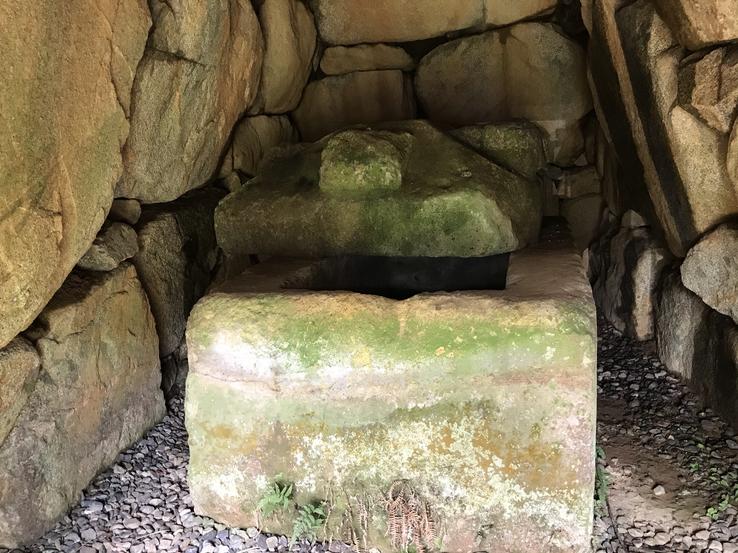
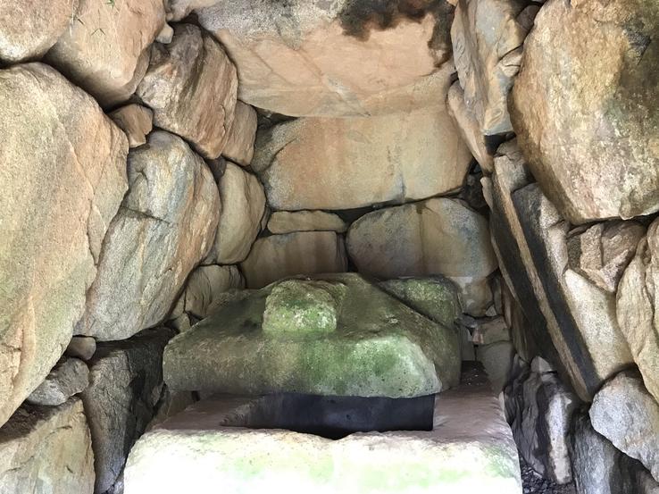
This is the only kofun in which a stone chamber with a sarcophagus can be seen by the public. The horizontal hole-type stone chamber is 12.2 meters long, the entrance chamber 5.2 m long, and the central part 2.95 m wide and 3.55 m high. The surroundings are 1.9 m wide and lack stones on the roof. Near the center of the stone chamber is Tatsuyama's hollow stone house-shaped sarcophagus, originating in Takasago City, Hyogo Prefecture, almost 8 kilometers away. The sarcophagus is 2.36 m long, 1.58 m wide and 1.72 m high. The lid is 3 cm longer and 12 cm wider than the body.
Claudio Suenaga exploring and exposing THE HIDDEN JAPAN
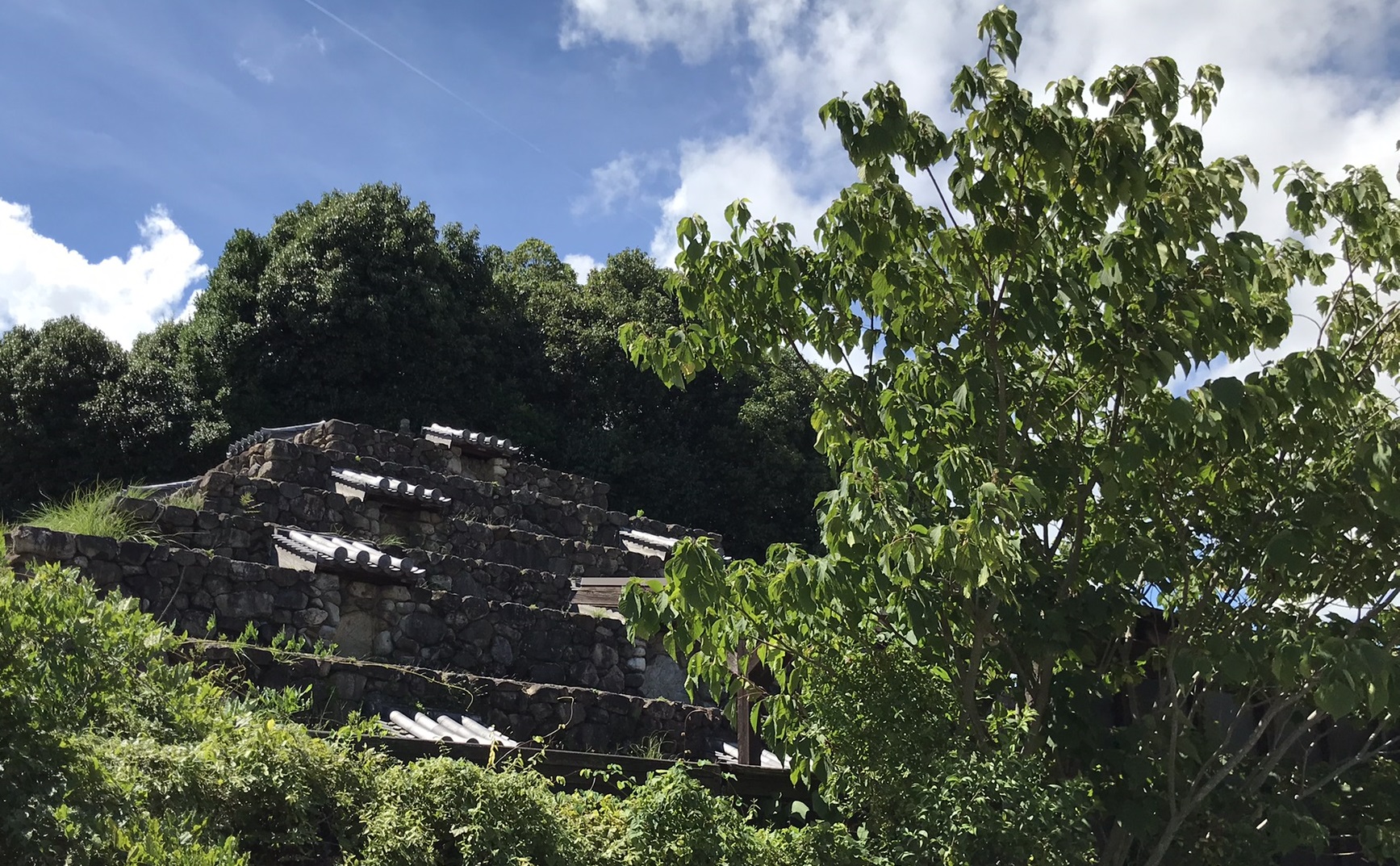
The forgotten and hidden Mahayana Buddhist Pyramid of Nara
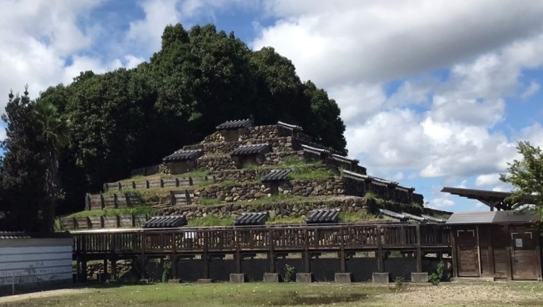
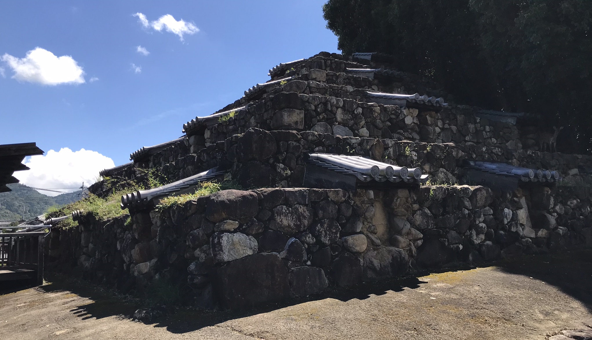
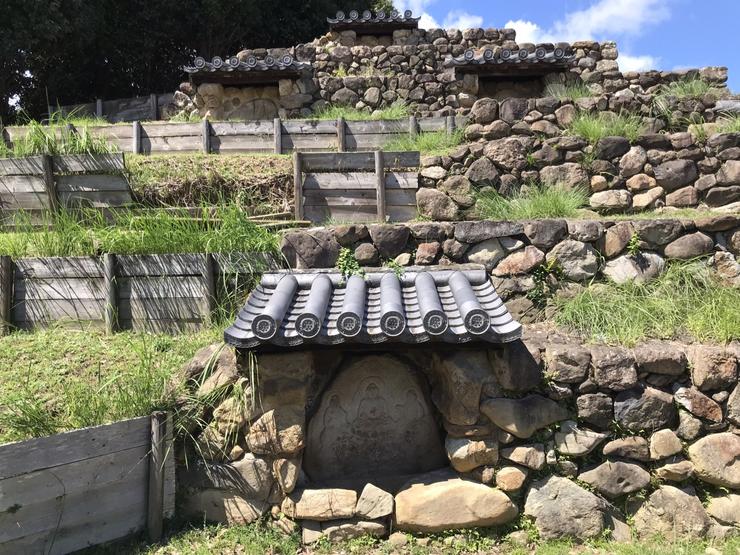
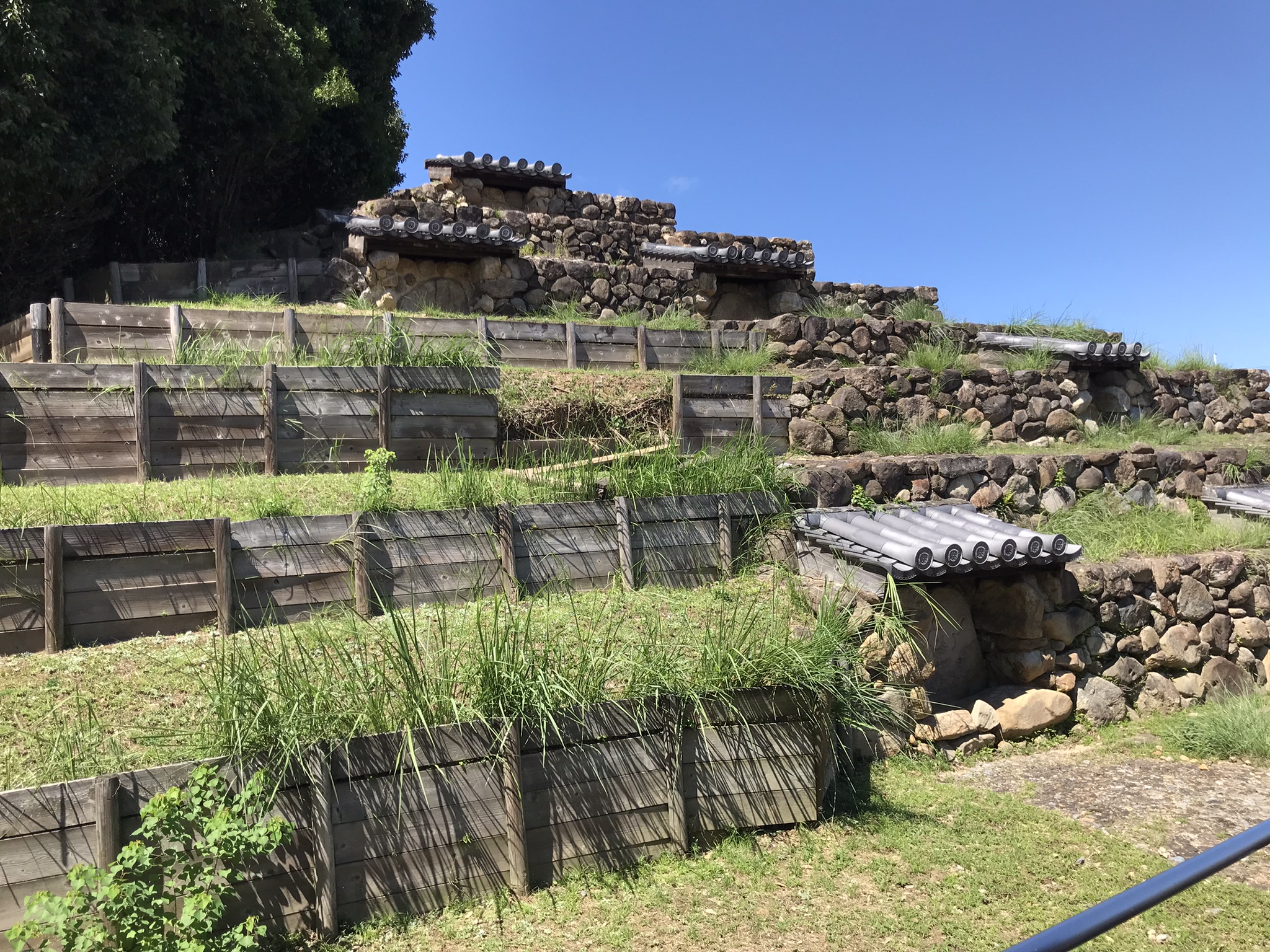
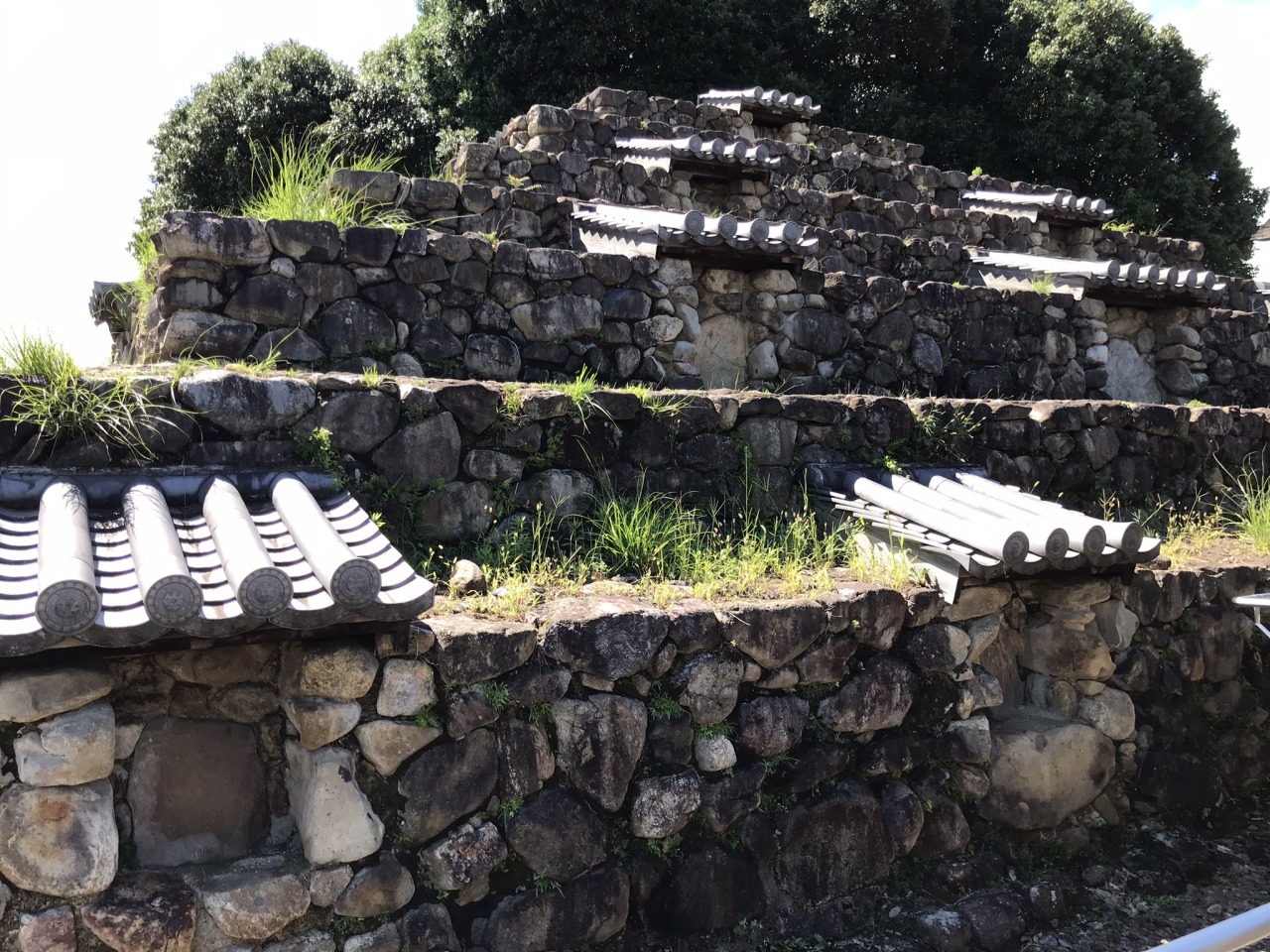
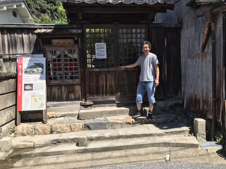
Until the end of September 2021, no one was aware of the existence of this pyramid in the middle of the residential neighborhood of Zuto, in Nara, the ancient capital and the region richest in history and archeology in Japan. When the neighboring hotel that obstructed his view was eventually demolished, leaving only an empty lot, those who passed through it daily noticed his sudden appearance.
Address: 921 Takabatakecho, Nara, 630-8301
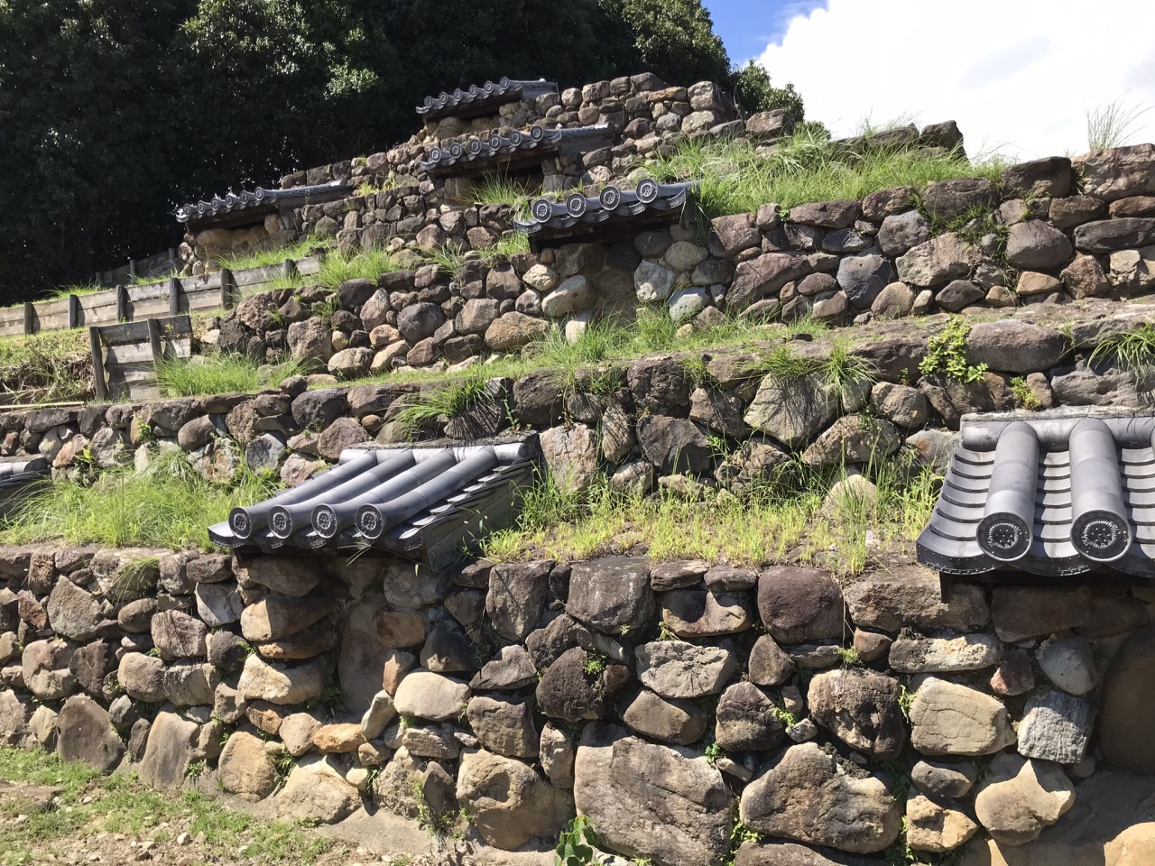
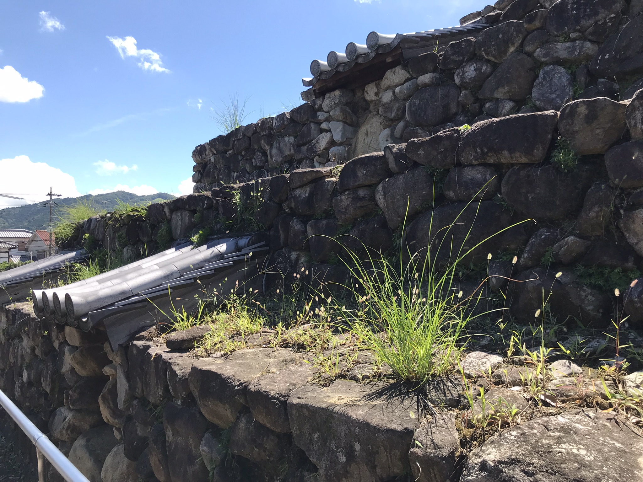
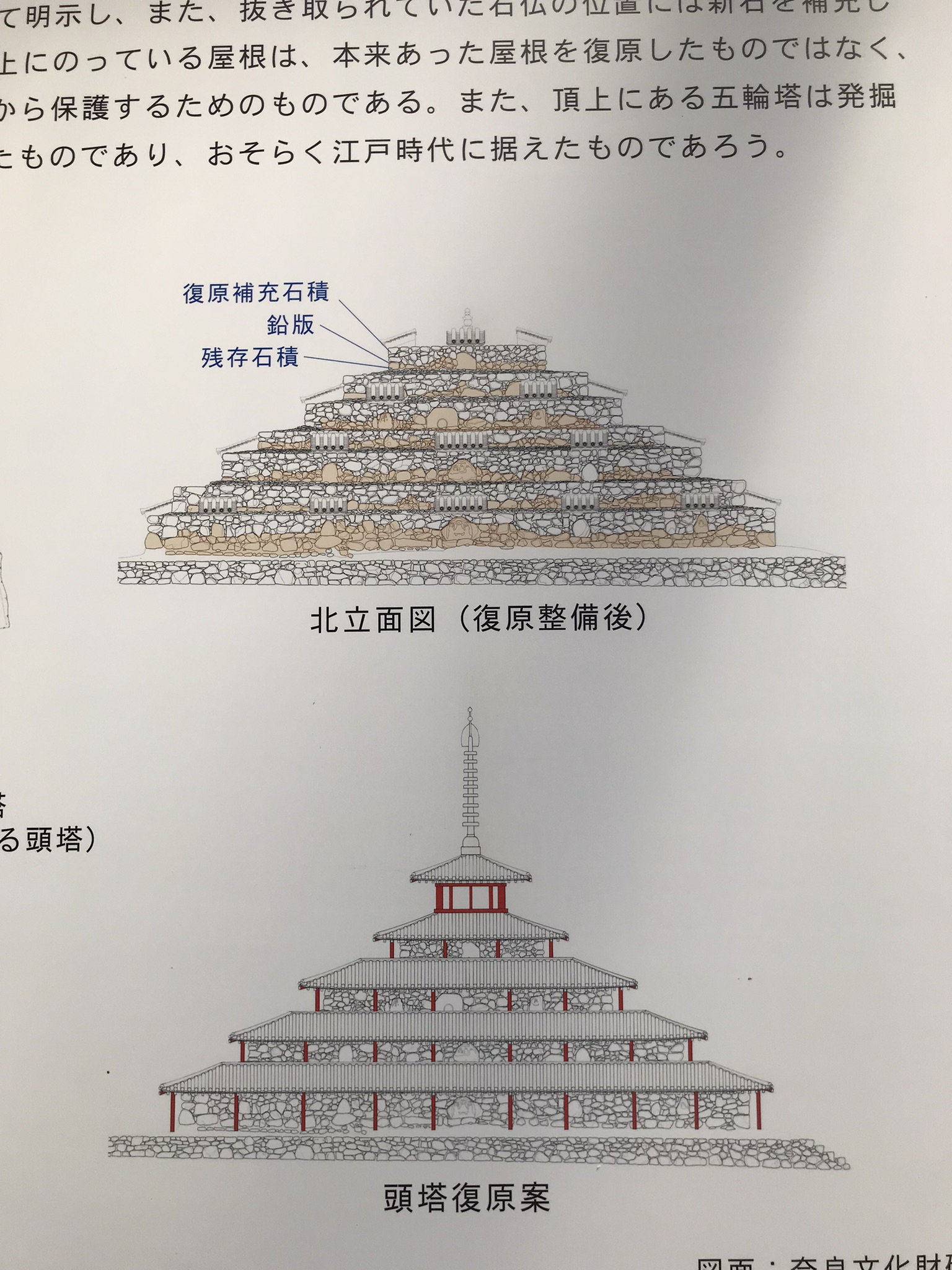
The soil and rock structure, dating from the Nara Period (710-794), stands on a square base 32 meters on a side (some estimate, in fact, 24 meters), with seven square layers of earth and stone forming a12 meters high pyramid.It has three main layers (2 to 3 meters high), lower layers (about 1 m) between them, and an upper layer (about 1 m).
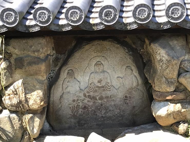
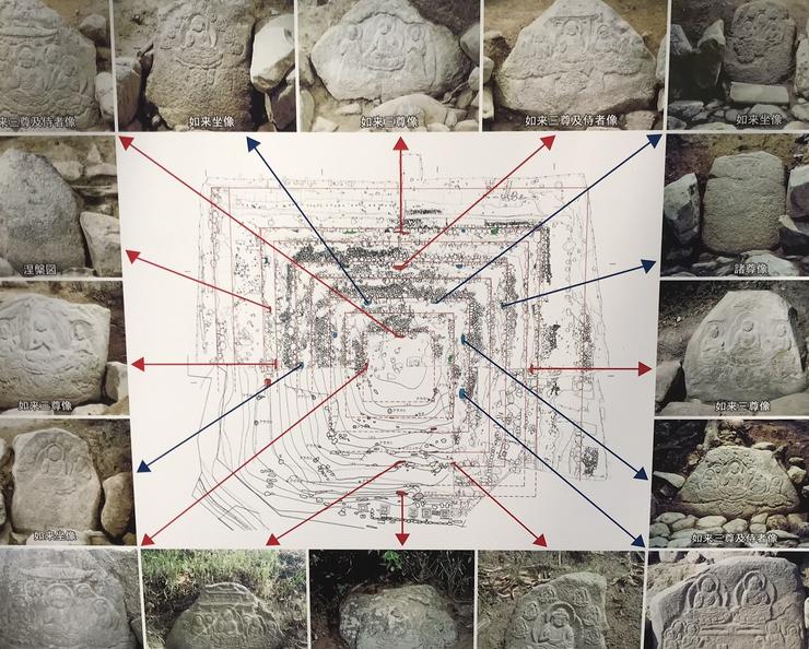
Each face of the 1st and 2nd main layers has three niches, each of which contains an embossed rock of Buddha about 1.20 meters high.Each face of the 3rd layer has two reliefs, and each face of the top layer has one.The shape of the relief rock is varied, as it was carved from a natural rock whose face was polished.Almost all the reliefs are granite – only a few are slate, and they have a refined, familiar and modest style.
In 767, the first year of the Jingo-keiun era, Jitchu (?-824), a Buddhist monk of the Kegon sect, is said to have built the structure on the orders of the clerical founder and chief priest of Todai-ji temple, Roben (689-773).In his later years, Jitchu had already overseen the expansion of the Todai-ji temple and introduced the liturgy and rituals still used today.
Genbo (?-746), a learned monk and bureaucrat of the Imperial Court in Nara, with great influence in politics and who was later exiled to Dazaifu on the island of Kyushu, is said to have been buried there, and that this was theorigin of the name Zuto, which is composed of the kanji characters for “head” and “tower”.
Some compare its design with that of Borodubur, a Mahayana Buddhist monument (or Maaiana, “Way for the Many”, the greater of the two main traditions of Buddhism, the other being the Theravada, “Teaching of the Sages” or “Doctrine of the Elders”, the oldest Buddhist school founded in India) situated on the island of Java, Indonesia, built from 750 AD, as well as that of the stepped Mayan pyramids of Mexico and Guatemala. This style is unique among the numerous Japanese Buddhist architectures.
Claudio Suenaga exploring and exposing THE HIDDEN JAPAN
Kameishi (Turtle Stone): A terrifying legend behind a serene stone face
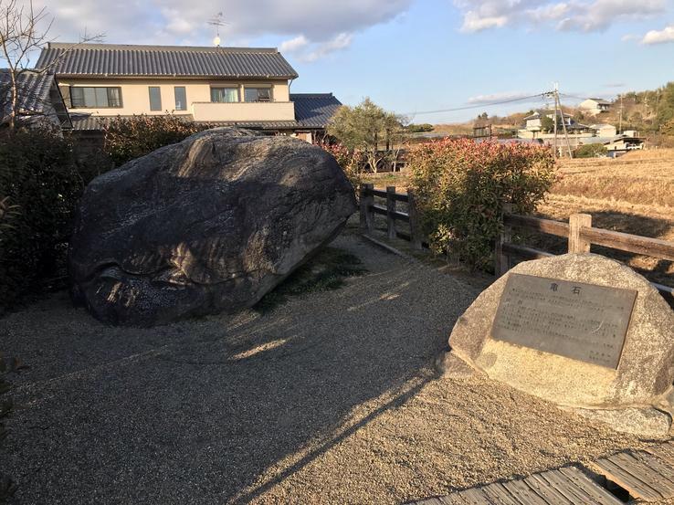
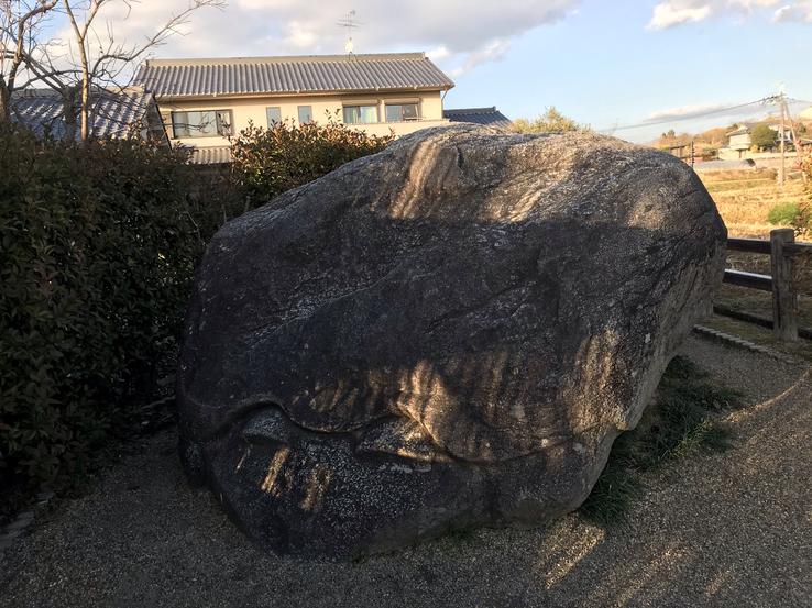
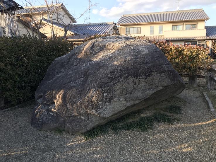
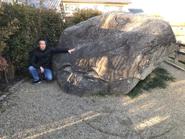
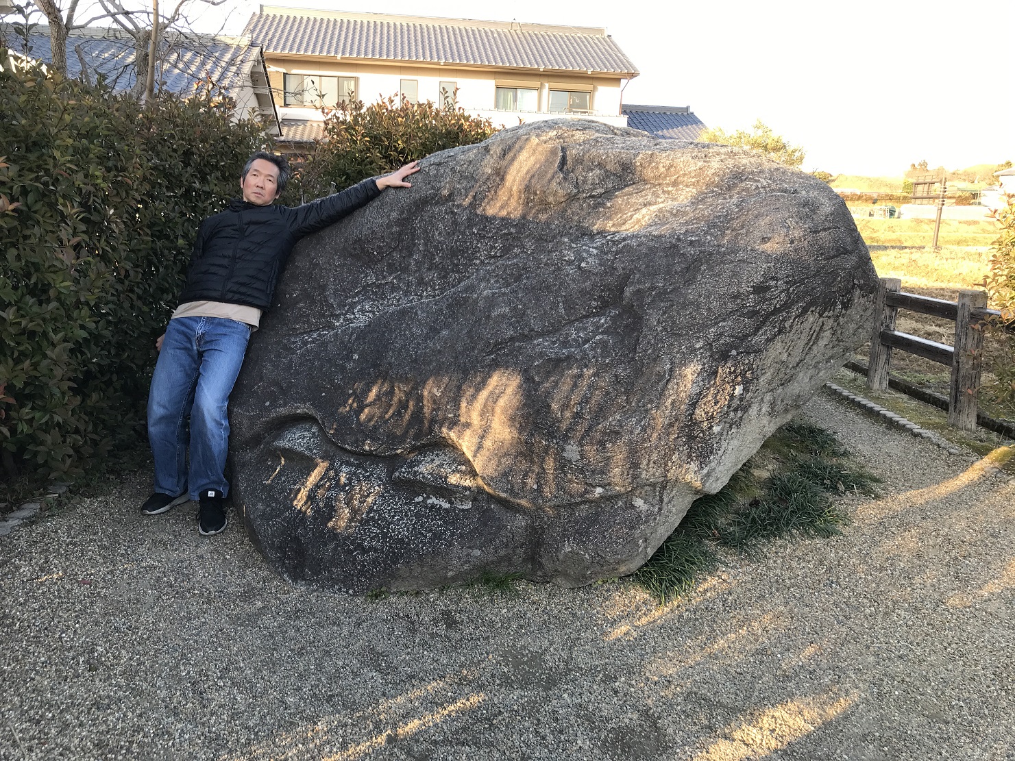
In Asuka Village, home to several mysterious megalithic monuments and their legends, there is a huge granite face called the Kameishi, or “Turtle Stone”. Some thought it resembled a tortoise, hence the name, but the fact is, it doesn't look much like a tortoise, but rather like a serene woman with thick hair.Whether it was carved with the intention of looking like a turtle is unknown.In fact, nothing is known about this stone face, which measures about 4 meters long, 2 meters wide and 2 meters high.Nor who carved it, when, how or why.
Address: 108 Kawahara, Asuka, Takaichi District, Nara 634-0141
There is only one scary legend behind it. It is believed that the stone was originally facing north, but for reasons unknown it is now facing southwest. Legend has it that if one day the face turns to the west, all of Japan will sink into a sea of mud.
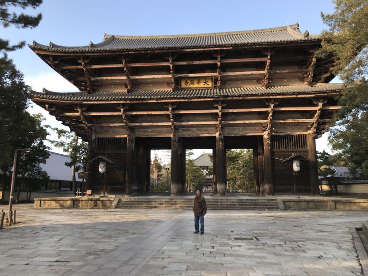
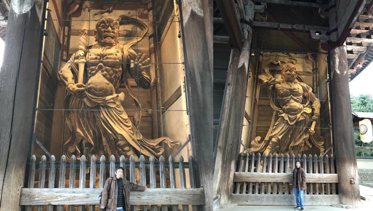
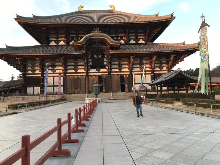
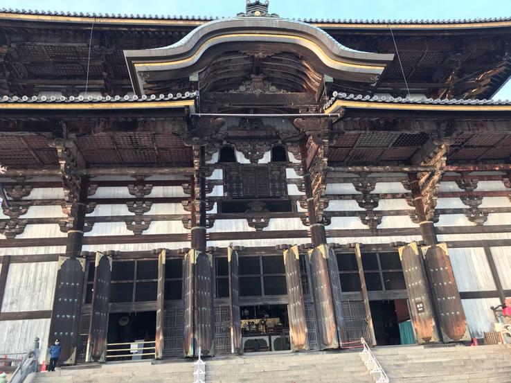
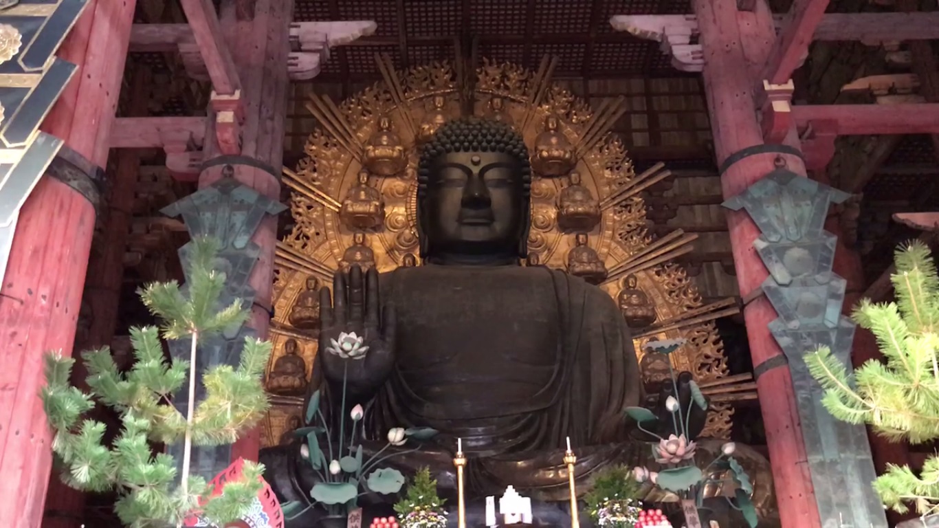
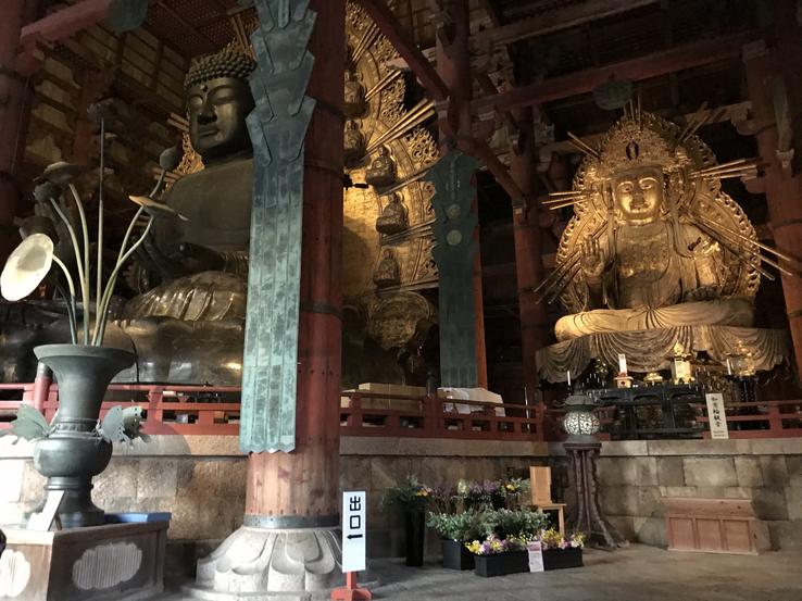
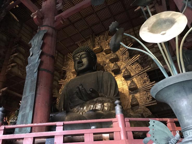
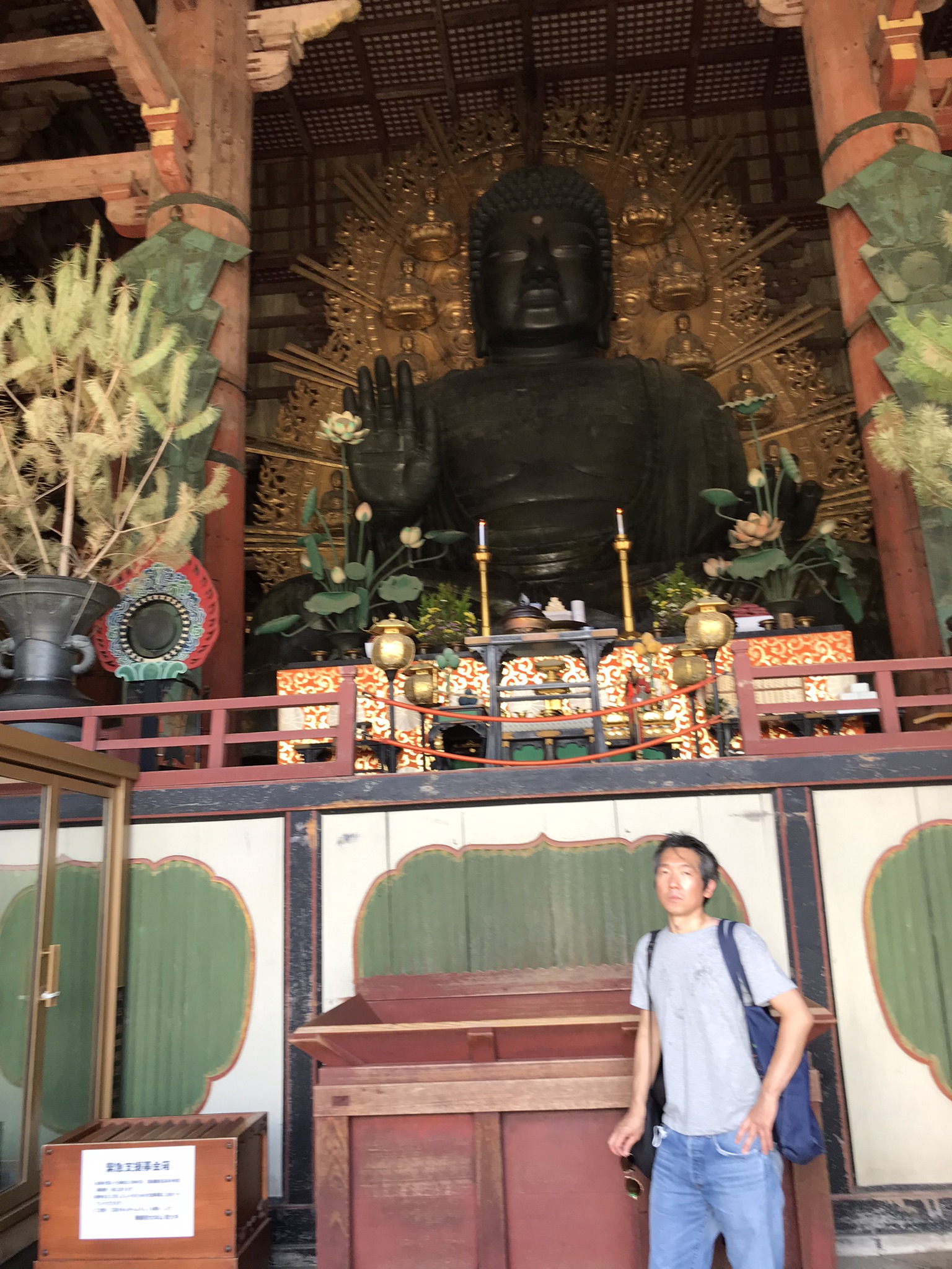
Tōdai-ji, in Nara Prefecture, is one of the most spectacular temples in Japan. The full scale of its complex, the largest wooden structure in the world for a millennium, is monumental and breathtaking.There, in the Daibutsuden (“Great Hall of the Buddha”), is the world's largest bronze Buddha statue, 15 meters tall and weighing 500 tons, built in the 8th century in an attempt to obtain divine protection for Japan after a large smallpox epidemic devastated the country and wiped out 1/3 of its population. To get there, you must first go through the Nandaimon Gate, 25 meters high, guarded to the right and left by the Guardian Kings Nio, two giant demonic-looking statues.
Address: 406-1 Zoshicho, Nara, 630-8211
Tōdai-ji Temple is located in the northern part of Nara Park and along with many other interesting sights. On your way to Tōdai-ji, you will stroll through the famous Nara Park (Nara Park), at the foot of Mount Wakakusa, founded in 1880, where hundreds of deer or deer (shika) roam peacefully and freely among the public.
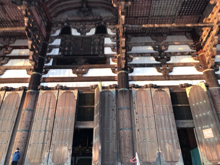
You will then pass the main gate of Tōdai-ji, the ancient, magnificent and imposing Nandaimon Gate (Great South Gate), 25 meters high. The structure, all of original wood, composed of immense and unbroken tree trunks, leads us to ask how in those times men managed to accomplish such a feat. Dating back to 1199, this portico – as, in symbolic terms, other constructions of the genre – serves to ritualize the passage from the mundane world to the processional courtyard, which at the time housed thousands of pilgrims and Buddhist monks.
Nandaimon was rebuilt in the Kamakura Period (which stretched from 1185 to 1333 and marked the rise of the samurai warrior caste and the establishment of feudalism in Japan) under the direction of Chōgen Shonin himself (1121-1206), the Buddhist monk who restored the TempleTōdai-ji after he was destroyed in a fire.The gate uses a unique construction method in which thick, straight pillars are transfixed by horizontal crossbeams (or nuki) with two layers on the outside, while it is open and hollow on the inside. Be sure to look up as you pass through the gate to enjoy an astonishing masterful view.
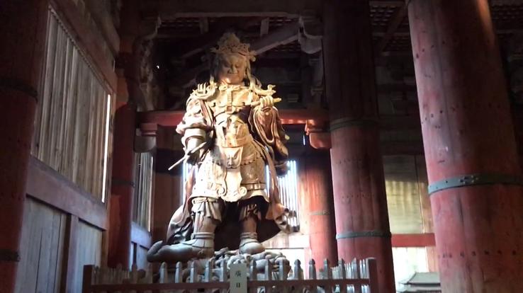
Nandaimon is guarded to the right and left by the Kongo Rikishi statues, also called the Nio Guardian Kings, depicted as two wrathful and muscular guardians of the Buddha. According to Japanese Buddhist history, they traveled with Buddha to protect him from enemies, so they have since been placed at the entrances of many Buddhist temples in the form of frightening statues, similar to fighters of demonic appearance, frightening and fierce.
Normally, the two guardian gods Nio of a temple face the main gate and consist of Agyo, facing right and opening his mouth, and Ungyo, facing left with his mouth closed. But the statues at the Great South Gate of Tōdai-ji, created by Unkei and Kaikei sculptors, are positioned in a rare style: instead of facing each other, they are inverted from the typical pattern. Kaikei (1183-1236) helped set the standard for traditional Buddhist sculpture in Japan. Along with his father and brother Unkei, he made statues for the Kōfuku and Tōdai-ji temples in Nara. Kaikei's style, while sharing the direct and realistic manner typical of the time, was known for its smoothness and grace in contrast to Unkei's, which was extremely dynamic. Among Kaikei's remaining twenty works are painted sculptures of Hachiman, the Japanese god of war, as a Buddhist priest, and Jizōbosatsu, the guardian deity of children, both at the Tōdai-ji Temple. He later became a monk and took the name Anami Butsu, hence his style is known as Anami style.
Tōdai-ji means “Temple of the Grand Orient”, and was named for its location to the east of Heijō Palace in Heijo-kyo, which was the capital of Japan for most of the Nara period, from 710 to 740 and 745to 784. It is one of Japan's most famous, imposing and historically significant temples and a landmark of Nara in central Honshu, home to the country's richest archaeological sites, filled with intriguing megalithic monuments such as Masuda-no-Iwafune.
In the Nara period, Chinese civilization exerted a strong influence over Japan, based on the state of the glorious Tang Dynasty, considered the golden age of medieval China, founded by Gāozǔ of Táng, born Lǐ Yuān (566-635), emperor of 618 to 626, belonging to the dynasty that had reunited China between 581 and 618, and which extended from 618 to 906.
The construction of the gigantic complex of Tōdai-ji can be traced back to 728, when Shōmu (701-756), the 45th Emperor of Japan (724–749), decided to pay homage to his first son with Kōmyōshi of the Fujiwara clan, the Prince Motoi, who had died a year after his birth. During the Tenpyō Era (between August 729 and April 749), Japan unfortunately suffered several disasters and epidemics. It was in order to obtain divine help to rid the country of these problems that Emperor Shōmu enacted a law in 741 to promote the construction of provincial temples throughout the country.
Tōdai-ji (still called Kinshōsen-ji at that time) was chosen as the temple of Yamato Prefecture and the flagship of all provincial temples. With the devastating smallpox outbreak between 735 and 737 – which killed no less than 1/3 of the population – compounded by years of poor harvests and followed by a rebellion in 740, the country was in a chaotic situation. Emperor Shōmu was forced to move the capital four times [in 740 he had ordered the capital to be transferred to Kuni-kuo (now Kyoto)], indicating the level of instability of this period. According to legend, the monk Gyōki went to the Great Shrine of Ise to reconcile Shinto with Buddhism, spending seven days and nights reciting sutras until the oracle declared that Buddha Vairochana was compatible with the worship of the sun goddess Amaterasu.
In 743, Shōmu issued a law declaring that the people should be directly involved in the establishment of new Buddhist temples throughout Japan. The emperor believed that such piety would inspire Buddha to protect his country from future disasters. Gyōki, with his students, traveled through the provinces asking for donations. According to records kept by Tōdai-ji, more than 2,600,000 people, equivalent to half of Japan's population at the time, contributed rice, wood, metal, cloth, etc., and of these, 350,000 were directly involved in constructionof the colossal bronze statue of the Vairochana Buddha (Daibutsu) and his Hall.
Kuninaka No Muraji Kimimaro (died 774), a Japanese Buddhist sculptor whose grandfather was an immigrant from the Baekje kingdom (18 BC-660 AD), located in the southwest of the Korean Peninsula, was in charge of designing the statue. Historical documents record that Kuninaka used two nested clay molds in order to pour the molten metal into the cavity thus formed. The statue was constructed from eight pieces cast over three years, the head and neck being fused together as a separate element.
After enduring numerous fires and earthquakes, the Tōdai-ji Temple was completed in 745, and the Buddha was finally completed in 751, having consumed most of Japan's bronze production and leaving the country nearly bankrupt.
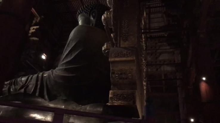
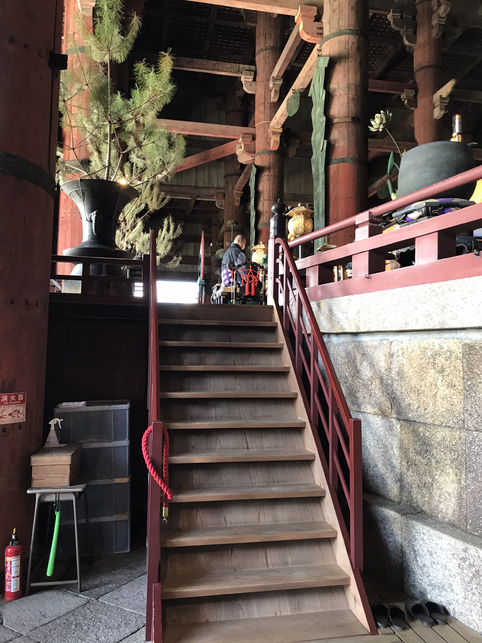
Tōdai-ji's main hall, the Daibutsuden (“Great Hall of the Buddha”), has a formidable scale that spans approximately 57 meters in width, 50 meters in length and 48 meters in height. 48 lacquered cinnabar pillars, 1.5 meters in diameter and 30 meters in length, support Daibutsuden's blue-tiled roof.
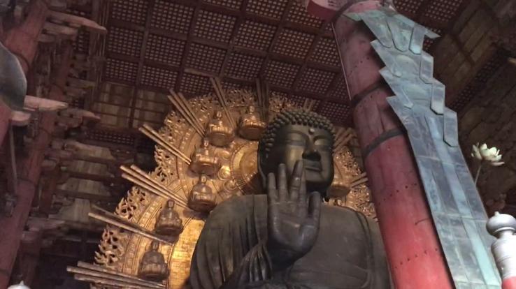
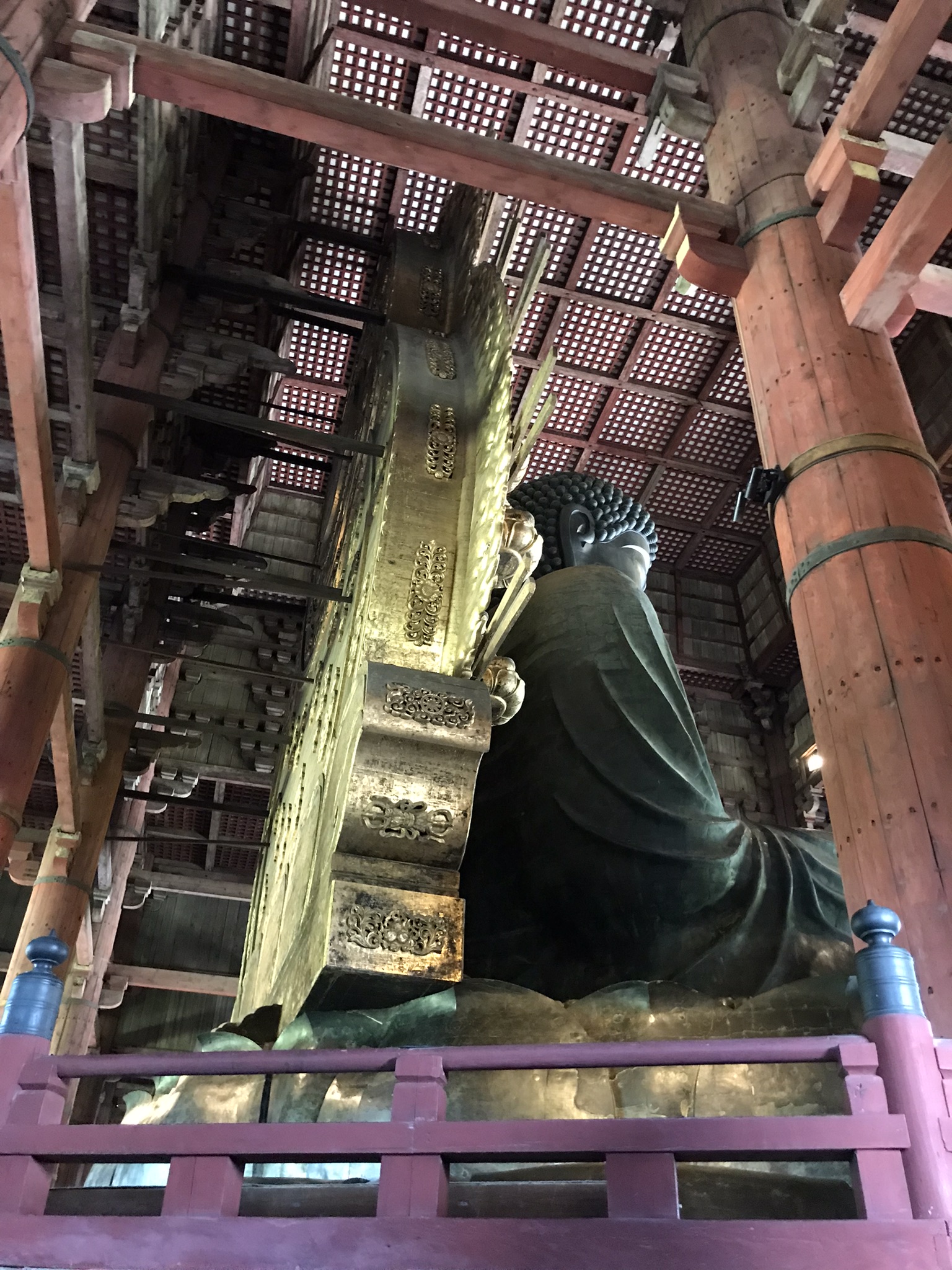
The Vairochana Buddha statue is an incredible 15 meters tall, with a face 5 meters long. Only your open hand is as tall as a human being.
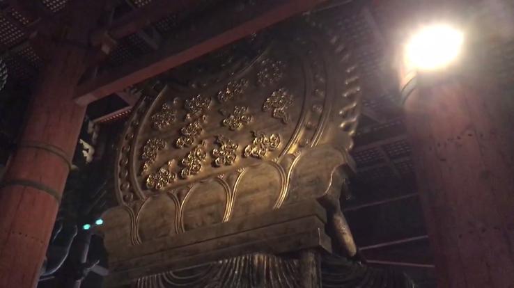
On the huge lotus petals at the base of the Great Buddha are engravings of the Lotus World Treasure (Rengezō sekai) and pictorial representations of the world of enlightenment described in the sutra. They are beautiful representations of the notion that each individual is not an isolated existence, but that all phenomena have unlimited connections and dimensions and that the entire universe is enveloped in the light of Vairochana's wisdom.
On a cliff atop Mount Kasagi in Kyoto, the 15-meter tall Buddha image carved by a celestial being has been preserved and worshiped for over 1300 years by the Shingon sect, one of Japan's leading schools of Buddhism, originally from India, practitioners of shugendō (“path of spiritual power through ascesis”), a form of esoteric Buddhism formed by syncretic elements, including shamanism. Nearby, it is said, there is a deep cave that leads to the fourth of the six Buddhist heavens where a monk named Jitchu would have penetrated and found none other than Maitreya. Whether there is this underground passageway or not, no one else has reached such a degree of enlightenment, but it is certain that strange megalithic monuments – where the gods are believed to reside – and reminiscences of a distant past that have survived abound all over the top of Mount Kasagi. to the bloody Genkō War of Emperor Go-Daigo, which redefined the history of political power in Japan.
Address: Kasagiyama Kasagi, Distrito de Sõraku, Quioto 619-1303
Far away from modern Japan is Kasagi, a city located in the Sōraku district, southwest of Kyoto Prefecture (founded in the 1st century and which was the capital of Imperial Japan until 1868, when it was replaced by Tokyo), near the borderbetween Kyoto and Nara Prefecture, at the intersection of Nara's Tsukigase Kaido Road and Kyoto's Iga Kaido Road.
Within the Kasagiyama Nature Park (Furitsu Kasagiyama Shizen Kōen, founded in 1964), near the Kizu-gawa Gorge and on the south bank of the Kizu River (which flows from east to west), is Kasagi, a sacred mountain (yama) of 289 meters high, it was the scene of several historical dramas and where many gigantic and strange granite rocks remain, which adds to the atmosphere of mystery.
At the top of Mount Kasagi is Kasagidera, an ancient Shugendō Buddhist temple of the Shingon sect, one of the main schools of Buddhism in Japan and one of the few Vajrayana lineages (name comes from Sanskrit meaning “Diamond Vehicle” and is also called mantrayana, tantrayana, esoteric or tantric Buddhism) surviving in East Asia, originally spread from India to China through traveling monks such as Vajrabodhi (Jīngāng Zhì, 671-741) and Amoghavajra (Bukongjin'gang, 705-774). Shugendō is a form of esoteric Buddhism that emerged in Japan and formed by syncretic elements from various religious traditions, including Shinto, Taoism and pre-Buddhist animist beliefs.
The strange stones are just outside Kasagidera, that is, the temple sprouted in the middle of these large stones (iwakura) which is where the kami (deities of Japanese folklore) were thought to reside. Mountains, waterfalls, large rocks and trees have been objects of worship in Japan since ancient times and considered sacred places where the invisible kami dwell. The gigantic granite boulders along Kasagi Mountain, therefore, have naturally made it a sacred place of worship and worship of the megalithic religion par excellence since prehistoric times.
The megalithic religion syncretized with Buddhist concepts is embodied in the image of Maitreya (“Miroku Bosatsu”) carved into the steep cliff wall. Several legends try to explain how the impressive image of this Buddha was carved.
The volume 11 of Konjaku Monogatari Shu (Anthology of Tales of the Past) tells that on a certain day in 664, when Prince Ōtomo no Miko, future Emperor Kobun (648-672, and who reigned only for a few months in 672), son of Emperor Tenji (626-672), was hunting deer on his horse, he was trapped at the base of the Oma cliff and was saved when he prayed to the mountain god: “If you help me, I will carve a Buddha image on this rock” . Prince Ōtomo left his conical straw umbrella (kasa) in place to serve as a marker for when he returned. This is said to be the origin of the name Kasagi (literally, “the place where the umbrella was left”). When Ōtomo returned to Mt. Kasagi, he himself tried to carve the Buddha image into the face of the Oma cliff as he had promised, but was unable due to the tilt. Providentially, a celestial being appeared and carved the Buddha image, which is 15.7 meters high and 12.7 meters wide, which remains the largest and oldest celestial sculpture in Japan carved into the surface of a cliff.
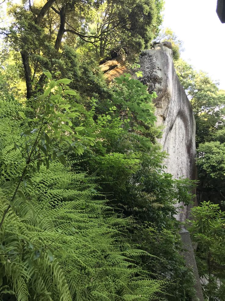
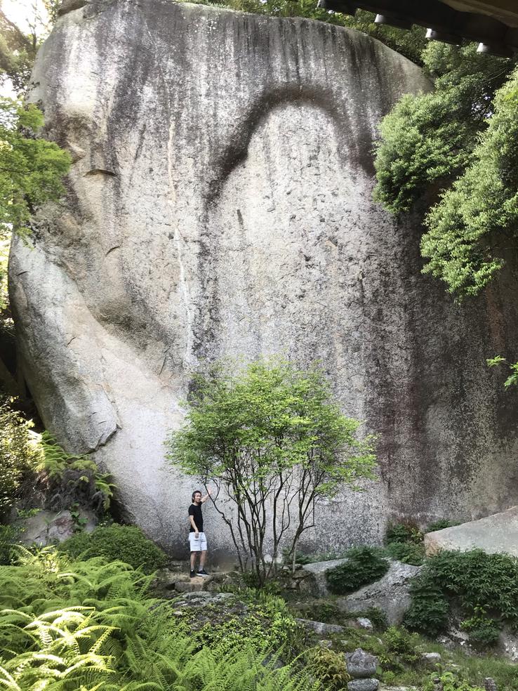
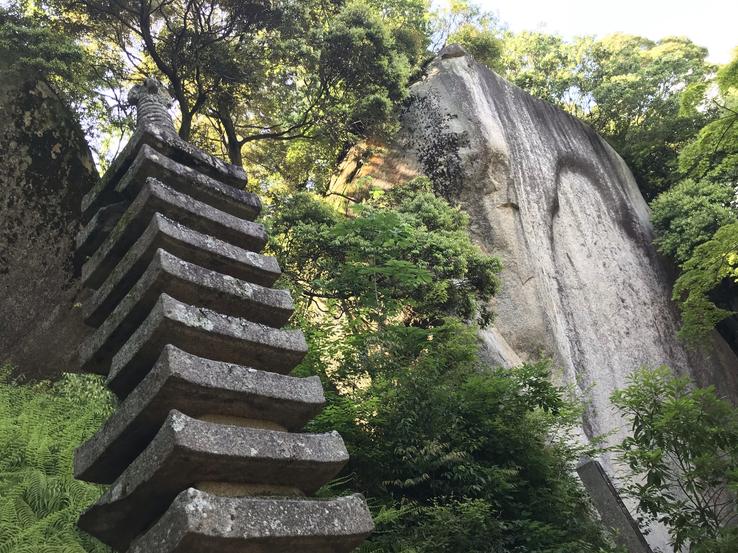
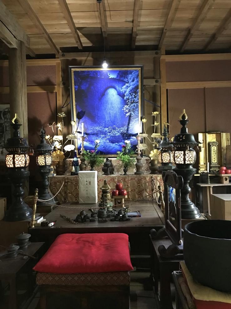
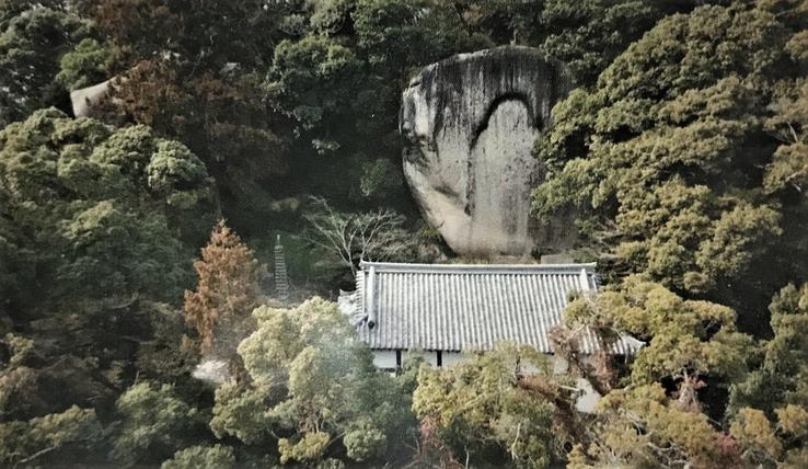
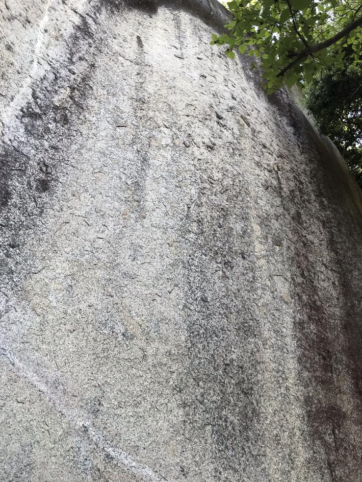
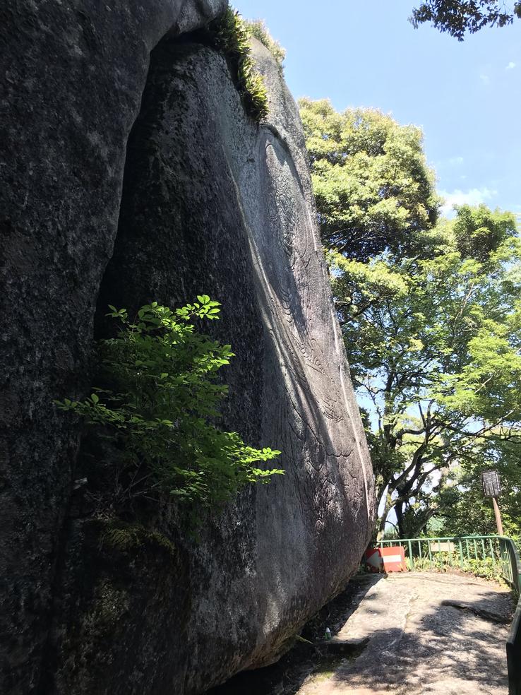
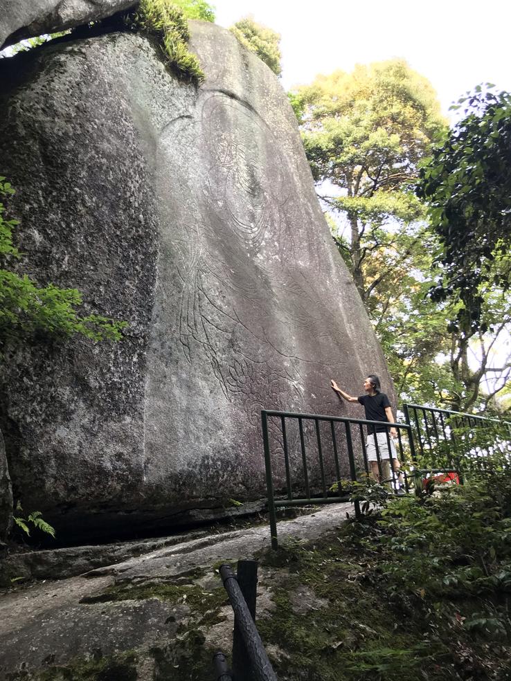
The Cliff Buddha of Oma was burned during the Genkō War (1331-1333) and now only the halo shape remains, but the granite cliff Kokuzo Magaibutsu, beside Senju Cave, considered the holiest site in Kasagidera, has survived to the fire and still retains a clear figure of the Buddha 12 meters tall and 7 meters wide, seated on a lotus pedestal with his right hand raised and his left hand on his knee. Carved in bas-relief with graceful lines, it is covered in a flowing celestial cloak and also shrouded in a halo. The time of its creation is uncertain due to the lack of comparable works, but it is believed to date from the end of the Nara Period (710–794) and the beginning of the Heian Period (794-1185).
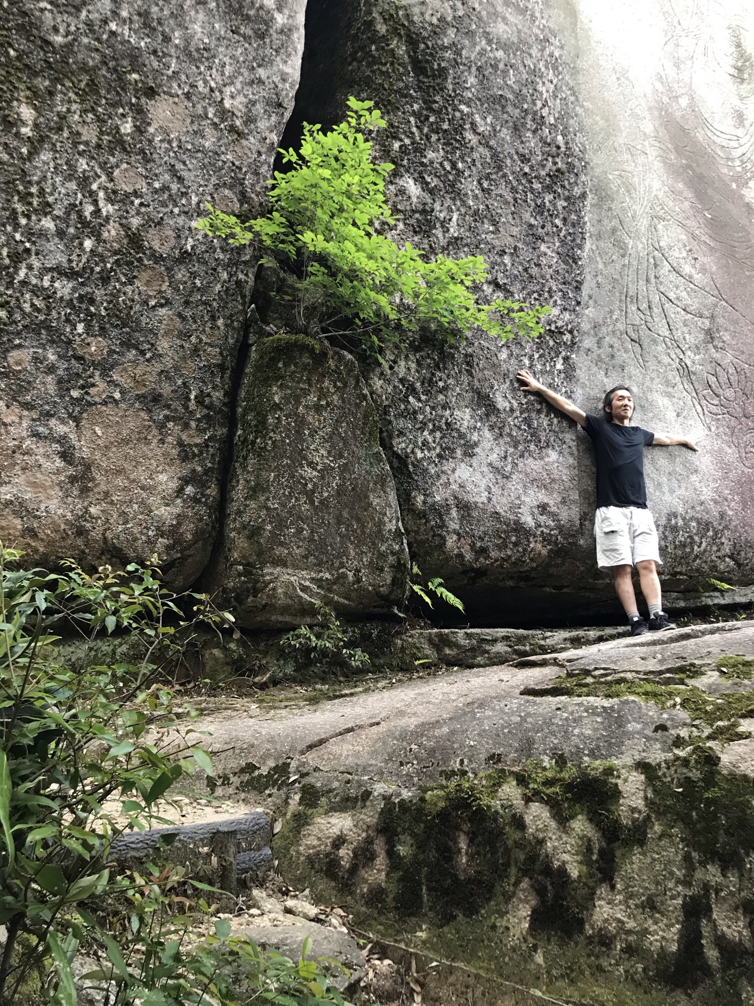
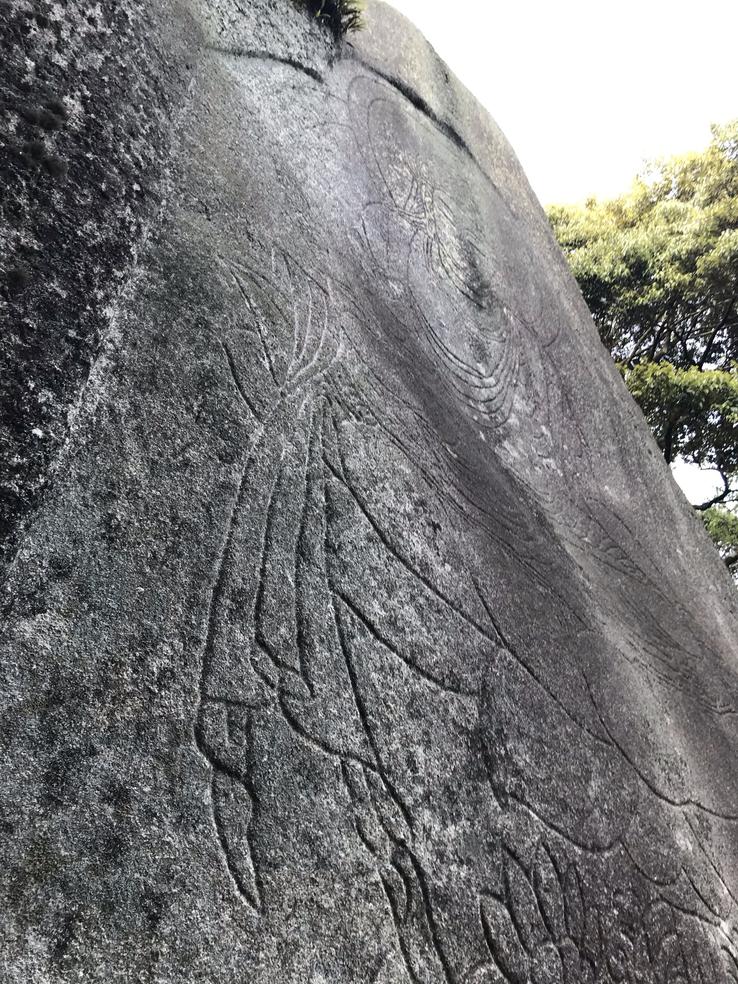
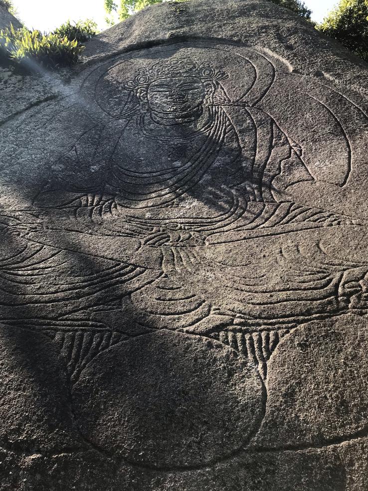
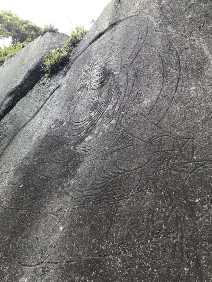
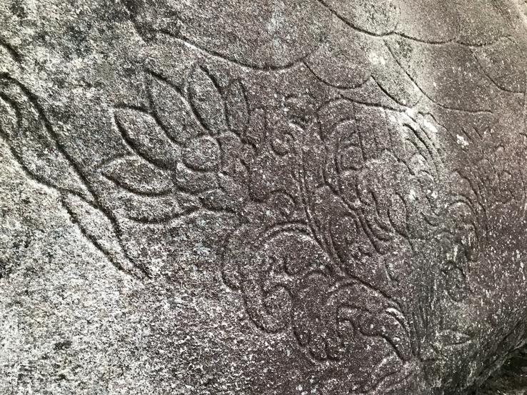
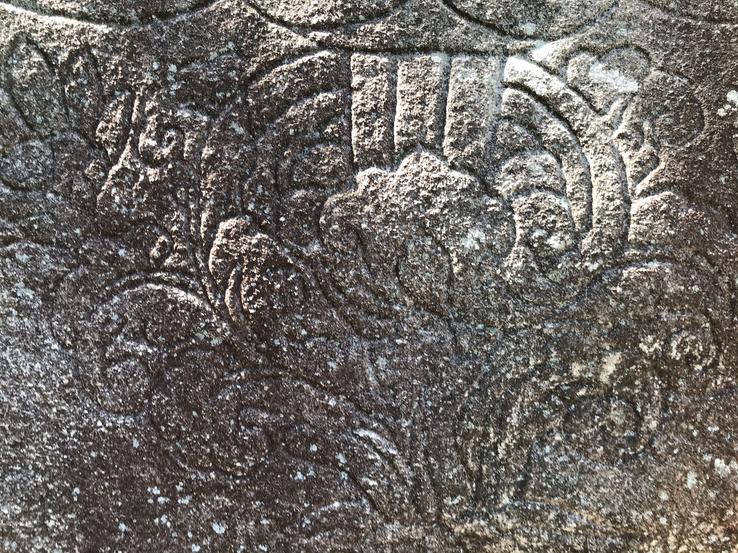
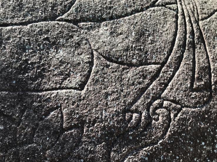
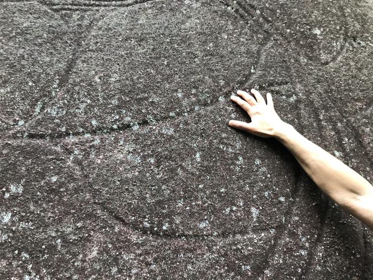
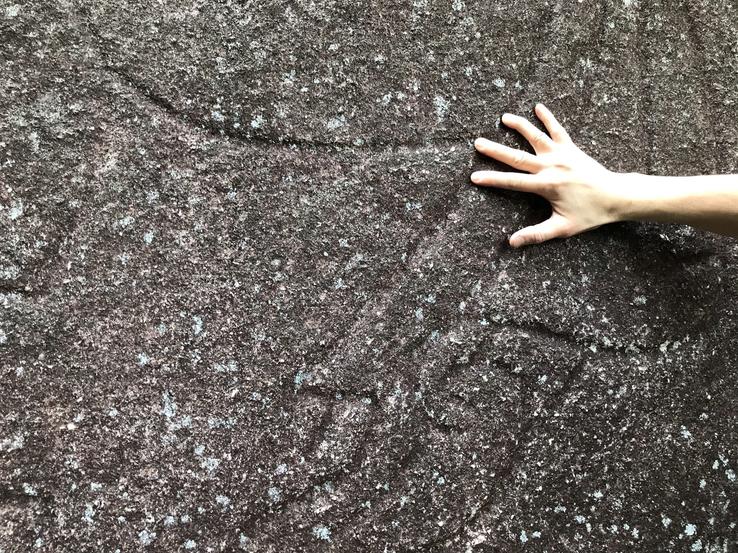
The entire mountain, all around the top, is so dotted with megaliths that it can be called “paradise” or “megalith theme park”. Most of them are absolutely natural, although they look like Cyclopean ruins, as they acquired suggestive shapes of gigantic blocks cut and fitted together. Or perhaps they are, it is not known for sure, as some megaliths were clearly stirred and altered to form corridors and galleries, while others were superimposed, giving the distinct impression of constructions. Despite the self-indulgents who intend to see only the "whim of nature" in everything, here there are weighty elements attesting that an extremely evolved civilization disappeared and the Japanese themselves from the feudal era, have left their silent but grandiloquent marks on Kasagi, perhapsa perennial witness for us, the men of the future.
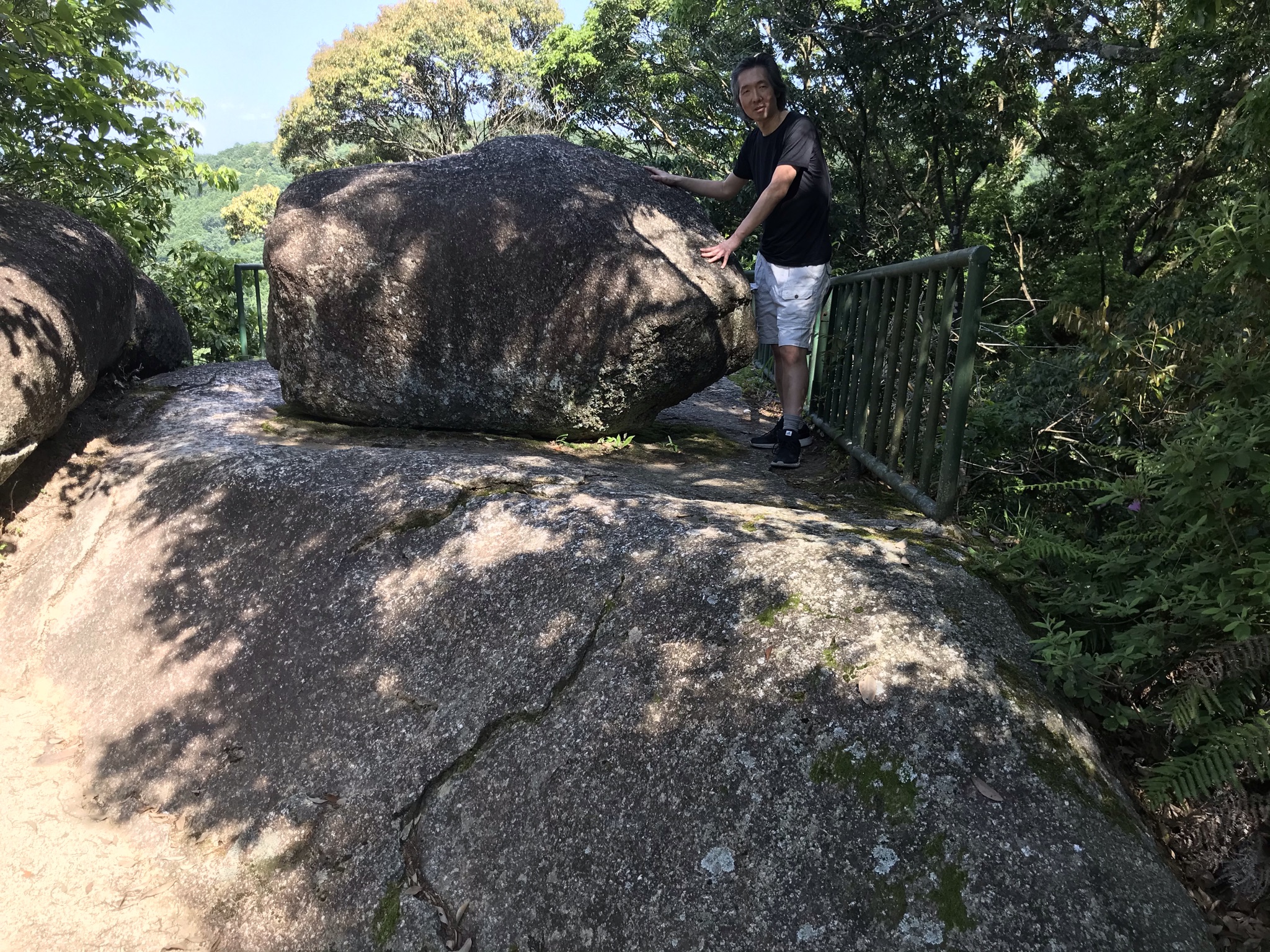
Just before and right beside the Oma Cliff, where the 15-metre-high Magaibutsu stands, we come across two gigantic rocks that seem to have been split in half, with a leafy centenary tree just ahead. There's a round stone that's stuck in the crack between the two, like it's about to roll. It may have been a natural astronomical observatory, as the Sun can be seen passing right through the middle of the slit at certain times.
Three megaliths called “Miroku”, “Bunshu” and “Yakushi” are lined up just in front of and to the right of the Buddha in front of the Kasagidera Main Hall.
There is a 13-story stone pagoda built in the late Kamakura Period and early Muromachi Period that stands on the site of a former thirteen-story wooden pagoda that was burned during the Genkō War.
Along the path that leads to the Buddha on the Kokuzo Magaibutsu granite cliff, we come across the most enigmatic rocks.
We first passed Senju-kutsu (literally, Cave of a Thousand Hands), where Roben would have confined himself and prayed, an act said to have removed rocks from the bed of the Kizugawa River that impeded the passage of ship cargoes. There is another legend that says that Jitchu, Roben's disciple, would have entered a deep cave called Ryuketsu (Dragon's Cave), where he would have reached Tosotsuten (The fourth of the six Buddhist heavens in the world of desire), inhabited by Maitreya.One day, while training in Ryuketsu's cave, Jitchu decided to walk to the inner depths and finally reached Tosotsuten. He visited the 49 inner temples of Tosotsuten, and a ritual he witnessed and reproduced in the mortal world became the ceremony of Todai-ji Temple's Annual Omizutori Festival.
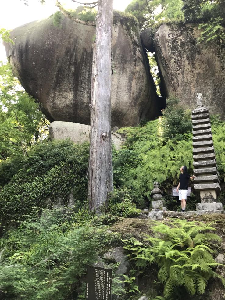
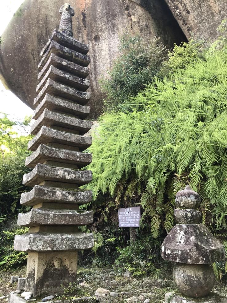
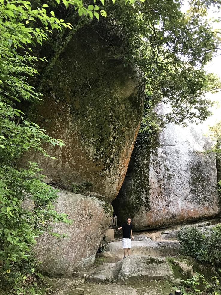
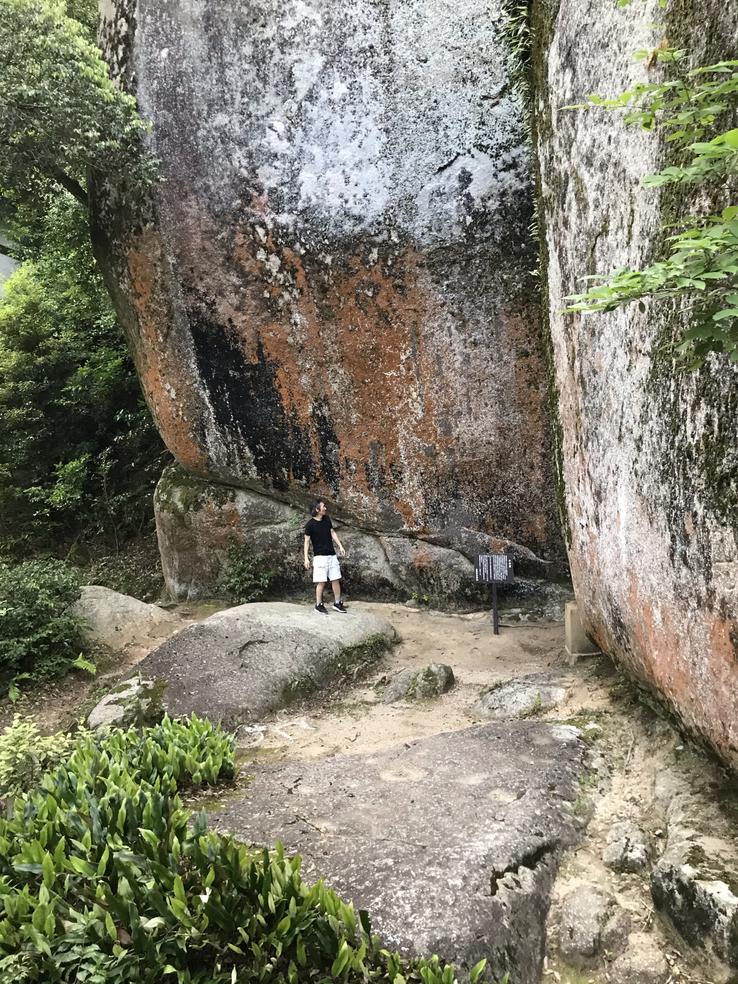
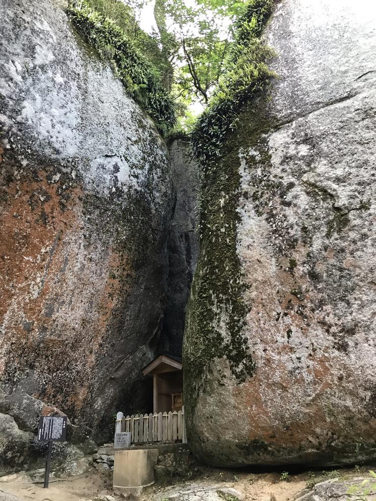
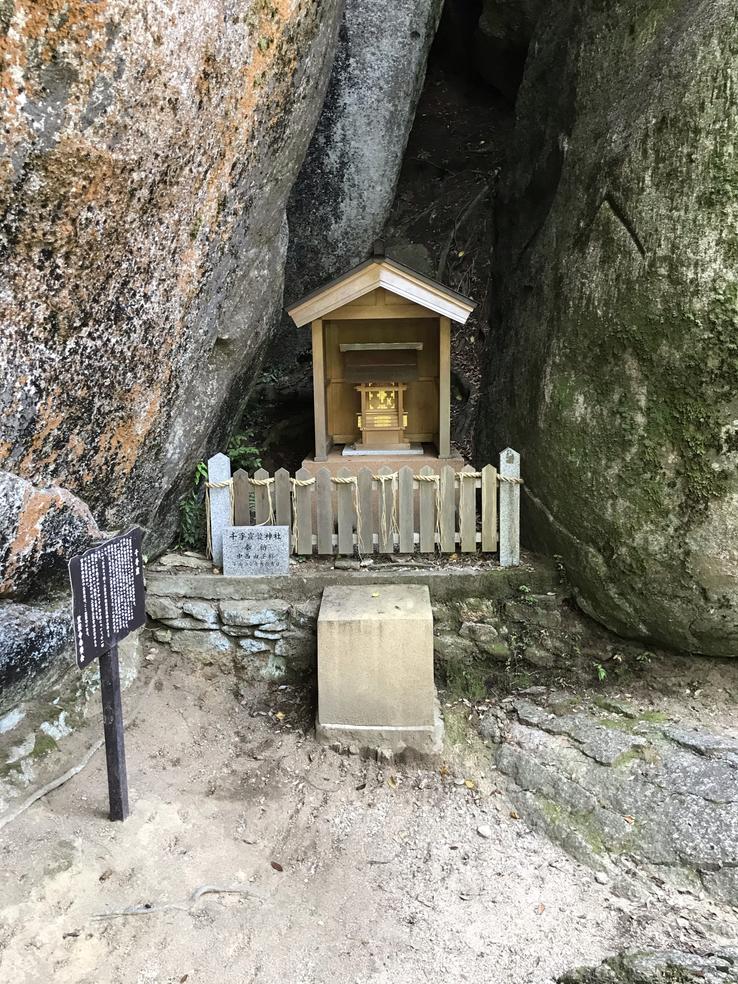
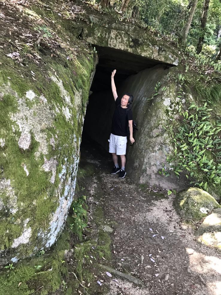
On the way, one crosses a clearly artificial narrow corridor called Tainai kuguri (meaning “through the body”), cut through the rock and topped with lintels.
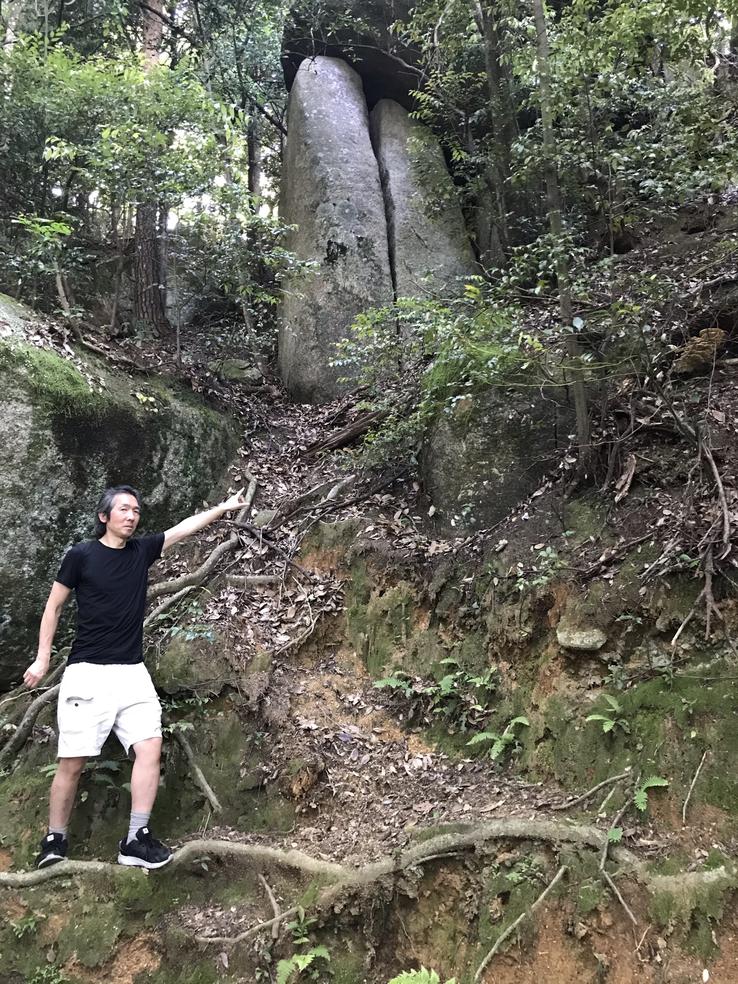
From there we came to two twin rocks in the shape of an obelisk that might have been a single one and ended up split in half.
We found on the way an elongated head such as that of the pharaohs of Ancient Egypt and so many other people who performed such practices of cranial deformation, as to imitate the shape of the elongated head of the "gods".
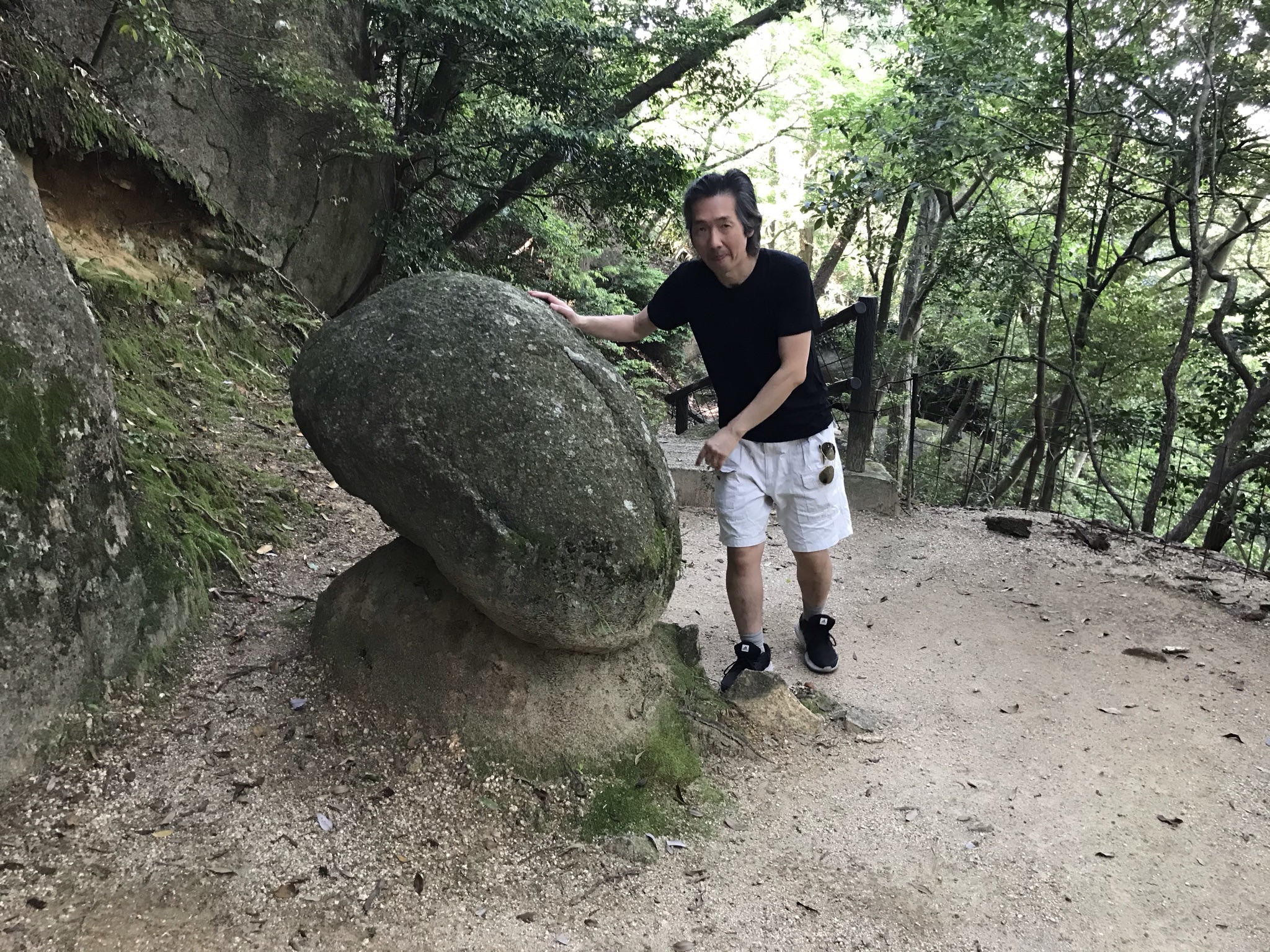
There's a huge loose rock whose bottom is flat and you can rock it slightly with just one hand, even though it weighs two tons. After the Kobe Earthquake of January 17, 1995 or the Great Hanshin Earthquake, the stone's movement slowed down a bit. Its origins go back to the Genkō War. Emperor Go-Daigo (1288-1339 was fighting the Kamakura shogunate around Mount Kasagi, and during the battle he planned to use the stone as a weapon for a surprise attack, hurling it at enemies attacking from below. The “Yurugi Stone” (Yurugi Ishi) was then carried to the location but was not used, and ended up remaining in the position in which it is found. The sign explains that its center of gravity is in the center, so it swings easily when you press the edge, hence its name.
